| Difficulty | V |
| Length | 0.07 mi |
| Avg Gradient | n/a |
| Reach Info Last Updated | January 26, 2022 |
River Description
Steinacher Creek may hold more whitewater than just Steinacher Falls but it is the near-vertical 25-foot drop of the falls that has lured kayakers to this small tributary to Wooley Creek.
Until about 2010, paddlers could drive on the Steinacher Creek Road to access the falls with a steep hike down from the road to the top of the drop. But this road was decommissioned and now the steel arch bridge over the Salmon River carries a road to nowhere that dead ends at a turnaround. This is where the hike up the former roadbed begins in the quest to access Steinacher Falls. Very few paddlers hucked Steinacher Falls when it had road access and even fewer are willing to hike in for a single drop. But it's there for those who want it.
The falls mission can be a loop where you hike in and paddle out on Wooley Creek to reach the vehicle you parked at the end of the road when you started hiking. Or it can involve a shuttle if you continue from Wooley into the Salmon River to take out at the Brannon Bar River Access about a half mile downstream.
Steinacher Falls can also be accessed during a run of Wooley Creek by hiking up to the top of the falls to run it and then continue paddling out on Wooley Creek.
River Features
Parking Area
Access PointDistance: 0.07 mi
This is the end of the road. Park here and hike up the old roadbed toward the falls.
Steinacher Falls
Waterfall / Large DropClass: VDistance: 0.08 mi
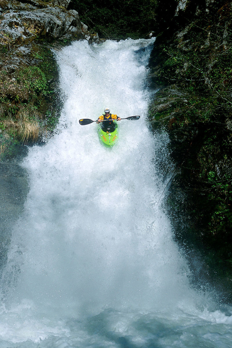
Steinacher Falls drops about 25 feet within view of the confluence of Wooley Creek.
Trip Reports
Log in to add a reportNo trip reports yet.