Wilson Creek
C) The Gorge: National Forest sign to parking area above Brown Mtn. Beach
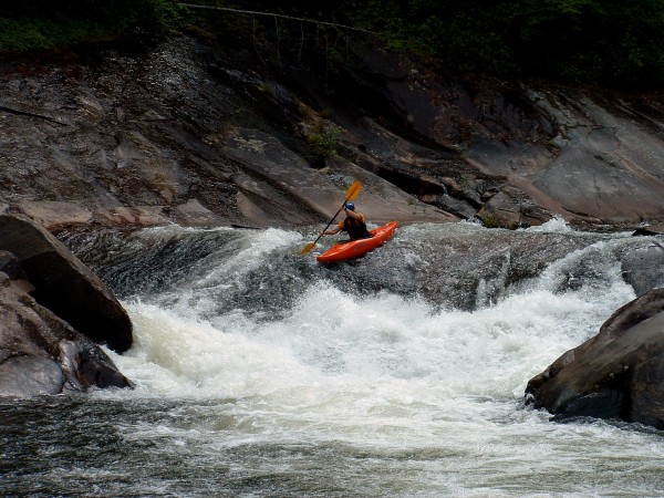
October 2, 2024
| Reporter | Nathan Anderson |
| Gauge Reading | 4.49 ft at WILSON CREEK AT SECONDARY ROAD 1335 AT ADAKO, NC |
| Flow | Low Runnable |
Me and my buddy set out on Oct 2nd, 2024 to explore Wilson Creek following the destruction of Hurricane Helene. The level was reading around 15' on the Bridge Gauge and the online gauge seemed to reflect this too. Right away, after putting on, I could tell that is was nowhere this high. We both thought it felt more around 0. In terms of the rapids, they were all still there but things were different. Some changes are subtle while others were substantially different. Even the lead-in stuff above Ten Foot Falls had changed. Regarding the changes:
[MANK ABOVE TEN FOOT] is more of a driving to the left move while still using Idaho (Thumb) Rock as a reference point for running it.
[TEN FOOT FALLS] is pretty similar. The right side boof seems to have opened up a bit and then you ride the flow to the slide and come down the middle or slightly middle right on the horizon line.
[NO NAME LEDGE] is more of a drive to the left side of the drop. it kind of looks like there is a piton rock on the right side of the ledge.
[PITON LEDGE] which is right below No Name doesn't seem to be that different
[BOAT BUSTER] is a bit different left line is a bit blocked with rocks but it still goes. These rocks probably will become more in play at lower levels. In terms of running left line make sure to drive over the curler so you don't get sucked into the main hole in the middle. The Boof line on the right side looks like it still goes.
[THUNDERHOLE and DENTAL WORK] are each pretty much the same
[TRIPLE DROP] has significantly changed where some rocks have collapsed into the left line and a decent amount of water is feeding through rocks in the middle of the river and through the rocks on the right side of the left line. Definitely take a look at this one, especially at lower levels.
[BITCHSLAP] or as some people like to call it Uurunnable Rock Jumble is pretty similar in terms of working to the right side of the river as you come down. there does seem to be more water flowing through the rocks on the left of the river.
[MAYTAG] seems to have gotten worse in terms of the hole. I took a sneak line on river left.
[RAZORBACK] The right line is basically the same. There is also a really neat centerline move. both of these lines do seem to be cleaner now. I have no idea what the current status is of the fire escape line.
[HUNTLEY'S RETREAT] seems to be steeper now. rocks that have been deposited on the right side seem to block off the flow on river right and therefore it directs more water to the left side. Some of the rocks in the left line seem to be gone now and others have shifted around
[RAILSLIDE] now has some weird rocks in the main S-turn move. I hope this beta helps, and as always, look before you leap, especially as the level drops.
A video showcasing the new Wilson can be found here: https://www.youtube.com/watch?v=uydWv5L9dT0