| Difficulty | I-II |
| Length | 6.2 mi |
| Avg Gradient | 3 fpm |
| Gauge | Yadkin River at Elkin, Nc |
| Flow Rate as of 1 hour | 452 cfsrunnable |
| Reach Info Last Updated | December 3, 2021 |
River Description
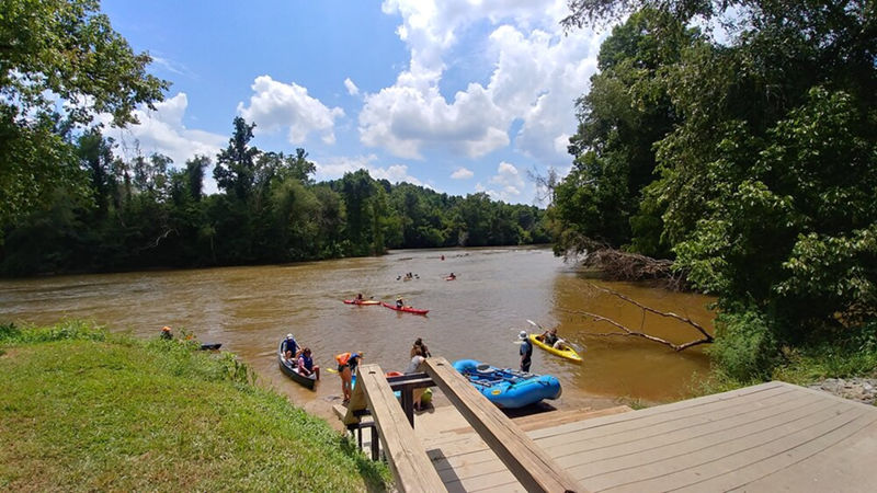
The Yadkin River is one of the longest rivers in North Carolina. The river starts in Caldwell County near the Blue Ridge Parkway and flows to the Pee Dee River. Approximately 35 miles is located on the boundary (border) between Surry and Yadkin Counties. Most of the river is beginner-friendly with mellow paddling. New paddlers tend to like this river because of the quality of accesses. It has safe and well-maintained access facilities. This wide river allows for paddlers to select the difficulty of challenge they prefer by selecting a line that best fits their paddling experience. Many of the rapids have multiple lines. These lines generally vary in difficulty and allows the paddler to choose their own challenge.
This section starts at Crater Park access and flows to Burch Station access. Burch is managed by Surry County Parks and Recreation (336-401-8235) and has 13 parking spots. The access to the river is a cartop launch that uses steps to access the river. The handrails double as a boat slide. Burch is located river left of an island and can be missed if not careful. Fishermen may enjoy paddling up the Mitchell River to experance this tributary's high water quaity and great small mouth habitat. Burch Access is located at the the confluance of the Yadkin and Mithchell Rivers. Please remeber leave no trace.
River Features
Crater Park Access Put In
Access PointClass: IDistance: 0 mi
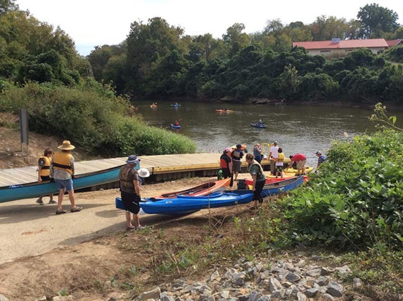
Ramp and Floating Dock at Crater Park
Trip Reports
Log in to add a report?
Untitled
Nov 17, 2009
The portion of river from Ronda to 601 is best between 800-1600 cfs @ Elkin. Above 1600 the rapids may start washing out. I have run it in a jon boat as low as 550 cfs. Water quality and scenery is best in fall or spring. Risk of muddy water increases in summer. There are many rapids but the best are;
1. Three miles downstream of Ronda the river enters a small gorge and goes around an island. Go left for waves. At 1600 cfs water will come in a canoe. A very scenic spot.
2. Just upstream from 21 are some splashy waves.
3. 2-3 miles downstream of Elkin is a nice ledge.
4. Long technical run just upstream of 601.
ZS
Zack Sipper
Jun 10, 2009
The Pilot Mountain State Park has quit allowing camping on the island but my buddy and I did it anyways but we waited till night to set up or start a fire. The park ranger yeiled from accros the river but they won't come get you at night just pretend like you didn't see the signs and you will be ok haha. We just made sure we was ready to go by sun rise.
MR
Mack Roebuck
May 25, 2009
The Yadkin River Canoe Trail is 165 miles long with 38 access sites. This particular section has accesses at highway 601,Rockford,Old Shoals Road, Yadkin Islands State Park, Donnoha (67) and 421 Park.
From the Shoals access at Old Shoals Road through the Yadkin Islands to Donnoha there are about 30 tiny islands and two sizeable ones. Canoe camping is allowed on the largest island. This is an excellent section for birding offering numerous speecies including Bald Eagle.
The section between Donnoha and 421 Park is senic with some surprisingly high bluffs. Be careful of the low head dam. Portage on concrete steps on right.