| Difficulty | I-II+(III) |
| Length | 4.5 mi |
| Avg Gradient | 18 fpm |
| Gauge | Little River Near Star, Nc |
| Flow Rate as of 1 hour | 5 cfsbelow recommended |
| Reach Info Last Updated | July 13, 2026 |
River Description
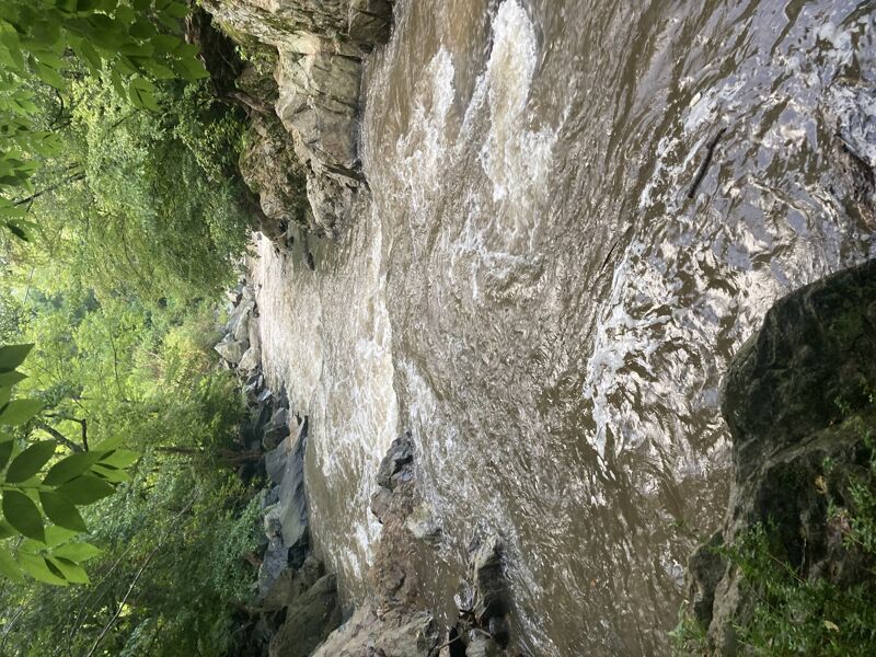
This is likely to be a 'go' with 1 inch of rain in winter or 2 inches during summer. To confirm runnability, there is a paddlers gauge at Erect Road: 1' would likely be a good level. We have Little River at Star, NC connected to the creek on here as a proxy since headwaters for both are in a similar location, but really a visual inspection will be needed to confirm there is enough water in Richland Creek.
Update 2/16/26: Check from either Little Beane Store Rd, Pickett's Mill Rd or Riverside Rd for water level. Erect Rd might not be a good indicator since the creek is narrow near the dam breach and might make water level seem higher than it is in other places. Look for few rocks showing. We had what might be considered minimum level, some scraping when Little River gage was at 3.6' and falling.
Here's the breakdown of each bridge to bridge section. Note that the best section is between Picketts Mill Rd and Erect Rd. Other parts can be skipped (E.G., if you want something quick after Cedar Falls), but they do have some rapids.
Little Beane Store Rd to Picketts Mill Rd (1.1 miles, I-II)
One small class I right under the bridge followed by flat. After a little less than half a mile, there is a sharp left turn followed by some class I and faster moving water with noticeable increase in gradient. After a right turn is a class II with slightly more complex lines. More than likely, you'll be taking the channel left of an island. Within sight of the next bridge is the best rapid on the first stretch: a 1.5 ft or so drop at an old busted dam wall is followed by some fast boogie. This can also be reached by parking at Picketts Mill bridge if you want a shorter trip.
From Picketts Mill Rd to Erect rd (just under 1 mile, II-III)
Right away you will go under a bridge with a class II drop. About 0.1 miles in is the first rock garden. Half a mile in you reach a more technical zig zag of rocks. Stay left for t
...River Features
Little Beane Store Road Bridge Put-in
Access PointDistance: 0 mi
From here to Picketts Mill bridge is 1.08 miles, and drops just 11', or about 10.2 FPM.
Boulder Garden
OtherClass: IIDistance: 0.59 mi
Nothing too difficult but some zig zagging needed to find the right line.
Busted Dam #1
OtherClass: IIDistance: 0.97 mi
A small pour over ledge hole followed by some easy boogie.
Picketts Mill Road
OtherDistance: 1.08 mi
From here to Erect Road is 0.88 river miles. In that distance, the river drops about 39', for a gradient of 44 FPM in this section.
Sharp Left Blind Turn
RapidClass: IIDistance: 1.46 mi
A narrow point where the creek takes a sharp left. I've seen strainers here, but was able to move them when running. Not too difficult if you lean hard left, but a scout may be needed since it is a blind turn.
Class III Boulder Garden
RapidClass: IIIDistance: 1.59 mi
A large boulder covers most of the creek in the middle. The actual drop is not very difficult at lower levels, but scouting is recommended to look at if the path is clear since the left side, which has more water is blind from the top. Run this left into a ditch area and then proceed to the right just after an island to the only surfable wave in this section. This channel has a 2 ft ledge with a quick move right and then a small opening back to the middle or if water permits, you could continue to the left back to the main channel. If water is too low, you will need to portage at the island and seal launch into the rapid. At higher water levels, the right channel would be runnable from the top and could be boat scouted. If water were high enough to slide down the middle boulder, this whole section would likely be a total step up in difficulty.
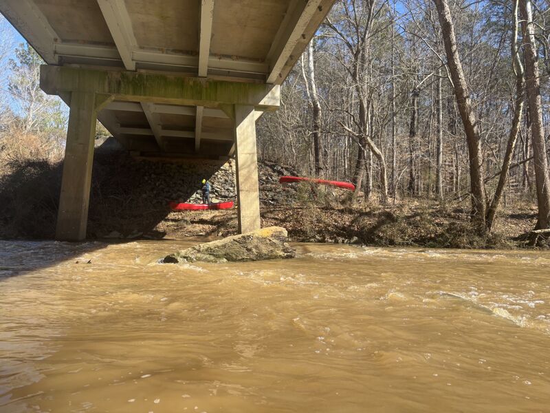
Erect Rd Dam
RapidClass: II+Distance: 1.9 mi
One of the most unique rapids in the area in my opinion. Work your way left when you see the dam wall. Hug the inside of the curve and watch for rocks. This also can be used as a gage for how water will be for the whole run. If you park at Erect Rd and see exposed rocks here, you are going to scrape the whole way down. This is also the last significant rapid. Downstream are some class I-II with one or two ledges with a surf wave and lots of flat.
Erect Road
OtherDistance: 1.96 mi
From here to Riverside Road bridge is 2.57 miles, and drops just 33', or about 12.8 FPM.
Riverside Road Bridge Take-out
Access PointDistance: 4.53 mi
Trip Reports
Log in to add a reportZS
Zach Schiada
Feb 17, 2026
Ran 2/16/26. Little River gage was 3.6 for reference. Water was low, but passable with some scraping occasionally. We figured 6' or so higher water would have been perfect, maybe over 4' on little river.
ZS
Scrapey but fun. - Zach Schiada
Dec 17, 2022
Level was just under 6' on the Erect Rd Pier. This level is too low for after Erect rd, but is passable for the sections up to this point. The only part that was not runnable above Erect Rd was the second part of the class III drop. I had to portage on the island and seal launch back into the surf wave below.
On a side note, if you want the biggest section of whitewater this creek has to offer, head to Old Humble Mill Rd to Fairview Farm Rd. It is about 35 ft/mile and offers one of the largest drops in the are at Mendenhall Falls. For there, I'd recommend running the creek early or on a rainy day since the falls is right at the Zipline place and I'm unsure what it would be like to run into staff when you need to scout the falls. That section is class II-III and Mendenhall Falls would likely be class IV at high water.