Canyon Creek
Middle Canyon Creek Falls to Canyon Creek Falls(Waterfall to Waterfall Run)
Jun 10, 2023
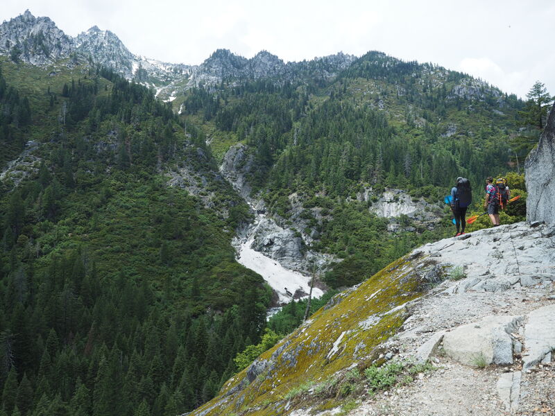
We heard about it around the picnic tables the night before at the American Packrafting Association's 2023 Packraft Roundup - clean granite slides and boofs high in the Trinity Alps, bookended by unrunnable waterfalls. We'd all had a few beers, yet our source seemed credible: legendary local paddler Don Iverson. He drew us a map. We made a plan. At the crack of 10:30am the next morning, Jack Henderson, Quinlan Pfiffer, and I drove to the Canyon Creek trailhead and started hiking. Pro beta #1: 10:30am was too late of a start for this particular adventure.
We hiked approx. 6 miles in and put-on when we decided we were running out of daytime, about 1/4 mile below Middle Canyon Creek Falls. There are probably good rapids all the way up to the Falls, but we'll save that for next year. The hike itself was epic, with amazing views of the Trinity Alps. I wish I'd brought an extra pair of socks, because the trail was flooded from snowmelt and I detest wet socks inside a drysuit. Pro beta #2: hiking 10 miles with two trail runners who are a decade younger than you makes for a really great time.
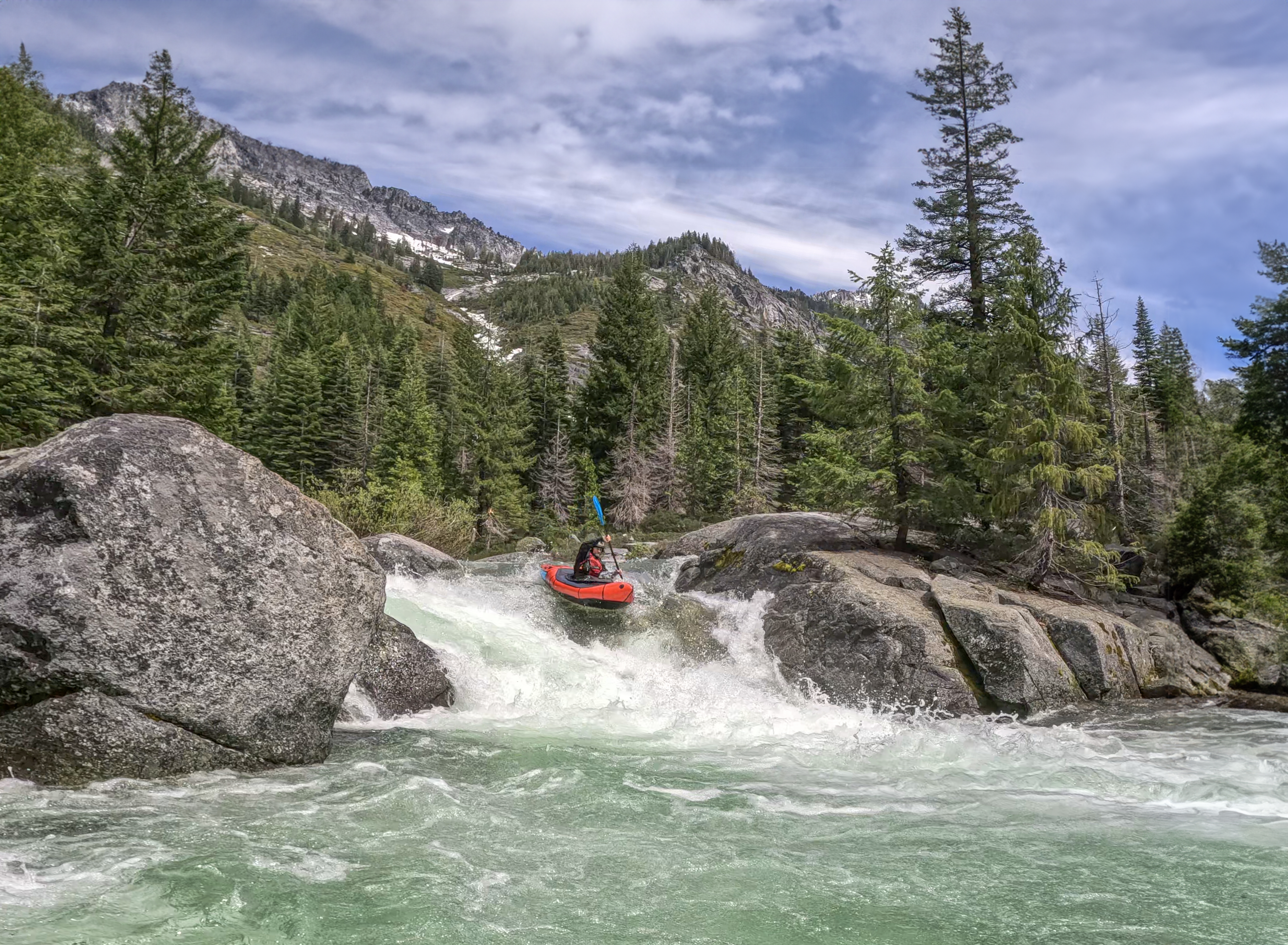
We launched at the top of a series of low-angle granite slides which were challenging to scout due to streamside vegetation but easy enough to read and run. Below this series was a classic shoulder boof that reminded us of Elkmont in the Smokies, then a bigger mid-river boof, then some boogie leading into the biggest drop of the section - a 6-ish foot ramp / boof on river left. More boulder gardens followed, then we were forced to portage left around multiple logs and braided channels. This opened into a section with a large mid-river boulder with a slot down the left.
After this the gradient eased and we floated through a meadow with 3-4 log portages, most of which could be done at river level by crawling on top of the logs (thanks packrafts). The run ended with a granite ledge that was not clean (both channels landed on rocks) leading into a congested boulder garden which really deserved a scout in hindsight. We took out on river left at the obvious large campsite. Don't miss this, as the next series of rapids lead into Canyon Creek Falls.
The hike out was roughly 4 miles, for a total of 10 miles of hiking for ~2 miles of amazing whitewater. Since our ratio of hiking to paddling was 5:1, we determined that we did in fact go packrafting. We made it back to camp by 8pm and missed the raffle, but I was informed that I won a resusable pee rag.
Flows were medium, most of the mank was covered in the boulder gardens but nothing was pushy. The Dreamflows gauge for Canyon Creek at Junction City showed a diurnal peak of 660cfs, dropping to 440cfs.
View the video of our run here.
Jun 10, 2023