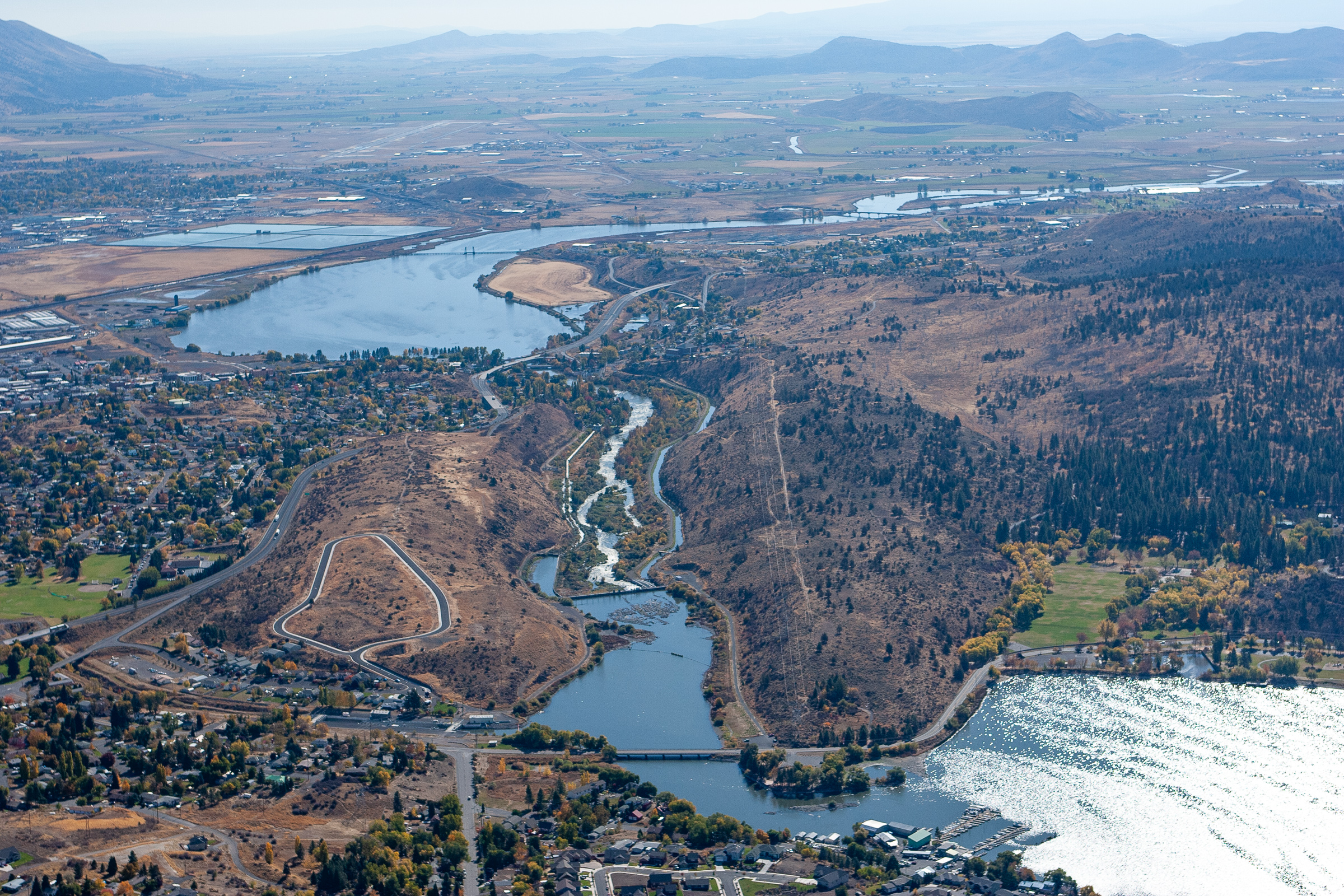
Link River
Below Link Dam to Veterans Park
| Difficulty | III |
| Length | 1.2 mi |
| Avg Gradient | 28 fpm |
| Gauge | Link River at Klamath Falls, or |
| Flow Rate as of 25 minutes | 1200 cfsrunnable |
| Reach Info Last Updated | January 26, 2024 |
The 1.5-mile-long Link River connects Upper Klamath Lake with Lake Ewauna, after which the river takes the name of Klamath River.
There are several rapids on the river, but the main attraction for local boaters is the Link River Wave which is in only during rare high flows. Upper Klamath Lake must be full and additional heavy precipitation or runoff is needed for the Link River to flow high enough to create the wave. This is most likely to occur between February and April in wet years only. The diversion of water to the Upper Klamath Project's A-Canal and to the Keno Canal may also affect flow.
The rapids just below the dam on the Link River are the namesake falls in Klamath Falls. The channel splits around a few islands, offering different routes and options.
The Link River Trail is on river right for the full length of the river and provides walk-in access. The trail is actually a gravel road that is closed to vehicles. The northern trailhead, which is the one convenient for boaters, is off Lakeshore Drive. The southern trailhead is behind the Favell Museum on West Main in Klamath Falls.
Flows out of Upper Klamath Lake are controlled by the Bureau of Reclamation's Link River Dam, which fully spans the river and also diverts water into canals on both banks. The dam has no means of passage for boats and is not runnable, so it poses a barrier to navigation and boaters should enter the river below the dam. The area around the dam is fenced off.
If the Link River is in, the Klamath River's Keno Run is almost certainly in as well, providing another run nearby.
Put-in
Although it is possible to enter Upper Klamath Lake just upstream of the dam, paddle a short distance downst
...Park at the Link River Trailhead off Lakeshore Drive to access the northern end of the trail for walking in to the river below the dam. (The southern end of the trail is accessible at the trailhead behind the Favell Museum on West Main in Klamath Falls.)
Put in on river right about 750 feet downstream of Link Dam where a bridge over the Keno Canal allows access to the river. This is downstream of the area immediately at the base of the dam, all of which is fenced off.
Rapids on both sides of the islands just below the put-in.
The best surf wave in Klamath Falls. Needs flow of approx. 3,000 cfs below Link Dam. This only occurs when Upper Klamath Lake is full and there is heavy precipitation or runoff.
Take out at the boat landing/dock on river left at Veterans Park on the upper end on Lake Ewauna.
