Klamath
04. Access 6 to Access 1 (Beswick Run)
| Difficulty | II+ |
| Length | 4.4 mi |
| Avg Gradient | n/a |
| Gauge | Klamath River Blw John C.boyle Pwrplnt, Nr Keno,or |
| Flow Rate as of 34 minutes | 895 cfsrunnable |
| Reach Info Last Updated | February 25, 2026 |
Restoring the Klamath River: A Historic River Reborn The Klamath River now flows freely for the first time in more than a century. The removal of the four lower Klamath dams—J.C. Boyle, Copco 1, Copco 2, and Iron Gate—marks the most ambitious river restoration effort in U.S. history. For [...]Read More
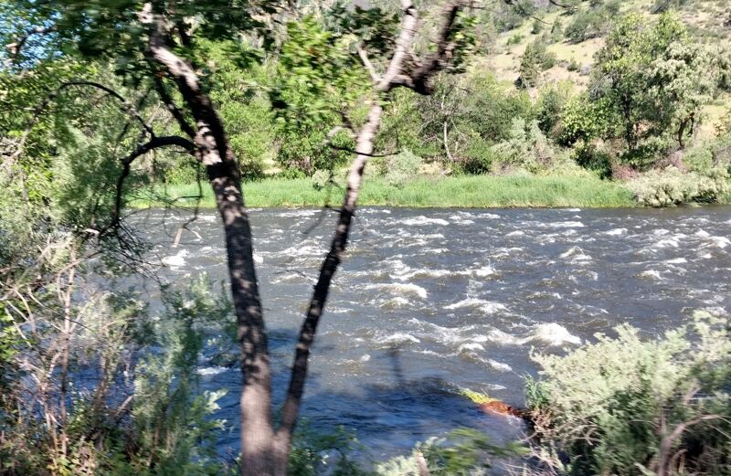
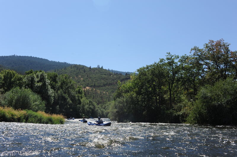
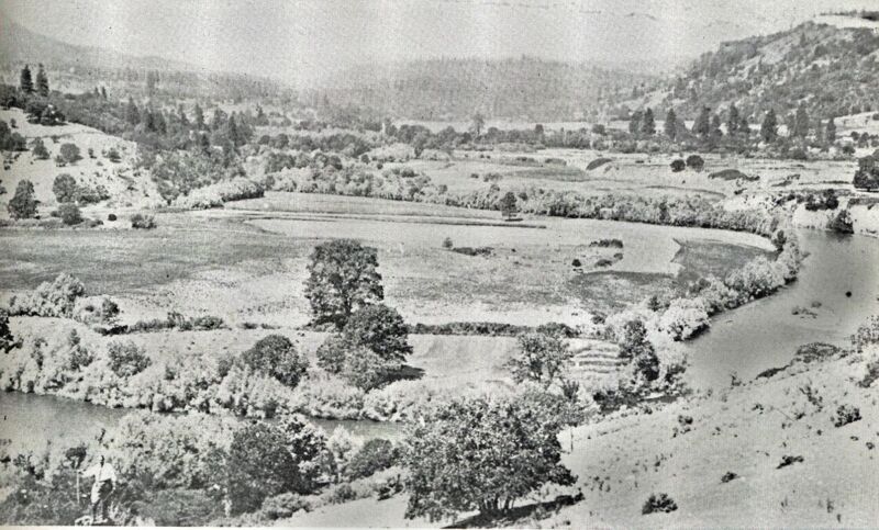
Near the California-Oregon border the Upper Klamath emerges from its rugged canyon and enters a broader valley where the gradient and rapids ease. For a bit over ten miles, the river traces a relatively mild passage as it winds a gentle valley bounded by steeper slopes and ocassional basalt cliffs. There are two distinct whitewater runs within this stretch, the upstream Class II+ Beswick Run and the downstream Class II Copco Valley Run.
The Beswick Run begins at Access 6, the typical take-out for the Hells Corner Run, and finishes at Access 1. The river here was not inundated by the Klamath hydropower dams but its flows were controlled by them. Before dam removal in summer 2024, this stretch had adequate flows for boating only very late in the afternoon, because it took at least four hours for “peaking power” releases from J.C. Boyle Powerhouse over a dozen miles upstream to work their way down to this stretch. Today, with J.C. Boyle Dam and Powerhouse removed, the river flows steadily around the clock and boaters can enjoy a run during daylight hours. Most of the river side land are private ranchlands, largely owned by the Klamath Indigenous Land Trust who purchased 10,000 acres from PacifiCorp in late 2025. This scenic valley is rich in Native history and cultural uses and is key to the restoration of this reach of river.
The river has a gentle gradient but is not without whitewater. Immediately below the Access 6 put-in, the river drops over a bouldery man-made shelf and then continues with a riffle-pool arrangement for the next 4.5 miles. The occasional island splits the flow and jogs in the river channel sometimes push the river against its banks. Expect some small holes and strong currents in places. At lower flows, some sections are rocky but not too shallow to be enjoyable year-round.
The Beswick Run can be extended in both the upriver and downriver direction. Put in at the Stateline River Access to
...
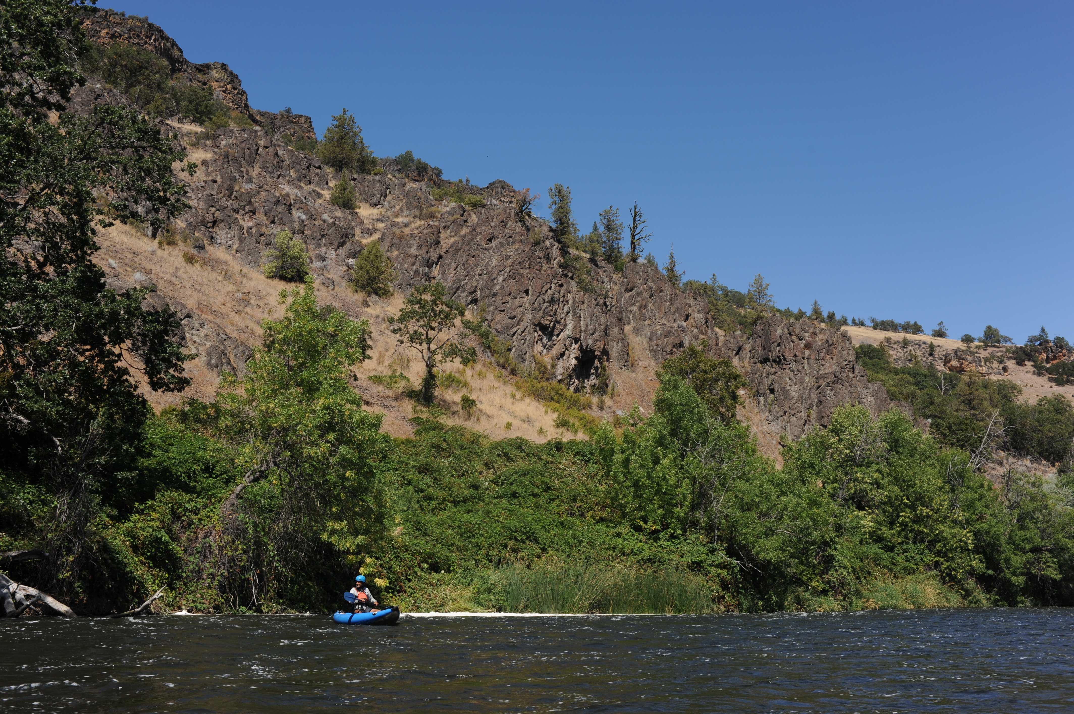
This put-in on river left is owned and managed by PacifiCorp. It was established as a condition of the hydropower project that has since been decommissioned. The big rapids of Hells Corner end about a mile upstream at Stateline. Most boaters use Access 6 in lieu of the rougher access at Stateline, which may be impassable to standard passenger vehicles. For the next 4.5 miles the Klamath runs through Class II rapids past private ranchlands.
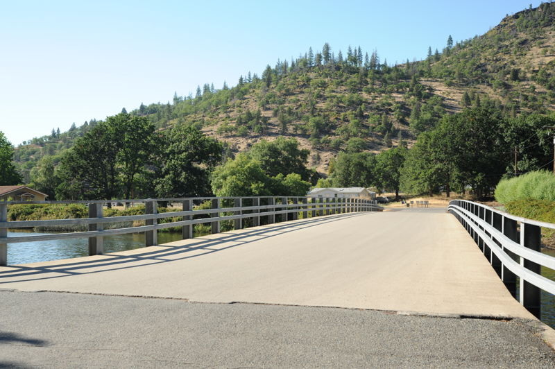
A private road bridge crosses the river where Shovel Creek, an important salmon spawning tributary, enters on the left. Nearby is the former location of the historic Klamath Hot Springs resort, which was popular around the turn of the 20th century.
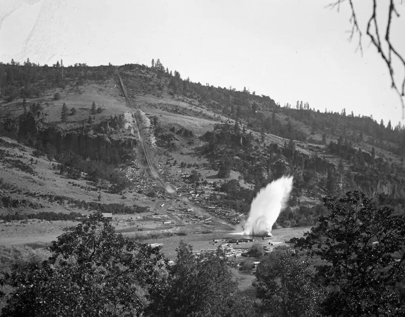
High on the slopes to the right boaters can see traces of the historic Pokegama log chute, which descended over 800 feet in about a half mile. The chute was greased with animal fat and delivered logs to the river at a blistering 90 miles per hour. The logs were then floated down the Klamath roughly 25 miles to the mill at Klamathon. A half mile downstream another private road bridge crosses the river.
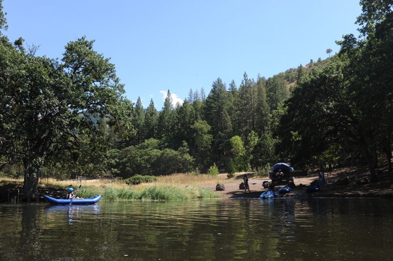
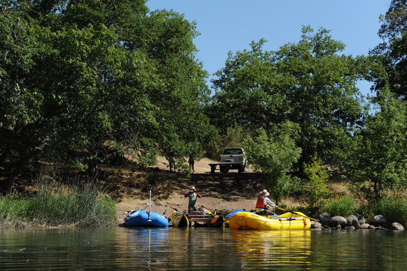
This is the take-out for the Beswick Run and the put-in for the Copco Valley Run. Before the drawdown of Copco Reservoir in January 2024, this is the access point is where the river ended and Copco Reservoir began. Access #1 now allows boaters to enter the river for the relatively mellow float through the former Copco Reservoir footprint. It is not possible to back trailers to the rivers edge here. Just downstream from Access 1 the Klamath passes several riverfront houses at the small settlement of Copco Village before meandering through the former reservoir footprint. Lands within the former reservoir currently belong to the Klamth River Renewal Corporeation, the entity that executed the dam removal project. Following the completion of the project, the lands will be transferred to the State of California with other lands being returned to the Shasta Indian Nation. The final result will be a mix of tribal lands and public state lands where Copco Reservoir once sat.
This river access facility is under construction and is not available for use at this time. It will open in late 2024 or spring 2025. Until it is open, there is no take-out access for this run upstream of Wards Canyon and its take-out at Fall Creek. In other words, boating through the Copco Reservoir footprint also requires boating thorugh the Class IV+ Wards Canyon. As of larte 2024, there are several tree hazards in the river in Wards Canyon. Boaters beware!
This future river access is tentatively called the Kikacéki Access in reference to the name of this region as it was known to the Shasta people who inhabited the area before the construction of the hydropower dams. American Whitewater is working with the Shasta Indian Nation to educate the public on this site and its significance while providing a safe place for those recreating on this segment to exit the river. American Whitewater worked to secure funding from the State of California to formalize this site for river access. The site will also serve as an access point for water trucks engaged in fire fighting activities.
May 31, 2025
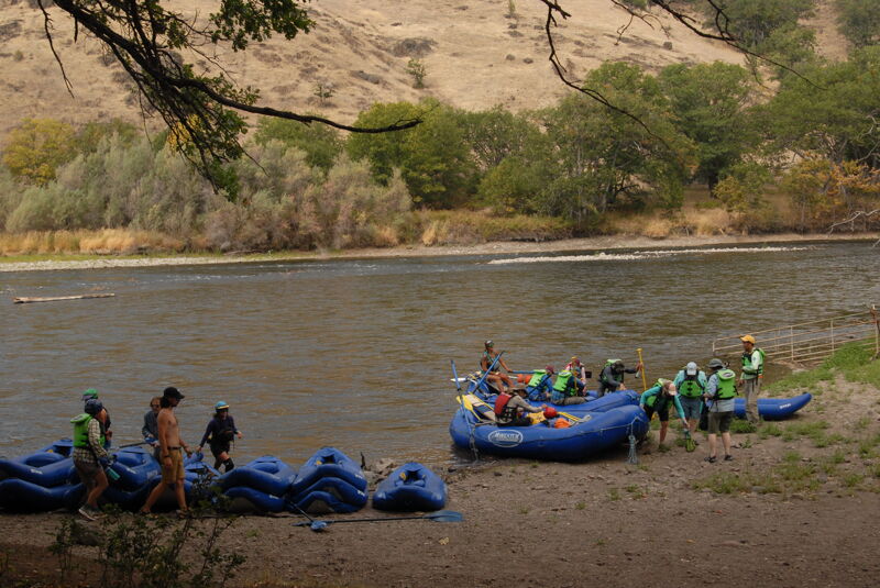
We ran our tandem whitewater canoe down the Beswick Run from Access 6 to Access 1 in late May. Air temps were hot (mid 90s), but water was very cold and swift. Neoprene just in case. Started off a with a drop right away, but there is a smooth line. Shortly after, a rocky section with barely submerged rocks required some maneuvering. This could be more of a rock garden at lower levels. Not much in the way of eddies. One of the last raipds, which seems like two offset holes, could swap a canoe if the wrong line is taken. Felt like a III the way we hit it, but we also didn't scout it. We bailed after that one. Easy dirt road bike shuttle.
Aug 17, 2023
Day 3 of Momentum's Klamath River Safari has the guests transfer to duckies at Stateline and paddle down to Access 1.