Deer Creek
4. Walters Mill River Access to Sandy Hook Rd./Deer Creek Conservation Area
| Difficulty | I-II |
| Length | 4.3 mi |
| Avg Gradient | n/a |
| Gauge | Deer Creek at Rocks, Md |
| Flow Rate as of 33 minutes | 1.96 ftbelow recommended |
| Reach Info Last Updated | August 2, 2025 |
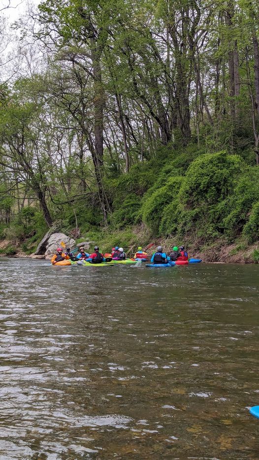
The reach is rather tame, but pretty. After a while it enters Deer Creek Park; when the river begins to take a sweeping right turn, it enters a little gorge towards the end of the gorge and a little before the Sandy Hook Rd./Deer Creek Conservation Area take out there is a rocky class II rapid. The Put-in for this reach is the Walters Mill River Access which results in a 4.3 mile paddle to the Sandy Hook Rd./Deer Creek Conservation Area take-out. To get to the Put-in take Ady Road (MD 543) north and turn left onto Walters Mill Road. Follow Walters Mill Rd. to the Walters Mill River Access.
To get to the Sandy Hook Rd./Deer Creek Conservation Area take-out from the Walters Mill Access, take Walters Mill Rd towards Ady Rd (MD 543). Cross Ady Rd and stay on Walters Mill Rd. Walters Mill Road ends at a stop sign at Sandy Hook Rd. Turn left onto Sandy Hook Rd and follow it down to Deer Creek. Just before the Deer Creek bridge turn left into the parking area.
To get to the take-out from Belair, MD, take US 1 north and follow it until it crosses Deer Creek. About a half mile after you cross Deer Creek on US 1, look for Sandy Hook Rd on the left. Follow Sandy Hook Rd a mile or so until you come to a stop sign. Turn left at the stop sign (still on Sandy Hook Rd.) and follow Sandy Hook Rd down to Deer Creek. Immediately after you cross the Deer Creek bridge, turn right into the parking area. There's plenty of parking here, but the take-out itself is rather muddy
If you'd like a little longer 6.1 mile run, another take-out is at the Benjamin Bridge River Access just off of US-1. The takeout is well maintained and not usually muddy.
Put-in - Walters Mill River Access (1202 Walters Mill Rd, Forest Hill, MD 21050). To get to the Put-in from US. 1, take Ady Road (MD 543) north and turn left onto Walters Mill Road. Follow Walters Mill Rd. to the Walters Mill River Access.
Take-out - Sandy Hook Rd./Deer Creek Conservation Area. To get to the take-out from the Walters Mill Access, take Walters Mill Rd towards Ady Rd (MD 543). Cross Ady Rd and stay on Walters Mill Rd. Walters Mill Road ends at a stop sign at Sandy Hook Rd. Turn left onto Sandy Hook Rd and follow it down to Deer Creek. Just before the Deer Creek bridge turn left into the parking area. To get to the take-out from Belair, MD, take US 1 north and follow it until it crosses Deer Creek. About a half mile after you cross Deer Creek on US 1, look for Sandy Hook Rd on the left. Follow Sandy Hook Rd a mile or so until you come to a stop sign. Turn left at the stop sign (still on Sandy Hook Rd.) and follow Sandy Hook Rd down to Deer Creek. Immediately after you cross the Deer Creek bridge, turn right into the parking area. There's plenty of parking here, but the take-out itself is rather muddy. There are no rapids and not much scenery between here and the Benjamin Bridge river access.
Alt. Take-out - Benjamin Bridge River Access. If you'd like a little longer 6.1 mile run (no additional rapids), another take-out is at the Benjamin Bridge River Access just off of US-1. The takeout is well maintained and not usually muddy.
