Sycan River
Coyote Bucket

| Difficulty | IV-V |
| Length | 16 mi |
| Avg Gradient | n/a |
| Reach Info Last Updated | August 7, 2024 |
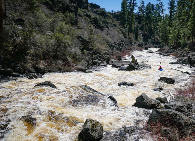
A high quality high desert run NE of Klamath Falls. The river doesn't run every year, but in the years that it does run the season is usually decently long.
The whitewater is continuous with many hydraulics. Sort of the same style as the NF Payette, but smaller.
There are two canyons, or 'buckets' as called on the map. The second is a half step up from the first.
The take out requires using a private road, be sure to close any gates you pass through behind you, and bring a 4wd vehicle with a bit of clearance. Or, add six miles of flat water and take out at the paved Drews Bridge.
This take out option drastically reduces the length of the paddle out. It requires driving private roads where public access is allowed, but the road can be difficult and 4wd with clearance is recommended. Be sure to shut any gates you open behind you.
The Drews Road Bridge is paved, and is easier to navigate to than Chester Springs, but taking out here requires floating almost 6 extra miles of flatwater.