Goose Creek
Upper

| Difficulty | III-IV+(V) |
| Length | 6.2 mi |
| Avg Gradient | n/a |
| Reach Info Last Updated | August 7, 2024 |
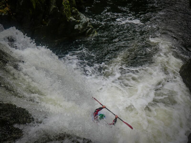
A high quality run with a complicated hike in. Runs usually continue down through lower Goose Creek.
Expect many class IV rapids with some IV+ and two class V's.
The beginning of the hike is here, just after turning off of the Go Road. The road quickly deteriorates but is walkable. It is about 8 miles if you follow the road the whole way, or about half that if you get clever with your cross-country shortcuts.
A difficult to access bridge near EF Goose Creek. A large hike from the parking area off of the 'Go Rd' is required to access it along gated or decommissioned roads.
The usual take out is on the SF Smith at the S Fork Rd bridge downstream of the Goose Creek confluence. This requires paddling Lower Goose Creek as well. Paddlers without the time for that can use the spur used for Lower Goose Creek access to hike out along the decommissioned road. If this is the plan, mark your take out well while setting shuttle. Again, it is recommended to continue through Lower Goose Creek after running Upper Goose Creek.