Box Canyon Creek
Box Canyon to Chetco River
| Difficulty | IV-V |
| Length | 6.4 mi |
| Avg Gradient | n/a |
| Reach Info Last Updated | April 16, 2025 |
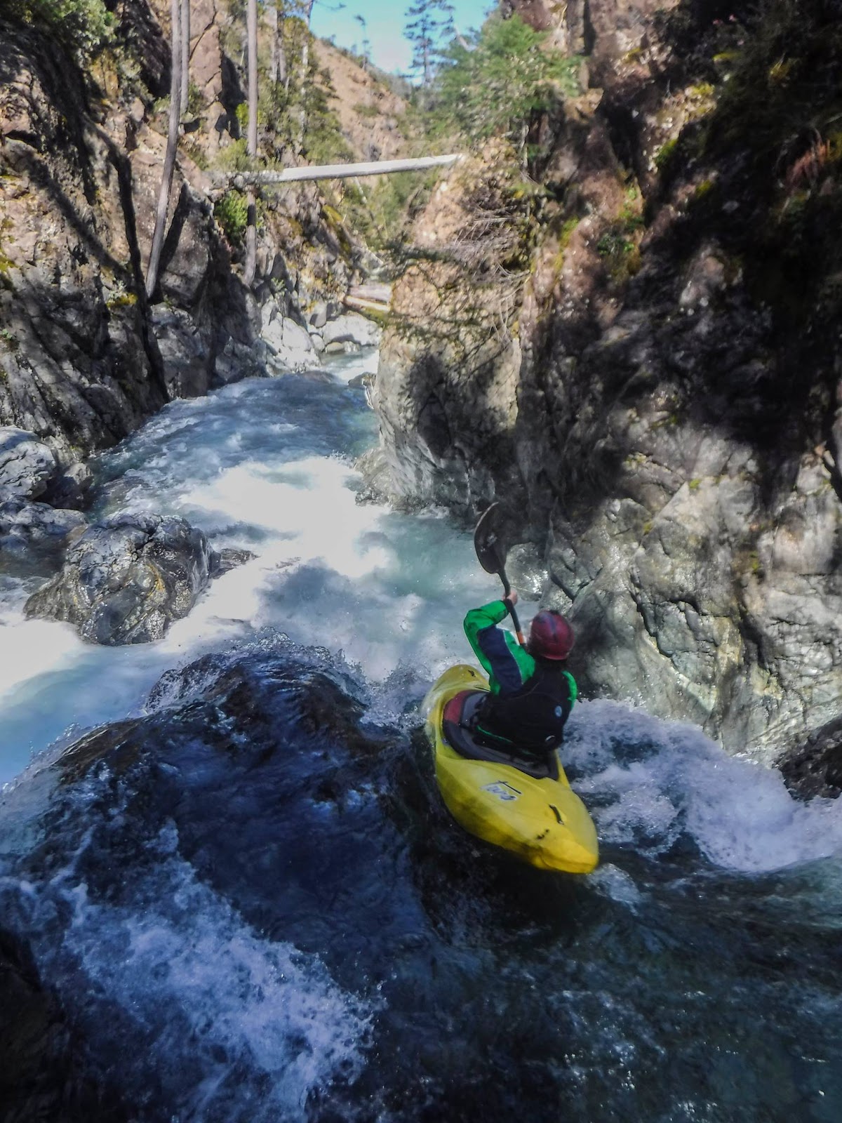
A committing adventure in the Chetco drainage. Box Canyon Creek lives up to it's name with vertical walled gorges. There are many class IV-IV+ rapids and a few class V's.
Nut Dust is the most committing part of the run, two class V rapids in a row that are difficult to deal with and dangerous. The first is a fluming ramp, then around the corner a ledge/slide with a nasty cave on the right. It is possible to portage the first high on the left, and the second on the right, neither is easy to do. Aside from that be ready to problem solve your way down this beautiful creek. Many fun ledges and quality rapids await, but if wood is in the wrong spot it can be rather problematic.
After the confluence with the Chetco, there are over 20 more miles of high quality class III-IV (V) boating left.
The Vulcan Lake trailhead is at the end of Forest Road 1909. From this point boaters follow an old roadbed for a ways before descending cross-country to the put in.
A hike in from the Vulcan Peak area is required to reach the put in. Some of the hike is along old mining roads, the rest is cross-country.
Take out at the confluence with the SF Chetco.
