Rough and Ready Creek, South Fork
Hike in to Below Confluence w. N.Fk

| Difficulty | IV-V |
| Length | 4.1 mi |
| Avg Gradient | n/a |
| Reach Info Last Updated | February 7, 2025 |
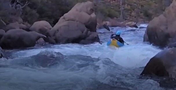
An action packed run with a hike in. The run is very continuous, and has sustained whitewater the whole way. Watch for wood, and be ready for lots and lots of action. There are no large drops, but the never ending barrage means focus is required the whole time.
After reaching the confluence with the NF of Rough and Ready, the whitewater eases off and becomes open read and run down to the Redwood Highway and take out. There is a low head dam in this section that can be portaged on the left.
Headwaters at 2720', at the base of the nose of land descended north from Our Mountain. Access is a bushwhack off of NF-112 (AKA Kalmiopsis Rim Trail).
There is a gate here where hiking usually begins. If the gate is open it is possible to drive further up the road and shorten the hike in.