| Difficulty | II+ |
| Length | 4 mi |
| Avg Gradient | n/a |
| Gauge | Little River Near Star, Nc |
| Flow Rate as of 58 minutes | 4 cfsbelow recommended |
| Reach Info Last Updated | March 7, 2025 |
River Description
This section of river, which passes through the Uwharrie National Forest on the south end with Piney Mountain on river left is mentioned in Paddling Eastern North Carolina by Paul Ferguson with a minimum of 1.9 ft on the USGS gage at Little River in Star, NC. However, if whitewater is what you're looking for, I'd suggest over 3 ft on the gage.
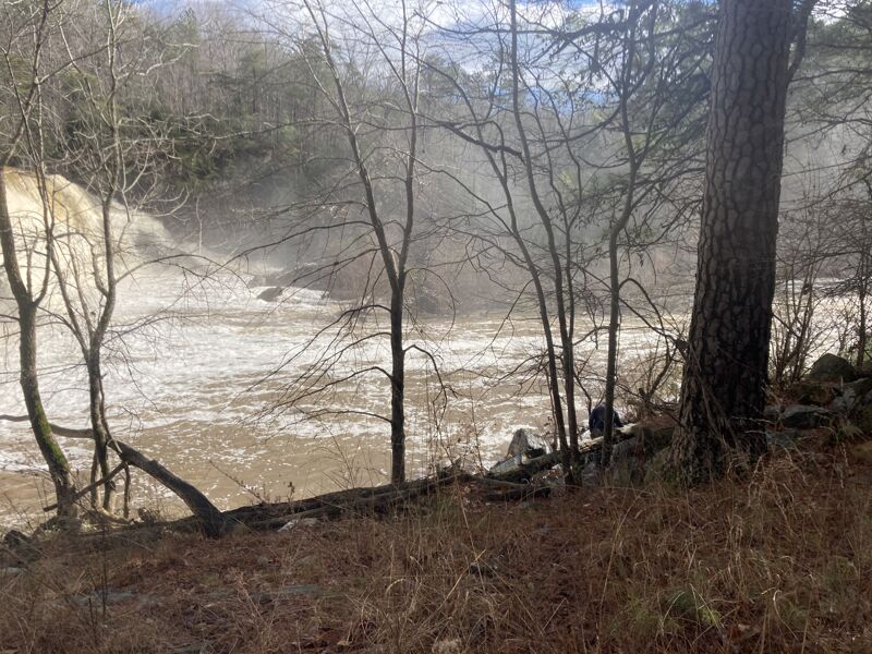
At estimated minimum, this should be class II and on the higher end of the range (4.5 ft or more), this gets more difficult due to the continuousness and gradient and is somewhat pushy compared to other class II runs around. The gauge is approximately 16 miles upstream, but suggested levels should still work for this run. It starts with a 1.3 mile flat paddle on Lake Eure and there is a $10 fee to launch at the private boat ramp there. It is worth the paddle on the lake once you get past the dam since the river below is continuous for two miles. As you're paddling on the lake, you'll see the surroundings that would suggest maybe there is more excitement below the surface of the water that would be unlocked should the 45 foot dam ever be removed. I have below some alternate put in options to consider if you do not want to pay to launch. If you choose to start at Rocky Creek, you want even more rain than normal for this to be runnable. The creek was scrapable and mildly entertaining when we made this trip with 5.2 ft and slowly dropping on the USGS gage at Star, NC.
From the lake, portage river right a bit before the dam and follow the trail below looking for a spot to put in just below. It might be easier to put in further downstream, but you'd miss some good rapids in the first 30 yards or so. The first half mile of rapids are the most difficult boogie with some small ledges and no distinct drops, but powerful current with large waves. The next mile and a half is a bit easier boogie throughout with very few stretches of flat. Once you see the bridge at Thickety Creek Rd, work your way left. Current is strong at
...River Features
Put-In (private)
Access PointDistance: 0.04 mi
The put-in is on the reservoir on river left at a private boat ramp that requires a fee.
Dam
PortageDistance: 1.32 mi
Dam requiring a portage. The whitewater begins downstream of the dam.
Thickely Creek Road Bridge Take-out
Access PointDistance: 4.01 mi
Take out at the bridge on the upstream river left side.