Diamond Creek
Diamond Falls to NF Smith River
| Difficulty | IV |
| Length | 4.1 mi |
| Avg Gradient | n/a |
| Gauge | Smith R Nr Crescent City Ca |
| Flow Rate as of 29 minutes | 314 cfsbelow recommended |
| Reach Info Last Updated | March 20, 2025 |
Wild and remote, Diamond Creek flows through the heart of the red rock peridotite country known as the Redrock Rainforest to join the North Fork Smith River just about one mile below the typical put-in point at Major Moore's Bridge. This means you get the full adventure of Diamond Creek (including getting to the creek) plus almost the full North Fork run. It's a full and amazing day of boating! It's even possible to extend the run another few miles by starting higher up on the North Fork of Diamond Creek.
Infrequently run due to the challenging drive in to the creek, most boaters opt to put in on the lowermost reach of North Fork Diamond Creek so they can start the day on the water by running the triple-drop of Diamond Falls. If getting the biggest thrill of the day straight out of the shuttle rig isn't your game, simply put in below it. North Fork Diamond Creek joins Diamond Creek proper not far below the falls.
This is a run fed by winter rain and, usually if there's been enough rain to bring up Diamond Creek, there's going to be some snow on the higher elevation portions of the drive in via Patrick Creek Road access. Don't underestimate the challenge: be prepared for snow and downed trees, rocks, and landslides on the drive. A skilled shuttle driver with knowledge of the area is key: you don't want to come back at the end of the day to retrieve your rig from the put-in and you also don't want to get lost out in this vastly remote landscape where you're likely the only human beings.
On the water, Diamond Creek is wide open for the first two miles below the falls with mostly Class II and III whitewater, flowing thorugh a sparse and recently burned forest. The red rock landscape is surreal. The lower two miles is where the Class IV rapids lie, descending into a tighter bedrock gorge on the way to join the North Fork Smith at a spectacular confluence complete with a waterfall cascading from a side stream into the confluence pool.
Use a short spur road off 18N09 to get close to the creek just upstream of Diamond Falls. Options exist to put in above or below the falls.
Triple drop Diamond Falls. Options exist to put in above or below the falls.
Diamond Creek flows directly into the North Fork Smith. Continue downriver on the North Fork to one of the take-outs in Gasquet.
Diamond Creek flows directly into the North Fork Smith. Continue downriver on the North Fork to one of the take-outs in Gasquet.
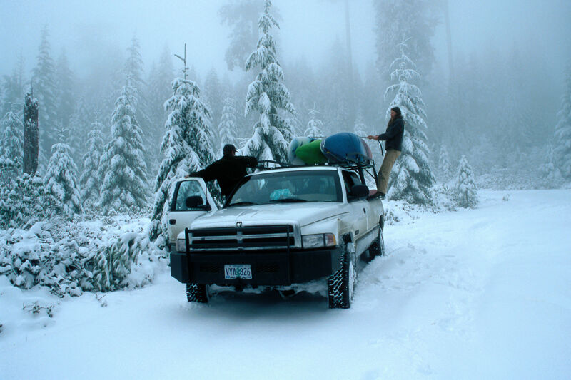
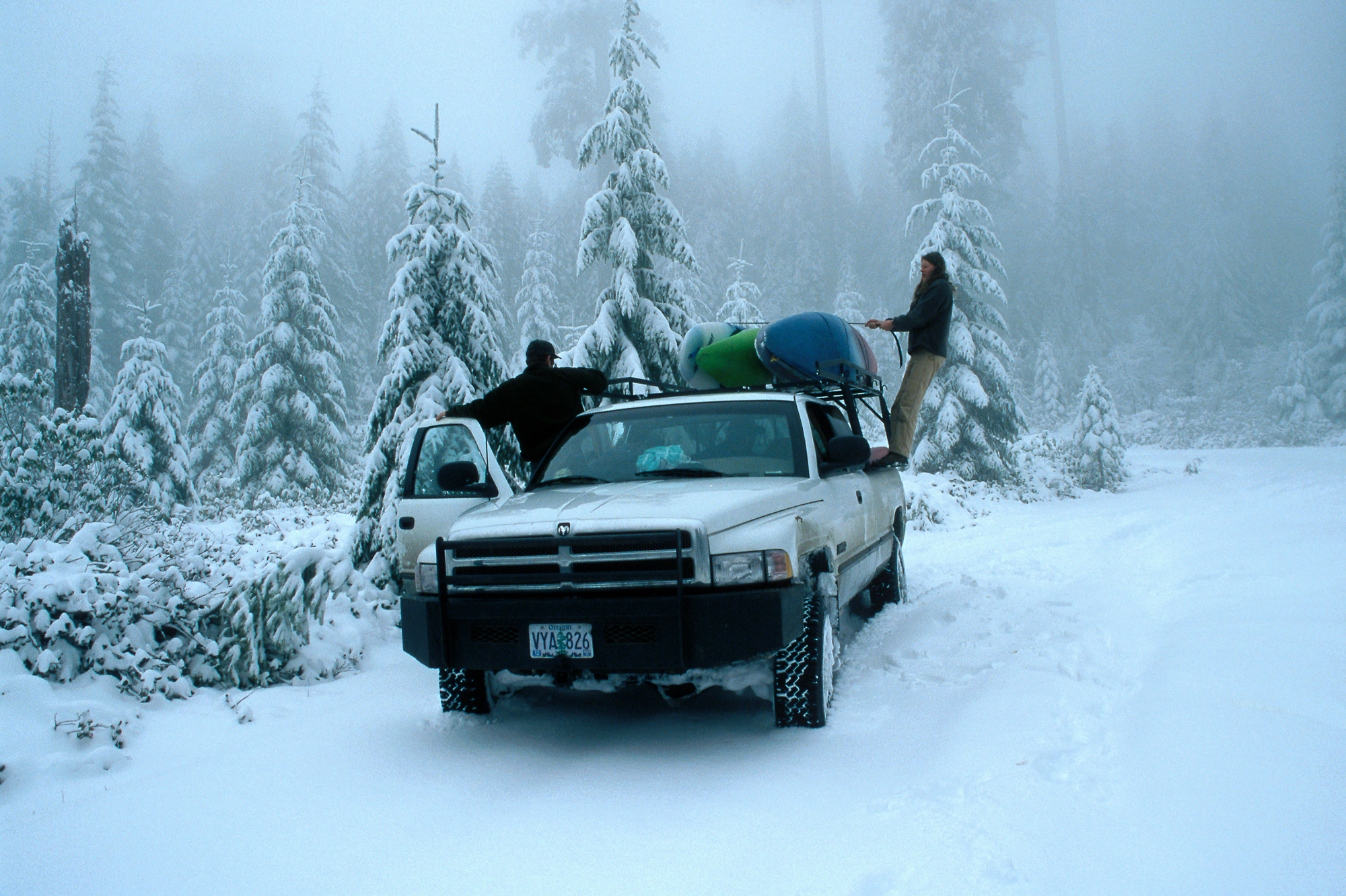
Feb 1, 1998
Somewhere I have some slides from boating on the creek, but I scanned this one years ago to memorialize the drive in to the creek, which was just as memorable.
We took the route up and over from Patrick Creek, encountering rocks, downed trees, small landslides, and then an abundance of snow higher up. It was a dicey ride even in a very capable truck with six of us to deal with all the issues. As we were about to get on the water, we felt unsure that our shuttle driver would be able to make it back on his own. So we all put our credit cards in our dry bags in case we gout out to civilation in Gasquest and our driver wasn't there. At least we'd be able to get rooms at the Wagon Wheel Motel in Gasquet (next to Margies, but now gone). But, our driver made it and we managed this as a very long one-day adventure.