Scott
USGS Gage Station to Boulder Creek(Upper Scott River Canyon)
| Difficulty | III |
| Length | 4.9 mi |
| Avg Gradient | n/a |
| Gauge | Scott R Nr Fort Jones Ca |
| Flow Rate as of 1 hour | 31 cfsbelow recommended |
| Reach Info Last Updated | April 25, 2025 |
At the downstream end of the Scott Valley west of Fort Jones, the Scott River abruptly changes character from an easy, valley-bottom stream to a whitewater river that flows through a beautiful and deep forested canyon. The Scott is a designated state and national Wild and Scenic River.
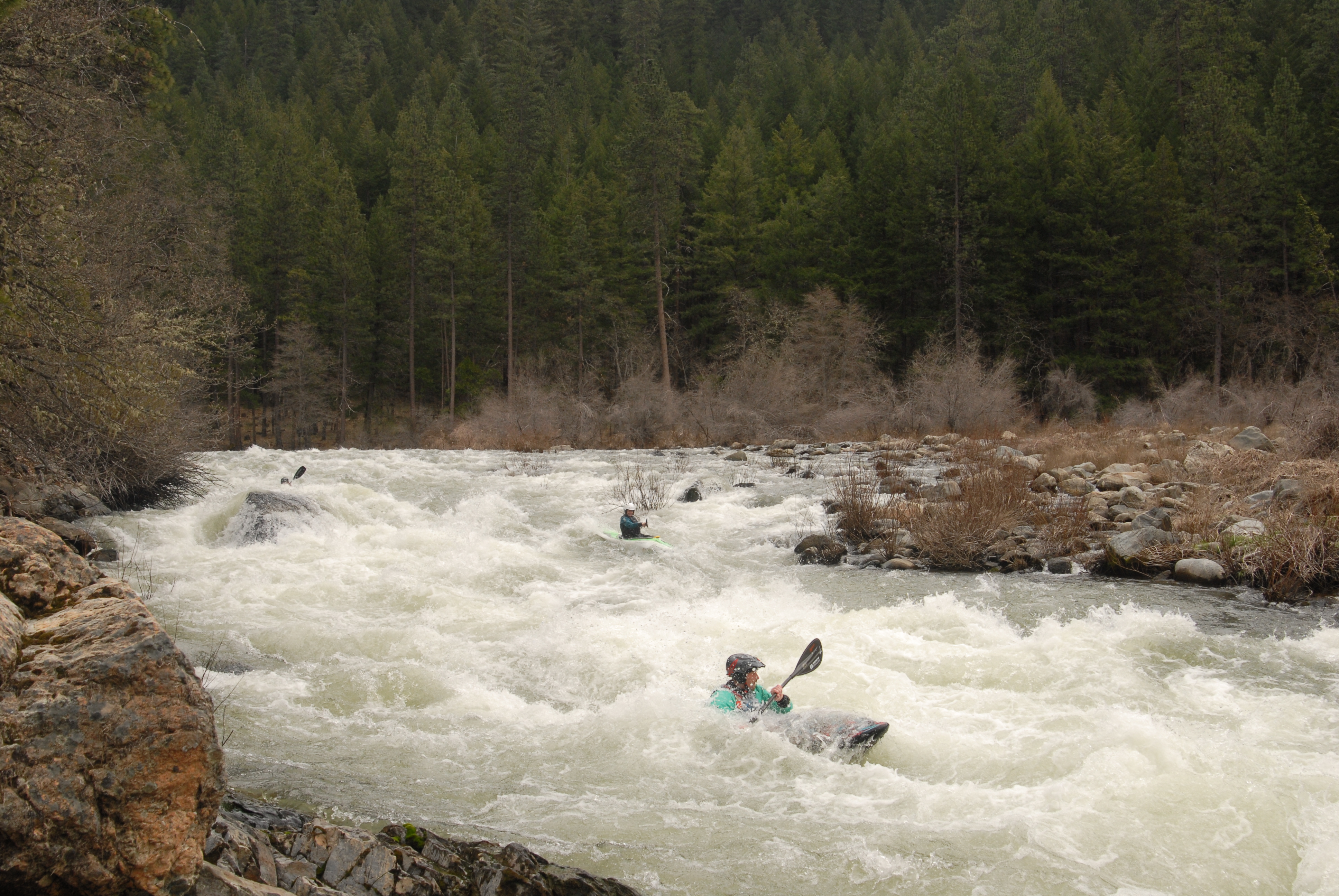
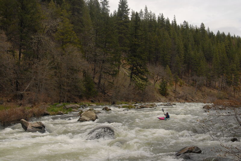
Unknown to most boaters and rarely run, this is a high quality and fun section that begins at the top of the Scott River's canyon and continues for nearly five miles, offering up many Class II and III rapids plus some stunning views along the way. The run is suited for kayaks, packrafts, IKs, rafts, and similar crafts.
The upper half of the run flows through private lands before the river enters the Klamath National Forest a little ways upstream of Jones Beach.
Be sure to scout the take-out if you do not intend to continue on downstream through the Class V Boulder Creek Falls and the more challenging water of the main Scott River Canyon downstream.
Flows & Season
The Scott River’s hydrology is heavily impacted by its history of post-settlement development and, in particular, by ongoing agricultural diversions and groundwater pumping in Scott Valley, compounded by a drying climate and declining snowpack. It once had reliable winter and spring flows, predictable and regualr enough to support several whitewater rafting outfitters. However, since the early 2000s, boatable flows have become increasingly rare and unpredictable. While nearby streams a fraction of the Scott’s size may run at 1,500 cfs, the Scott itself often trickles by at a mere 100 cfs. It doesn’t reach boatable flows every year, but in wet years, it can run fairly regualrly—feast or famine.
In good years, the Scott may start running in late December or January, usually after warm rain with a snowmelt component. If the valley’s depleted aquifer recharges during winter then late winter and spring rains and snowmelt are more likely to produce sustained boatable flows
...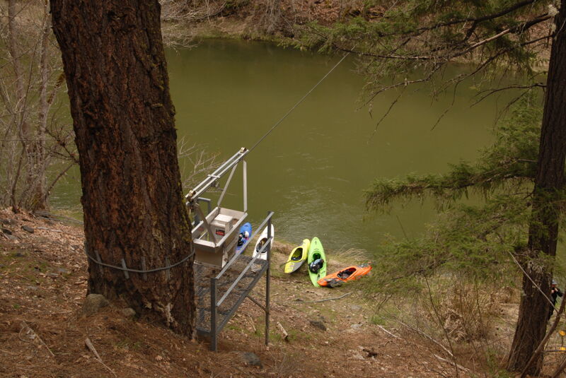
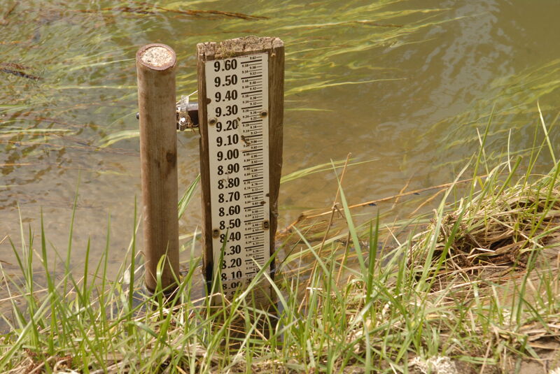
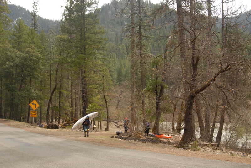
Access is avaialble at the USGS Gage Station (Scott R NR Fort Jones CA - 11519500) on river right. A small pull out for a couple cars is available at mile 10.5 on the road where a short trail leads down to the river shoreline at the gage station. This access is on private timber company land.
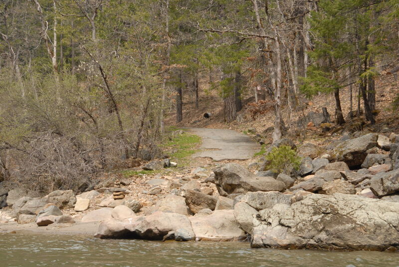
Jones Beach is the furthest upriver National Forest river access site and is easy to find along Scott River Road (at mile 13.2) just inside the Klamath National Forest. A paved parking area leads to a trail down to a sandy beach on river right. This access can be used by those desiring a warm-up before the action-packed section downstream, which includes Boulder Creek Falls (a solid V) and Canyon Creek Rapid (IV).
A cabinet maker in Knoxville, Tennessee had all of his tools stolen out of his pickup truck one night in 1998. With nothing more to lose, he drove across the country to couch surf at a friend's house. The house happened to be on the Scott River. This rapid was named to commemorate the event that brough the Scott River into the cabinet maker's life, changing him forever. It's a fun and easy drop, a lot better than having your tools stolen. Location approximate.
A great place to camp along the Scott River, Indian Scotty is a US Forest Service campground that is open seasonally (which means it's often closed during boating season). It's also possible to access the river here, though better for kayaks than rafts. The downstream group site has a great swingset with a view of the river.
Access is an informal access site available on river right a short distance upstream of Boulder Creek Rapid. It is located where the river comes up against the road at mile 15.2 with convenient lowbank access.
Apr 6, 2025
This is a really fun run that is almost completely overlooked by boaters. We had a good flow within the lower half of the medium flow range: ample water, few rocks in the rapids, fun waves, but also not too pushy.
Perhaps part of the reason this run is overlooked is that there is no official put-in and all the land in the top of the upper canyon is private. The best solution is to put in at the USGS gage that is located on private timber company land but which serves a public function.
This run has a ton of rapids, fun moves, some play features, and some really good views of snow-covered peaks and forested canyon.