Hoh
1. Lewis Meadow to Hoh Campground(Upper Hoh)
May 21, 2025
| Reporter | Jackie Ahern |
| Flow | Medium Runnable |
On May 10th and 11th our group paddled the Hoh from a little past Happy Four Campground (N 47.869589° W 123.816752°) to Hoh River Campground (N 47.857803° W 123.938542°). The section was about 8 miles of river, though could be made shorter or longer depending on choice of put-in.
Flow: Gauge downstream on the Hoh measured 1150 cfs on 5/11
Other logistics: Will need national park pass (or daily rate) + wilderness permit
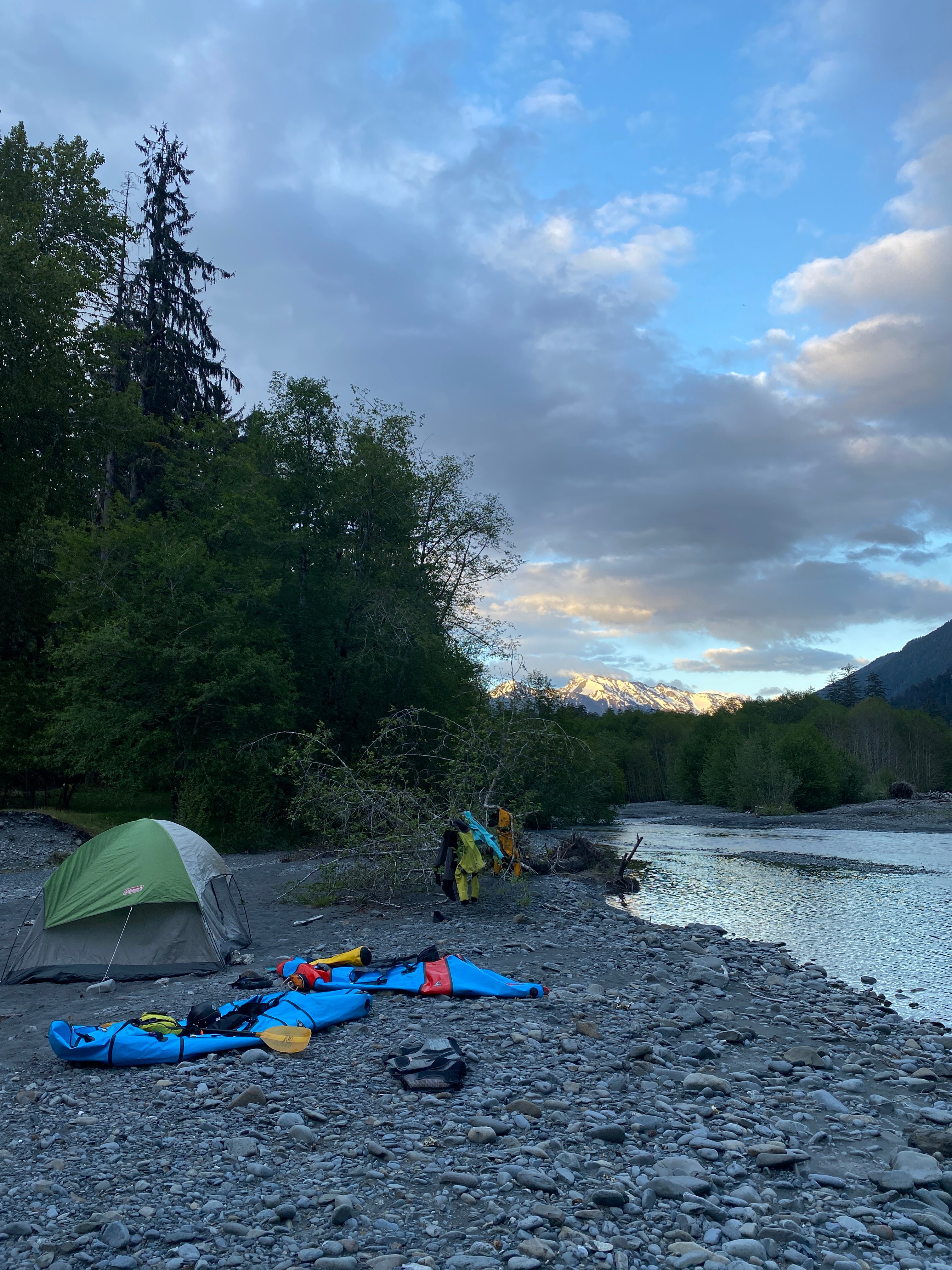
Day 1:
We parked in the backpackers lot at the Hoh Rainforest area. We hiked up the Hoh River trail for about 5 miles to 5 Mile Island Campground. There is a pit toilet at this campground. We were hoping to get more eyes on the river as we came up the trail to scout out log jams and rapids but didn’t get consistent views of it. At the campsite, we set up camp and dropped any unnecessary gear. We repacked our bags with our packraft gear to hike up for a little afternoon bonus paddle.
We walked another mile and a half up river and then followed a dried up creek bed to the river (turned at N 47.869772° W 123.816763°). We considered hiking further to the next campground for a longer paddle and easier put in but we were feeling tired and wanted to mindful of the time potential wood shenanigans might take coming back to camp.
Our first paddle leg from 1.5 mi upstream of camp to 5 Mile Island was fun. Some splashy class IIs and a couple waves to surf in. The scenery was incredible, we even got some sun. There was a channel spanning log jam that we portaged right after Happy Four Campground. Then as you approach 5 Mile Island Campground, the river braided into 3 channels, with wood across all of them. We stayed river right, and did a couple portages, re-entering the river after the little birch tree forested section, right before the campground.
Day 2:
We had a peaceful, quiet morning enjoying the scenery and watching the ducks nearby. From 5 Mile Campground, onward, there were some pretty large log jams. For a couple of them we shifted to a different river channel, portaging for 1/8-1/4 mile. For the large jam right before Mount Tom Creek (N 47.865327° W 123.875354°), we portaged to the right, through the birch forest, to the low water channel on the other side of the forest. This might be less pleasant as water levels drop.
After Mount Tom Creek, we got some reprieve from the wood. There were maybe another one or two more log jams that required a short portage.
Take out: Where the left braid of the river we were on reconnects with the right one near the southwestern loop of the Hoh Rainforest Campground (N 47.857803° W 123.938542°).
Overall more splashy fun class IIs, wildlife, incredible scenery. We had to booty scoot and walk our boats a little but it wasn’t too frequent. There were plenty of eddies and opportunities to scout wood hazards; but still definitely keep your eyes up! We had both the campground and the river to ourselves. A wonderful trip!