Merrimack
6) Amoskeag Falls to Goffs Falls (Crack Pipe, 293 Wave)(Manchester Run)
| Difficulty | I-II+(III) |
| Length | 5.1 mi |
| Avg Gradient | 4 fpm |
| Gauge | Merrimack R Nr Goffs Falls, Below Manchester, Nh |
| Flow Rate as of 49 minutes | 1900 cfslow runnable |
| Reach Info Last Updated | June 2, 2025 |
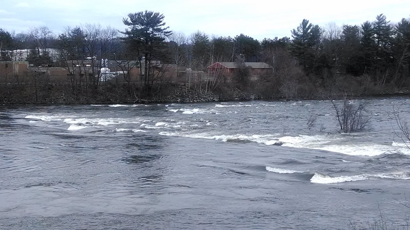
The Merrimack River through Manchester is more popular for its three play spots (Arms Park aka Crack Pipe, 293, and Goffs Falls) rather than a river run. However, this section does provide water at a time of year when practically every other river within 100 miles is too low. The scenery is poor since it runs through the heart of Manchester's mill district.
The manmade canyon created by the buildings from the Amoskeag mills have a lot of history. In the early 20th century these mills produced more woolen products than anyplace else in the world. As a result the river has been diverted, altered, and built upon creating an unnatural river environment. The parking lot located at Arms Park was the site of the Arms Manufacturing Company. Up to the anthrax outbreak in the fall of 2001, Arms Manufacturing had the reputation of having the worse anthrax death toll in the United States. In 1957 four people died of inhalation anthrax on goat hides, as it was used in their manufacturing process. The building was so contaminated with anthrax it had to be torn down, burned, and buried.
During times of heavy rains such as just after a thunderstorm the Manchester storm sewage drains are overwhelmed and dump directly into the river. This is especially noticeable at and below 293 bridge rapid. Normally (outside of times of CSO -- Combined Sewer Overflow) the water quality is not bad and according to the EPA it is acceptable for swimming.
Check out the Amoskeag fish ladder at the put-in. There is an interpretative center there showing the migratory habits of andromonous fish such as salmon, eel, and shad. The fish ladder is usually active in late May and early June.
During high runoff periods when water tops over the dam, there are three 1/4 mile long Class V channels that flow out from below the dam. Access and scouting is best from the east side of the river behind some mill buildings. At the time of this write up access was difficult because of constructi
...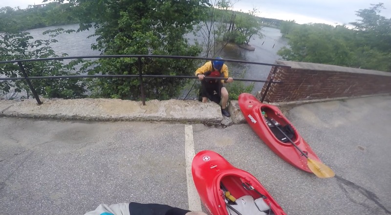
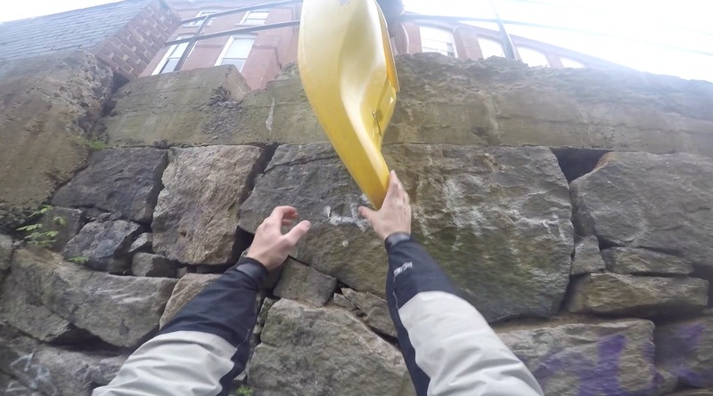
Jim Cavo wrote: Approx. 1/4 mile of class-II rapid. The river is bordered by a high seawall and access is limited. The putin and takeout are at Arms Park, at the large steps along the seawall. There are plans to install permanent putin steps upstream.
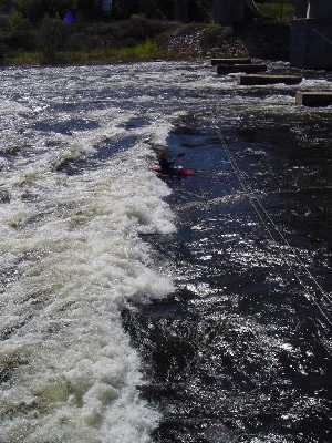
There are numerous permanently installed slalom gates, and many well defined eddies making this a good site for practicing slalom and attainment. Unfortunately, the play wave/hole described in Appalachian Whitewater was almost entirely washed away in high water several years ago.
Flow is controlled by Amoskeag Dam, but runs most afternoons and evenings. There's a good brew-pub adjacent to the park.
Directions: From Rt. 293 take Exit 6. Cross river on Granite Street. After crossing river, take first left onto Commercial Street and follow Arms Park signs; the park is about a mile ahead under a large bridge.
Paddlers' each can have their own opinion on the best level
for the Crack Pipe Wave. The range of opinions go from 3000 cfs
to 9000 cfs. Some prefer 3500–4500; others will say
6000–9000 is best. A few like it as low as 1500 cfs.
What most agree on is if the level is not to your
liking then head downstream to try the 293 Wave.
1122
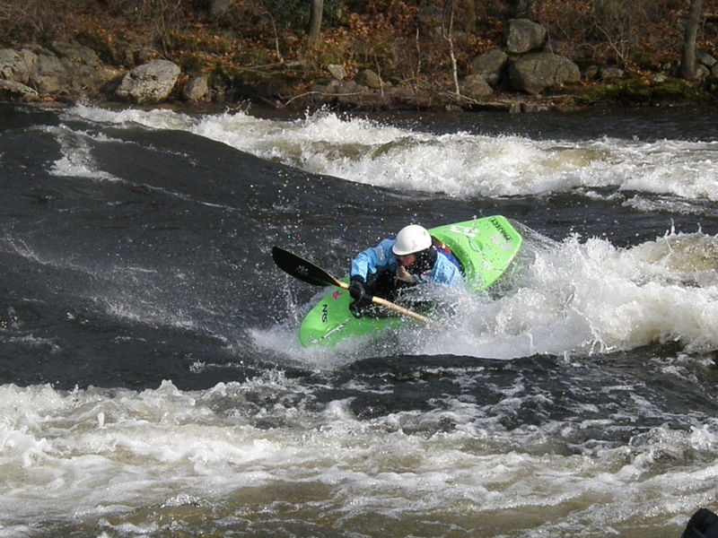
Currently the most popular play spot for play boaters. 293 is located directly below the interstate 293 overpass. At low through medium levels the river splits around a small rocky island. The river right channel is narrower. It has a nice surfing wave at low levels. On river left there are a variety of holes and waves for playing. Most boaters believe this section is best at river levels of 6000 to 8000 cfs. There is a sewage treatment plant located on the river left bank of the rapid.
If you are only interested in this segment of river, park on river right below 293 bridge. Take interstate 93 to Interstate 293, 101. Once you cross over the Merrimack stay on Route 101 by staying left where 293 exits to the right. Take the next exit for Route 3 after the exit for southbound Everett Turnpike. Take a right at the end of the ramp. After .7 miles take a left just after the Everett Turnpike overpass (road not signed). Go to the end of the road and park by the river.
Goffs Falls is best at medium to high water 6500 to 7500 cfs. At this level a nice wave forms under the railroad bridge. It is best accessed from river right of the river left channel.
Jul 31, 2020
Updated the location on Google Maps; search for '293 Wave Whitewater Rapids' or use these GPS' for the first parking spot:
42°56'43.9'N 71°27'42.6'W
42.945524, -71.461821
Aug 5, 2017
Where the put-in requires scaling a 10 foot seawall
Mar 28, 2009
Was at crackpipe today. Running about 8,000 CFS the eddy becomes almost completely washed out. It is a serious struggle to get up on the wave at this level. The front wave as well as Crackpipe are both great at this level for riding, very big, very good hold, very fun. But you will most likely have to take the 5 minute walk up to the put in after a run
Jul 23, 2006
Updated directions to 293 playspot: There's been a lot of construction in the area. From 101/293, take Rt 3 South. About .7 miles down, you'll pass a Dunkin Donuts, Lowe's, and Target. Aftre another 1/2 mile, turn Left at a light onto Hawthorne St, then Left on Station Street. Continue to the end of the pavement, then bear right onto a short dirt road (as of 7/06) that ends at a small pump/utility station along the river.