Pemigewasset
5) Ayers Island Dam (Bristol) to Coolidge(Bristol Gorge)
| Difficulty | II(III) |
| Length | 1.7 mi |
| Avg Gradient | 25 fpm |
| Permit | |
| Gauge | Pemigewasset River at Plymouth, Nh |
| Flow Rate as of 1 hour | 253 cfsbelow recommended |
| Reach Info Last Updated | July 20, 2019 |
River description.
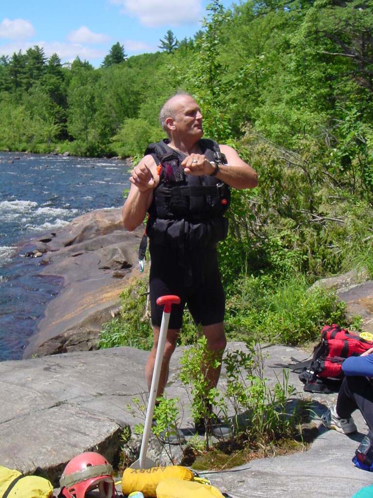
There is a small parking area at the put-in near Ayers Island dam. There is a porta poty located here along with trash cans. Additional parking can be found at the top of the dam where a hiking trail leads down to the put-in parking lot.
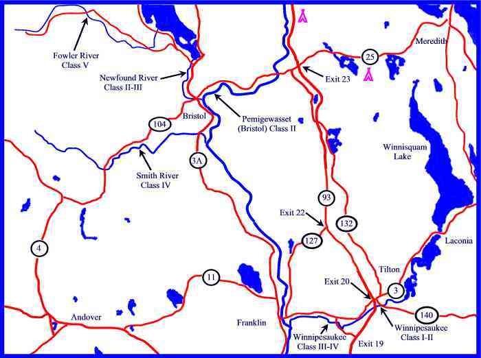
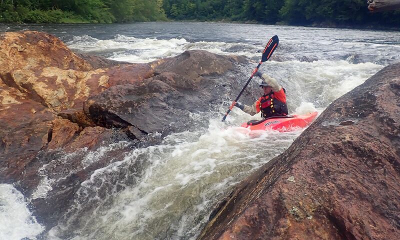
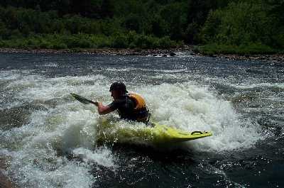
The river is about 1-1/2 miles long with three distinct play spots. The first big drop is about 1/4 mile downstream with a medium size sidesurfing hole (Rodeo Hole)it is not for novices to play in. Run right at this point. Downstream 100 yards there is a good surfing wave depending on level. The river from this point to the take out is mostly small rapids with a few oppertunities for surfing a sidesurfing. The last rapid is a series of reactionary waves and holes caused by protruding ledges on a long sweeping right turn. The last ledge at the take out is probably one of the best summer time play spots in NH with a great sunning and spectating rock to go with it. Depending on level it is either a sidesurfing hole, surfing wave, and or ender spot.
You can takeout at the Pemi Park & Play or just slightly downstream at a ledge. This take-out is easier for canoes and rafts. It also leads up to a small parking area on Coolidge Woods road which has new porta poties maintained by Public Service company of NH.
Put in elevation........370'Take out elevation......331'Total drop..............39'Average drop/mile.......25'Distance................1.6 milesRiver width average.....120'River geology...........small boulders and granite ledgeRiver water quality.....fair to good, clarity fair, sewage treatment dumps in below rodeo wave.Scenery.................Good forest scenery. Not many signs of civilization except for dam and bridge.Wildlife................Occasional deer, hawks, osprey, fishermen. Good trout fishing.
Nice sidesurfing hole located at the very top of Bruning's. Approach the top of Bruning's at the horizon line about river center. The hole turns into a surfing wave just right of river center. There is no convienient eddy to hop in and out of the hole so it will be necessary to catch it on the fly then return by carrying back over the ledges from the river left eddy just slightly downstream. The hole is best at about 1300 cfs, below this level down to 800 cfs the hole gets stickier and shallower so watch your head should you flip upstream. There is also a nice surfing wave that can be accessed from an eddy just downstream. It is best at 800 cfs to 1500 cfs.
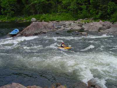
The first big drop is about 1/4 mile downstream with a medium size sidesurfing hole (Rodeo Hole)it is not for novices to play in. Run right at this point. After the first few small class I-II rapids from the put-in, the river widens and slows down. You will notice a ledge protruding from the left bank (Wourthen's Rock) forcing the river to the right. Get out and scout on these ledges or run to the far right to avoid 'Rodeo Hole'. The rapid continues for about 1/5 of a mile with waves and turbulance and a few rocks to avoid. Just downstream from the middle of the rapid you will notice the river takes a slight jog to the left between another set of ledges, eddy out river left below the ledges to catch a nice surfing wave.
Nice surfing wave at the end of Bruning's. Catch the eddy on river left just below the ledge. The wave is best at 1500 cfs flattens out and gets more difficult to catch down to 900 cfs.
The last rapid is a series of reactionary waves and holes caused by protruding ledges on a long sweeping right turn. The last ledge at the take out is probably one of the best summer time play spots in NH with a great sunning and spectating rock to go with it.
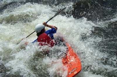
One of the best summer play spots in New England. Located at the end of Coolidge Run, the river piles up against a ledge then funnels into slack water below causing a series of waves at higher levels and a surfing hole at low levels. Typical summer time low levels of 300 cfs to 500 cfs provide a nice hole for surfing, side surfing, and many of the new play boat manuevers. Above 900 cfs the hole turns more into a wave. At 1500 cfs there is a nice wavetrain the forms with the best surfing at the top. Enders up against the rock are best at 800 to 1200 cfs.
Jun 22, 2025
On 6-14, the Pemi was at 900, which was perfect. There is an great spot before the rodeo hole on river left to eddy out and scout. From here, you can spot the tongue to the right of the hole. Paddle upstream on river left, then ferry over to river right and float down to the left of the hole. Immediately after the drop, there are numerous rocks and pillows to avoid. Much of the section leading to the put out can be rocky at this level.
Aug 27, 2023
Discovered that It's possible and fun to run left chute of Wourthen's
Oct 27, 2022
Just came out for a surf session, but the wave is washed out at 3600cfs.