Sugar
North Newport to Rt 103
| Difficulty | II(III) |
| Length | 3.4 mi |
| Avg Gradient | 34 fpm |
| Gauge | Sugar River at West Claremont, Nh |
| Flow Rate as of 51 minutes | 1.49 ftbelow recommended |
| Reach Info Last Updated | May 2, 2018 |
Thanks to Allan Berggren for the following information
Put in at the covered bridge 1/2 mi w. of hwy 10 1.5 mi n. of Newport.
First mile is easy I-II to Green bridge (Oak St.), then becomes steady Class II for 1.5 mi. The stream broadens, then narrows, confined by boulders to a II-III drop, called Sweet Tooth, because of a large stone in the center.
River turns right, along shale bank on left, dropping in staircase fashion for 100 yds. Turning left again, it resumes descent above old bridge abutments. After passing an island, the stream again broadens for the last half-mile before the Kellyville bridge takeout, on the right.
Jun 25, 2026
First time on this river. Guage was 2' when we started, and was just below when we finished. Was super-fun but we hit a lot of rocks. We figured it would be a lot more fun with just a couple inches more water on the guage. We counted 2 right turns and were looking for the Sweet Tooth Rapid section - kind of hard to know when you are there. Just before it, the river widened and became very gravelly - we had to drag boats. We dragged boats up into the open woods (river right) to scout. Not a good view of the rapid until you are even with the first big rocks. Right side very shallow - we put-in as soon as water looked deep enough (roughly even with first big rocks) and had no trouble finding a channel to slide down and across into the main flow. Looks like it's be pushy with a lot of water. We still bumped our way down it. Bottomed out multiple times after that but had fun trying to find decent channels. Channel to right of island was clear of debris.
Mar 17, 2016
obstructing tree in side channel has since washed out, but warning remains to exercise caution in entering any side channel you can't see all the way through.
Aug 4, 2009
I ran the river today for the first time with my son. We had a great time and the abandoned railroad grade that is now a biking path, runs right along the river, from the take-out at the Route 103 bridge, all the way up to the put in near Oak Street. This makes a self shuttle easy and very convenient.
Jun 19, 2005
The put-in for the Sugar River.
Near the put-in the river is a peaceful float for a while.
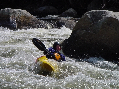
Richard contemplates his line at Sweet's Tooth.
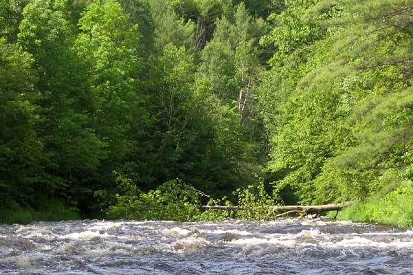
The river splits around a large island downstream of Sweet's Tooth. This tree blocked the right fork of the river in the spring/summer '05. As of 10/30/05 the tree could not be seen from this same location. We could not inspect it closely as we had paddled the left side of the island.