Swift
2. Rocky Gorge to Lower Falls(Middle Swift)

| Difficulty | II-III(IV) |
| Length | 2.1 mi |
| Avg Gradient | 55 fpm |
| Reach Info Last Updated | March 25, 2025 |
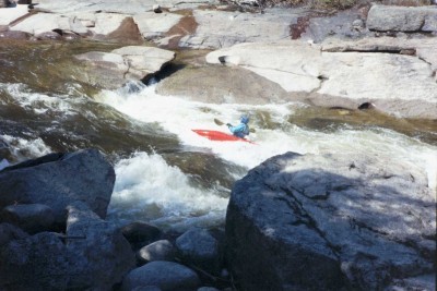
The Middle Swift is a very good intermediate run. This section of the Swift is sandwiched between two class V drops that can easily be by-passed. The rapids in between are a lot mellower mainly class III. The biggest drop in this section is Triple Drop; it is two 3' drops about 50' apart with a big wave/hole at the bottom. At lower water Triple drop should be considered class III+. A look at the take-out for this section is advised since you don't want to run Lower Falls without scouting.
The Swift runs along side the scenic Kancamaugus Highway in the White Mountain National Forest. It is not wild but still scenic, the road and tourist areas at the put in and take out can be crowded with curious people taking pictures or just gawking especially late in the Spring. Note: the above mentioned gradient information does not include Upper and Lower Falls. See also the Upper and Lower Swift.
Put in elevation.......1123'Take out elevation.....940'Distance...............2.6 milesTotal drop.............183'Average drop/mile......70'.....Including Upper and Lower falls1st mile drop..........85'......Includes Upper falls2nd mile drop..........58'......Includes Triple Drop2.6 mile drop..........40'.....Includes Lower fallsRiver width average....50'River geology..........large granite boulders, some ledges at fallsRiver water quality....Excellent, crystal clearScenery................Excellent mountain and forest scenery.Wildlife...............Some deer, moose, perrigrine falcons, touristNote: The technical information above includes Upper and Lower falls which greatly adds to the total and average drops on this relatively short river. The section in between the falls has less but very consistant gradient.
F
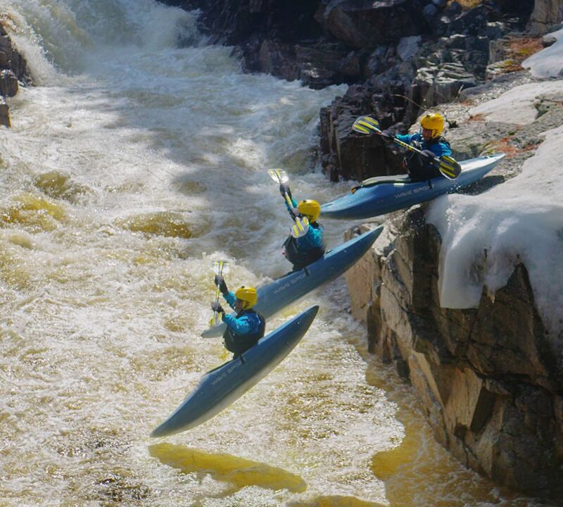
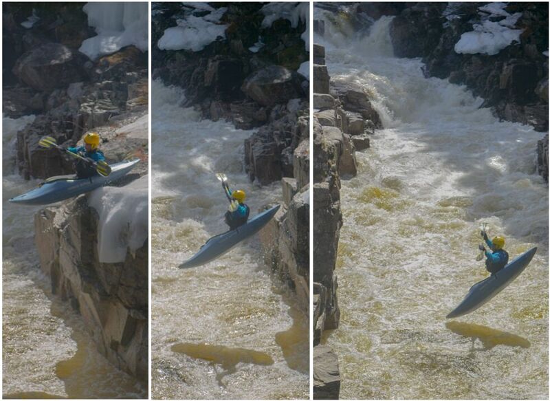
...Upper Falls is located in a tourist area called Rocky Gorge. From the parking lot at the put in class II-III water leads up to a 15' falls into a small box canyon. If you are running the upper section along with this section make sure you scout this area carefully. Pull out well upstream once the river starts dropping over small ledges with sticky holes. Carry around below the tourist foot bridge for an easy put in on river right or a 10' seal launch from either side of the box canyon. Should you choose to run the falls the usual line is from river right over a 45 degree slide to the 10' verticle drop below. Keep the nose of your boat up on the slide to keep from pitoning off protruding ledges at low water levels.
The biggest drop in this section, not including the put in or take out rapids, is Triple Drop; it is three 2' to 3' drops about 50' apart with a big wave/hole at the bottom. When the Kancamaugus highway disappears and is replaced with a high cliff wall on your right, make your way to river left just above the first drop and scout your line through the holes at each drop.
When picnic tables and tourist with sneakers and cameras appear on river right takeout and scout Lower Falls. The river gradually picks up pace and difficulty as one heads down through the entrance rapid. Lower falls is a series of 6' to 8' ledges that run parallel to the river from the center with the ledges dropping off from left to right. You must scout this drop. It is necessary to run a route through a series of blind drops. A far left route leads the paddler over a more gradual slide. But the approach requires you to punch two large stickey holes. The slide itself contains numerous holes and boulders along its path. The other route (the usual one) requires a precise drop over the 8' ledge between a boulder and some shallow water. Take a sharp left after this drop paddle hard to launch over the next ledge over a stickey hole at the bottom of the drop. Below lies a fairly large calm pool for an esier put in for the lower section.
Mar 20, 2025
Unfortunately, many gauge links and flow information have been lost since the latest AW code update.
Upper Swift
https://www.americanwhitewater.org/content/Gauge2/detail/id/45492/
Lower Swift
https://www.americanwhitewater.org/content/Gauge2/detail/id/45943/
All NH Gauges
https://www.americanwhitewater.org/content/Gauge2/view/state/NH/