Rockaway
Below Falls to weir at Morris Avenue(Boonton Gorge)

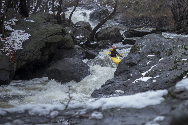
Dec 1, 2014
Snowy Thanksgiving run
Aug 14, 2013
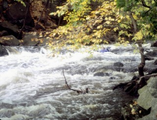
Oct 4, 2011
The section along the police firing range has completely changed. It has two rapids now and the rest is flat water.one rapid at the top and one about half way through. This was all after Irene. We did not paddle below the firing range as it looked like it had way too many strainers to continue that far.
Nov 9, 2010
Despite continued suggestions by locals that people aren't supposed to be paddling this stretch of river, there are NO ordinances in the Boonton Municipal Code relating to paddling, boating, kayaking, canoeing, etc. on the Rockaway through Boonton (Nov. 2010). If you stop before the Reservoir, and carry back up on River Left, Ferry across, carry under 287 on River right, and get into your car at the gauging station, you should be good to go.
I've been checking the agenda for the Boonton Town Council Meetings every month since 2007 to keep an eye out for attempts at legislation prohibiting boating. AW people have spoken to the town council regarding the economic benefits of paddlers and many other subjects, but, as Thomas Jefferson said 'It is impossible to reason someone out of a belief that they have not reasoned themselves into'. Meanwhile we simply have to be vigilant, and polite.
Nov 7, 2009
the river hippy is 6' tall
Nov 6, 2009
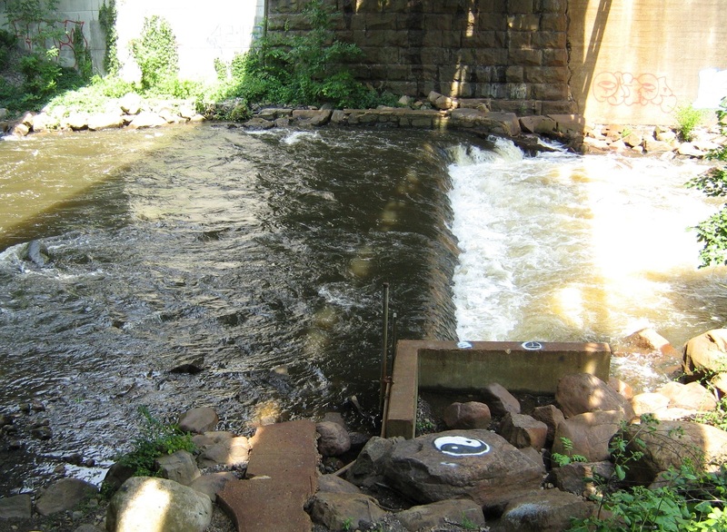
At lower levels, the weir forms a sticky (though small) hole. At around 4', it converts to a breaking wave.
Nov 6, 2009
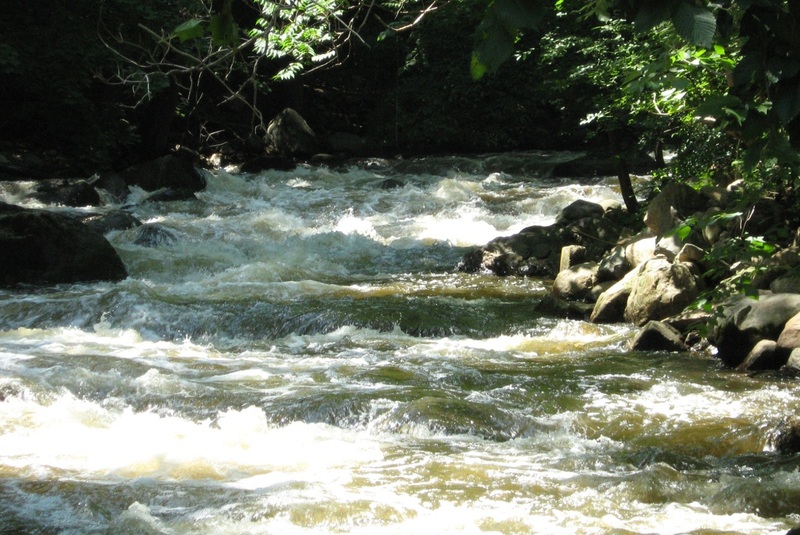
From the 'Big Pool' until the railroad bridge, this is what it's like. class 2 to 3 boogie. Bony at lower levels.
Oct 27, 2009
I ran this section from the Bridge rapid to the lake on 10-25-09. I was told by a nice Boonton officer that the run is technically off limits to ALL boaters after my trip. He did not ticket me though so perhaps the legislation is still not in place at this date. As for the take out I opted to stash my boat on river right next to the interstate because I was walking the shuttle. This does have the disadvantage of driving down past the I-80 interchange all the way to Whippany before you can head back north to your boat. I also noticed another police officer who had stopped just looking at the boat trying to figure out what to do (I had locked the boat next to a tree). He was gone by the time I swung back north on the interstate thankfully.
Watch out for a low head dam where the water gauge is, just before you leave Boonton and cross over beneath the interstate bridges. You can scout this rapid before the run by driving onto the southbound interstate ramp and making a small right turn just before committing yourself to heavy traffic. The dam is shallow enough that the hydraulic is not as grabby as it looks, but be sure to know where it is before running the creek as you will need to get a good head of steam to punch it when running.
Perhaps the AWA and other entities can attend a Boonton town meeting and explain to them they should be ENCOURAGING whitewater boaters only to run this stream. The town is not in the best of shape economically and any additional revenue they would be a desired shot in the arm. There is a nice diner and pub in the middle section of town, perhaps someone could renovate one of the older residential buildings into a B&B. The Rockaway River is the closest expert whitewater to the Western Hemisphere's wealthiest city (NYC) so the town is missing out on an economic opportunity here!
Dec 13, 2008
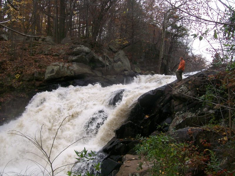
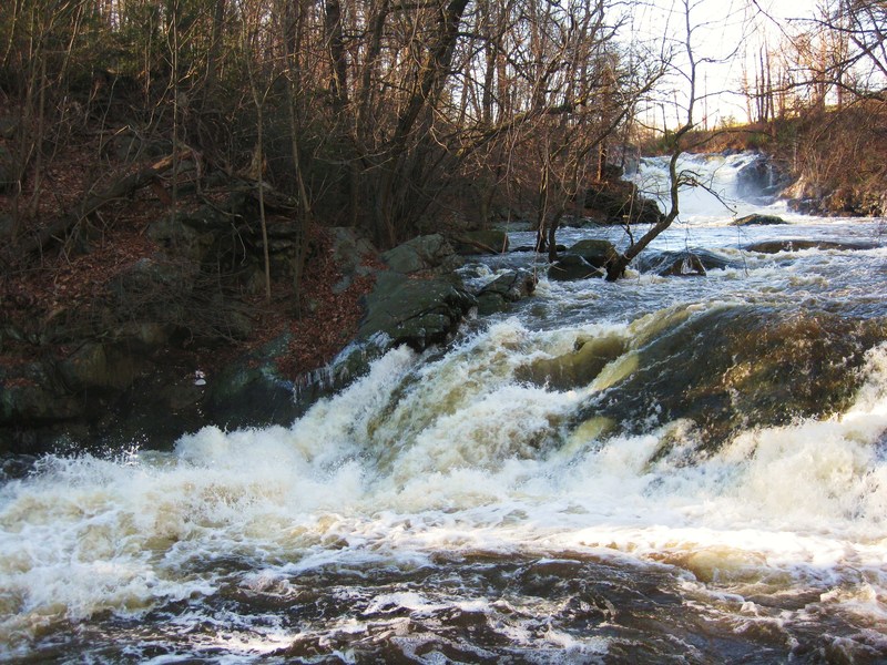
level was so high that graffiti rock was submerged
Boonton Falls on the Rockaway at a high level
Sep 8, 2008
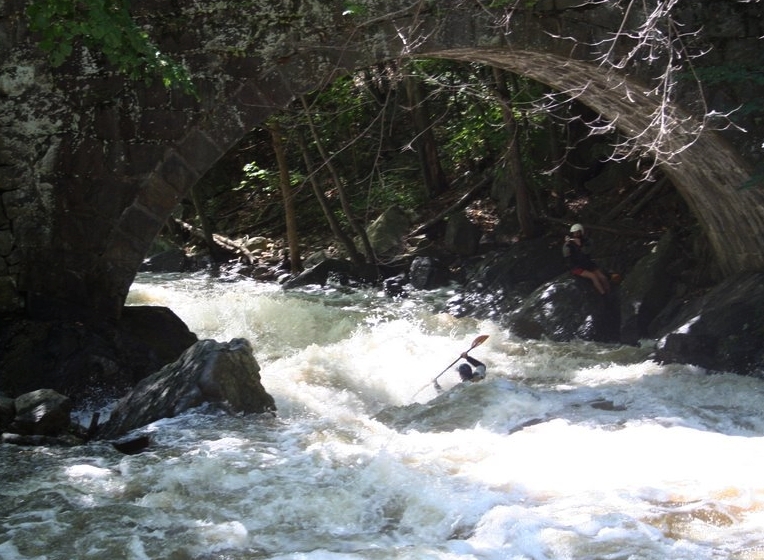
At higher water, Upper and Lower Bridge Rapid begin to blend into one.
Jan 29, 2007
I was just told that there is a strainer in 'Graffiti Rock' Rapid (the narrow drop which follows the pool after the falls). If you paddle this stretch of river now please be very careful, any mishaps would be very unappreciated by the paddling community due to the town's current heigtened concern and attention directed at boating in the river.
Jan 17, 2007
The town council of Boonton is trying to draft an ordinance to prohibit paddling access to this run. It would be very upsetting to lose this convenient and fun stretch of river which runs very frequently throughout the year. If you have ever paddled this reach or think that you might like to someday, please write to:
Mayor Cyril Wekilsky, Boonton Town Hall, 100 Washington St., Boonton, NJ, 07005
Let the town council that paddlers safely use this resource frequently with no problems and that we want to maintain that right.
Nov 19, 2005
This note is posted on the USGS page for this run now.
National Weather Service flood stage for this gage is 5 feet. Effective Dec. 17, 2004 the stage sensor has been replaced and relocated resulting in recorded stages about 0.5 feet higher than before.
I guess they noticed that the gauge was reading low as well. Now the min/max levels above should be accurate again.
Oct 4, 2004
I paddled this in June 2003 and Oct 2004. The staff gauge and the online gauge no longer match. The online gauge now reads about 0.35' low compared to the staff gauge. The staff gauge still correlates to the levels shown here. It seems that the online gauge is the one which has changed.
Jan 1, 1900
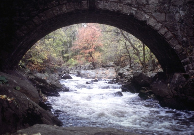
This is a very low level, but a pretty day none the less.
This is the view from the stone bridge downstream at low water.
Jan 1, 1900
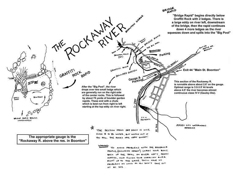
This map shows the whole run from the falls to the reservoir, including parking, gauge, etc. Save it, resize it to fit whatever paper you have and print it (for personal use, of course).
Jan 1, 1900
Check out the full-sized version of this photo by clicking here.