Rio Chama
05. Abiquiu Dam to confluence with Rio Grande
| Difficulty | I-II |
| Length | 7.5 mi |
| Avg Gradient | n/a |
| Gauge | Rio Chama Below Abiquiu Dam, Nm |
| Flow Rate as of 23 minutes | 216 cfsrunnable |
| Reach Info Last Updated | June 4, 2020 |
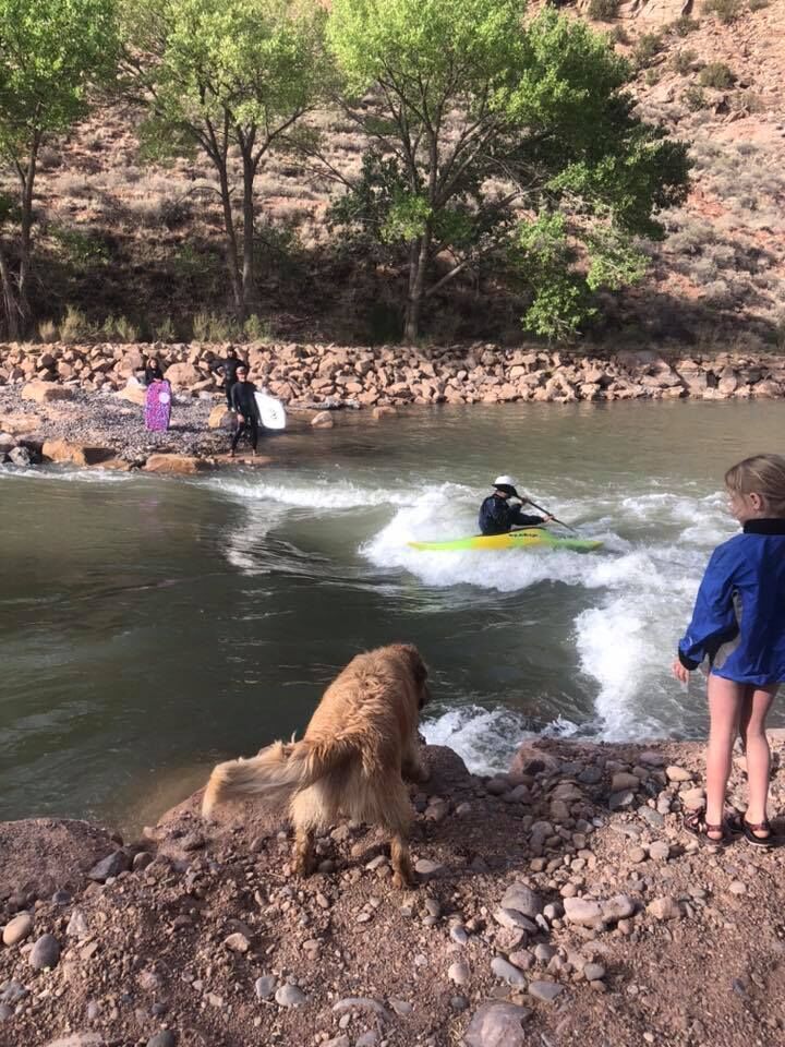
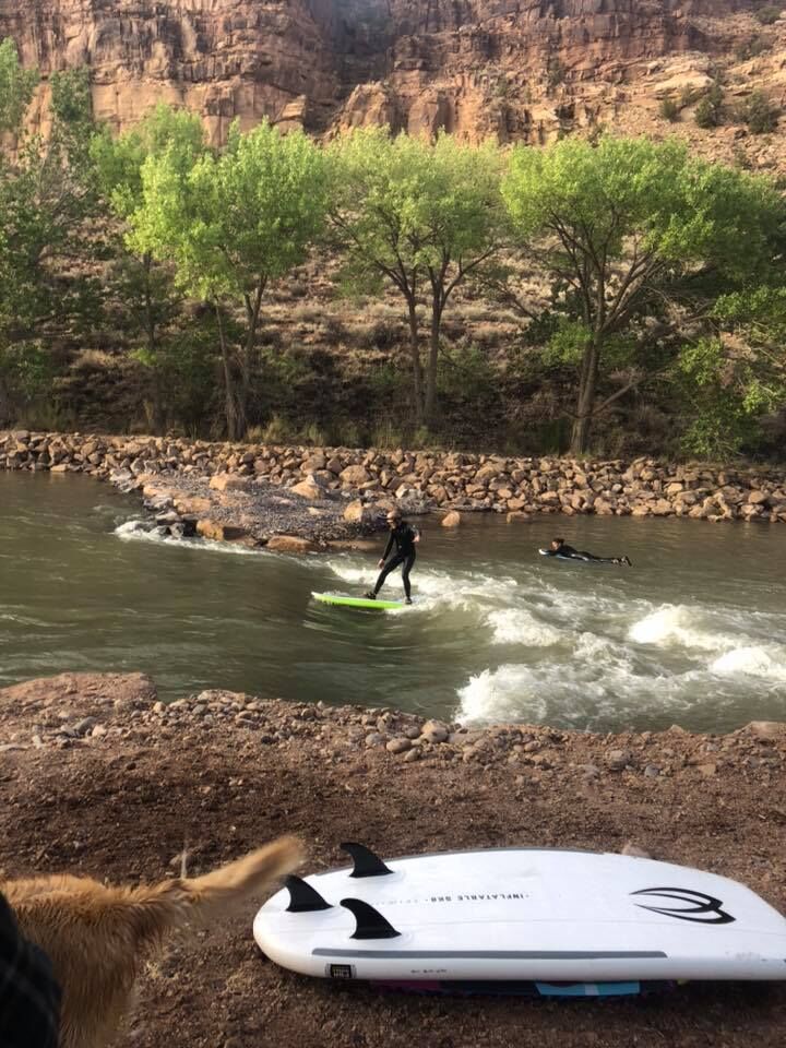
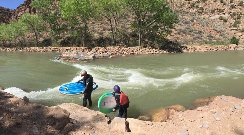
During the Fall/Winter of 2019/2020 the Army Corp. of Engineers and the New Mexico Fish and Wildlife office, completed a river enhancement of fish habitat/ fish ladder, by doing so they have created a play feature in that constriction. As we have tested flows the rapid is quickly becoming a great park and play feature. See the image gallery for pictures and flow rate. A big THANK YOU to NMFG and The Army Corp, along a huge THANK YOU to Ed Lucero who have the vision and the contacts to see this implemented.
7.5 miles of class I/II meandering river is available below with several low-head dams. The take-out is just above or below the crossing with NM 84.
For information, see New Mexico Whitewater, by NM State Parks & Rivers of SW, by
A single play wave accessed at the day use area below Abiquiu dam. The best put-in for running the lower stretch. Access is best from NM 96, which crosses the dam.

Two-stage, low-head weir. River right is deepest, and river left forms a shelf that barely flows at 700 cfs.
The only current cross-river fence in this stretch as of Spring 2020. It crosses just as the river hangs left around the bend, connecting to a large metal fence that is visible from up-stream. It is safely passable at around 700 cfs.
A rock wier/ low-head dam diverts water to the acequia on river-left. Portage is available river right. May present hazard at low-flows.
The stretch above is mostly class I with several sections of swifter water and riffles. At 5.45 mi, the second rock wier/ low-head dam of the run crosses here, diverting water to river left. It was run-able in the center at 700 cfs for kayaks, but be aware entrapment hazards may exist at any flow. Multiple logs and rocks make up a natural feature that is likely change.
The previous section is easy going class I leading up to the take out on river right. First and easiest takeout near accesss to Highway 84
If you miss the first take out, or really need another half-mile of class I, the second take-out is river left just after passing under Highway 84. Another rock weir / low-head dam is present here and may be runnable with an eddy of river left for take out. As with the previous rock wiers, they are natural features and could present significant entrapment hazards at any level.
The river below is unlikely to be run. The next take out is at the crossing with 554, at 13.6 mi, where another rock weir diverts a significant flow to river right. Below is an addition 20 miles of water crossing multiple low-head damns, some impassable, until the confluence with the Rio Grande at approximately 33 river miles.
Jan 1, 1900
Surfing a kayak at 550 CFS