Rio Grande
03. Chiflo Campground to Little Arsenic Trail(Upper Taos Box)
| Difficulty | V |
| Length | 7.8 mi |
| Avg Gradient | 69 fpm |
| Gauge | Rio Grande Near Cerro, Nm |
| Flow Rate as of 1 hour | 40 cfsbelow recommended |
| Reach Info Last Updated | September 1, 2023 |
This is truly one of the classic runs in the west. The Taos Box is actually where the Rio Grande has fallen into one of the largest rifts on earth. The entire Taos Box is almost 100 miles long. The Upper Box refers to the 6 mile Class V run from the Chiflo Trail to the Little Arsenic Trail. There is no access at all in between these two points so make sure to bring spare paddles and rescue gear as a hike out in the middle is not an option.
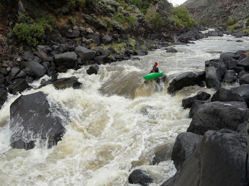
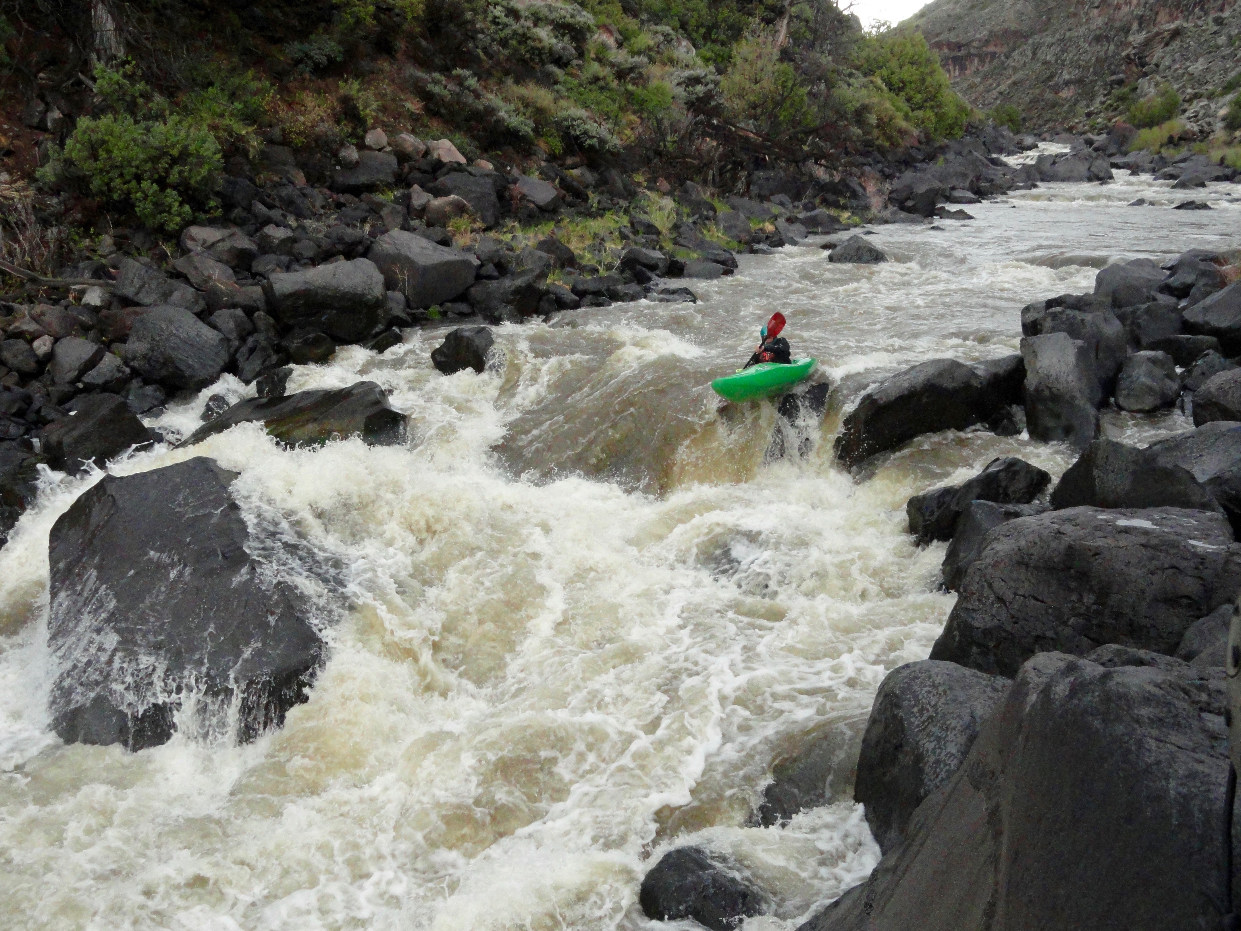
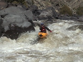
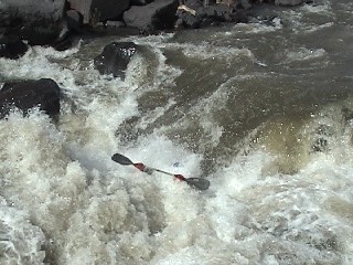
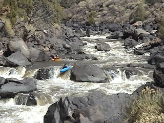
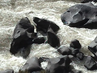
The one major thing you have to watch out for on this run are the sieves, they are everywhere! Some are much worse than others. Don't be fooled by the gradient. This river is the definition of pool-drop and doesn't waste any of its' gradient on easy rapids in between the big rapids. In general the rapids are long technical boulder gardens with lots of sieves. The riverbed is composed of large angular basalt rocks that have fallen from the cliffs above. Keep in mind that this is not Gore Canyon, keep the playboat at home! In fact, this run is always a good solid grade higher in difficulty that Gore at similar levels. The 3 mandatory scouts are NCO, Hell Hole, and Big Arsenic. These rapids have big drops at the entrance, and currents that push hard into sieves below. Swimming is not recommended! Fortunately there is ample opportunity to scout and portage as the cliffs are located high up on the rim, not at river level.
For many the run is defined by the takeout. You have 2 less than appealing options. You can float out on 9 miles of flat water, or take a 45 minute hike to the rim at Little Arsenic Trail. Although the Little Arsenic takeout is by far preferred, it does climb 750 feet up in .8 miles. The best camping is at the end of the takeout trail.
The reaches of the Taos Box area are...
Ute Mountain (Class II),
...The hike is what is rated class IV, a 350 foot descent down Chiflo Trail. The whitewater is going to be mostly pools with scattered Class III for the next 1.5 miles.
The first major rapid, directly under the powerlines spanning the gorge.
A steep entrance drop that pushes left, into multiple sieves, in the runout. It is possible to set safety to prevent someone from getting stuffed.
A large ledge with a large undercut rock center right, and the main current pushing hard left into a mean sieve. Safety is very difficult to set.
Long and technical boulder dodging, sieves but not as bad as the previous rapids.
Highly fun boofs to be had in the center and right channel.
Long and technical boulder dodging, keep an eye out for those sieves!
Big wave train leading into a large hole, boof hole on left side.
Sieves, mank, and steepness. Mandatory scout
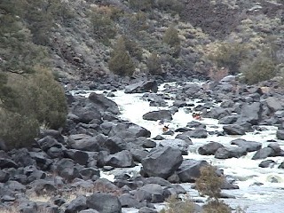
Long and technical boulder dodging with an abundance of sieves.
Long and technical boulder dodge rapid, with the infamous 'Room of Doom' seive.
The takeout for Little Arsenic Trail is notoriously ambiguous. The whitewater will obviously mellow out, look for the trail on river left, takeout about a 1/4 mile after when the trail climbs up and on top of a bench and is no longer next to the river. I look for a large dead tree with the top broken off, it's probably about 40' tall, it has been dead for a while and has no bark. The hike to the rim is 750 foot up in .8 miles and will take about 45 minutes. Your only other option is to paddle 9 miles of Class I. The pain is unavoidable.
Apr 25, 2012
1.) It is possible to put in at Bear Crossing, the trail is steeper and you will miss the class III warm up section. I don't recommend it.
2.) NOC and Hell Hole, scout, portage left.
3.) Boulder Fan, scout left. Might be a good idea to set safety 2/3's of the way down on river left hand side by the obvious sieve. Possible to portage on the left but, hike is brutal and takes a lot of time.
4.) Big Arsenic portage right above the big boulder on the screen field. Easiest portage on the river if done correctly.
5.) Little Arsenic, ran this on river right mostly. Eddied out and portaged the tail end of the rapid as it really starts to sieve out near the end. It is possible to take out sometime after Little Arsenic on river left and follow a trail to the trailhead for the Little Arsenic / recommend take out.
6.) Wear long pants as Poison Ivy is everywhere!
Mar 3, 2004
This is the crux move of NCO, you want to stay right and be in control, the current pushes hard left into multiple sieves.
Not the preferred line! A little farther river left would have been better.
Current pushes hard into this sieve, I have been told that a Wavesport Lazer went into this and has never come out.