| Difficulty | III |
| Length | 22.3 mi |
| Avg Gradient | n/a |
| Gauge | Rio Grande at Otowi Bridge, Nm |
| Flow Rate as of 49 minutes | 263 cfsbelow recommended |
| Reach Info Last Updated | July 14, 2020 |
River Description
For information, see New Mexico Whitewater, by NM State Parks & Rivers of SW, by
The reaches of the Taos Box area are...
Ute Mountain (Class II),
Razors (Class III/IV),
Upper Box (Class V/V+),
Lower Box (Class III/IV),
Pilar (Class III/IV),
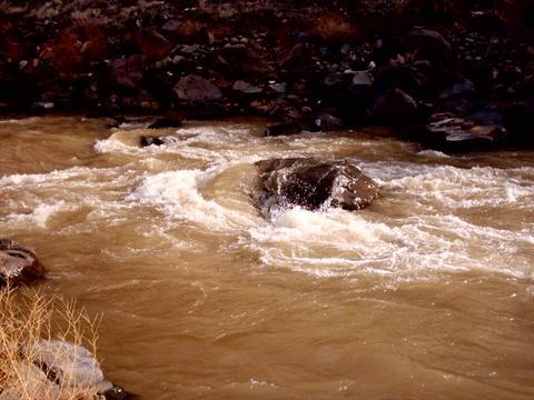
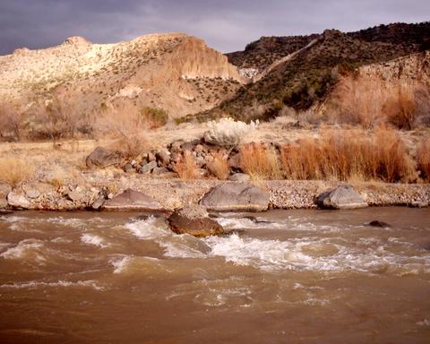
Otowi Bridge (Class III),
Red River (Class IV),
Rio Pueblo (Class V+), and
Rio Embudo (Class V+).
River Features
Put In
Access PointDistance: 0 mi
Take Out
Access PointDistance: 24 mi
Trip Reports
Log in to add a reportJS
Jerome Smart
Feb 21, 2024
Ran this yesterday in a whitewater kayak. At 700cfs. It took around six hours from Buckman Road put in (sounds like the only legal put in. Past Diablo Canyon climbing area) to Cochiti Res. The takeout on the East side of the res was closed so had to takeout on west side.
Really nice wilderness feel down there. A few class IIs and one III at Ancho(?) Rapid, at 700cfs. Kind of boney for a bigger boat at this level. All flat water after Ancho. Expect sand bars, headwinds and great scenery.
I think it would be great to do it with a packraft and after Ancho Rapid, a mile or two is a trail out on the East side. Hike up and out that to miss the long flat water section.
Great float! Do it!
QP
Quinlan Pfiffer
Oct 27, 2020
We ran this on 10/24/2020 at 260 CFS in packrafts and had a pretty good time. Everything was Class II- at these flows. The put-in/take-out situation has become a little different since the Bandelier Falls trail was wiped out by a mudslide in 2011.
For the put-in we were able to park on a little strip of land just north of the Otowi bridge on the highway and walk through the fence to get to the river. For the take-out we did some REALLY sketchy scrambling in the Rio de Frijoles Canyon where the trail used to be. I would not recommend this. We had a backup plane of continuing farther down and hiking out via the Burro trail.
Also there were a TON of tires in the river, we counted 335 at least between the bridge and just south of Ancho Canyon.
?
Untitled
Jun 14, 2011
According to the BLM, the put-in is now at Espanola 10 miles upstream. I don't know if Otowi Bridge is closed to put-in, or if the BLM is simply trying to discourage it. Be sure to look into this, it will add an extra day to the trip.
The Otowi Bridge put-in is on the Pueblo of San Ildefonso land and is fenced off and locked up. Instead of the Espanola put-in, you can put in about 2-3 miles downstream where the Buckman Road intersects the river on National Forest land. I wouldn't leave a car there overnight, though! This will make your shuttle much shorter.
?
Untitled
Jun 14, 2009
June 14,2009. We're running this next weekend. Will update on return. Contact hulih20@hotmail.com
TJ
Tim Johnson
Jan 28, 2004
The land surrounding Otowi bridge is on San Ildefonso Pueblo, so access is restricted, but there are several fun little class II rapids between there and the bottom of the red dot trail. After red dot, there are four class III's. The first two are one after another. Stay right for the second. Almost all the current in the third rapid goes over a big rock, we have had problems there before and haven't found a good way around it, it all depends on water levels. After the last rapid, which is pretty close to Ancho Canyon, it is really flat water all the way to Cochiti Lake and it seems to go on forever until you hit the lake and have to paddle a couple miles. I would recommend hiking out at the Bandelier falls trail. Overall, it is a very fun trip, lots of beautiful scenery and very remote, you probably won't see anyone on the river.