| Difficulty | III |
| Length | 6.6 mi |
| Avg Gradient | n/a |
| Gauge | Ausable River Near Au Sable Forks Ny |
| Flow Rate as of 38 minutes | 1.29 ftbelow recommended |
| Reach Info Last Updated | April 8, 2016 |
River Description
This is the upper reach of the AuSable, generally fed by snowmelt from the mountains. As such, it generally only runs in the spring or after very heavy rains.
This section is a remote and pretty paddle, with nice scenery. There are no trails near the river; a walk out through the dense balsam is difficult.
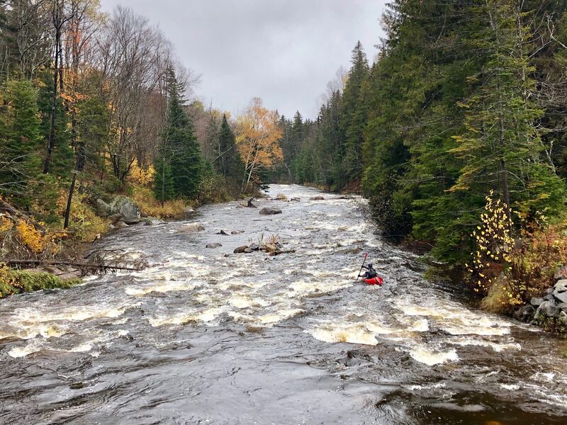
The stream is narrow, good maneuvering skills are a must for an enjoyable day. A smaller boat is helpful. There are many beaver-generated strainers. (At levels above 5 feet on the take-out gauge, these strainers become mobile.) The main characterisics of this stream are created by boulders and beavers. The eddies are small, few, and difficult to catch making this is a great natural slalom run. There are a few small surf waves if you can catch them. A private ranch with two small bridges over the river is about half way; please respect their privacy. State land is generally along river left with some private land on river right.
Guidebook: Adirondack Canoe Waters, North Flow. by P. Jamieson and D. Morris, published by the Adirondack Mountain Club.
Note: Any beginners should be comfortable on the Indian and Hudson before running this narrow stream.
Eastern Adirondacks Reaches
Ausable, E. Branch Ausable, W. Branch (1.) Ausable, W. Branch (2.) Balm of Gilead Brook
...River Features
Put In
Access PointDistance: 0 mi
Take Out
Access PointDistance: 6.5 mi
Trip Reports
Log in to add a reportJM
Joshua MacNaughton
Jan 1, 1900
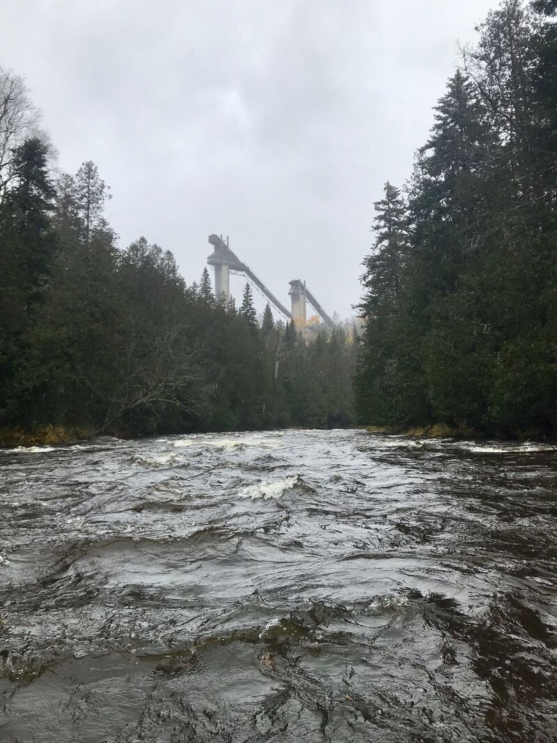
Olympic Ski Jumps!
JM
Joshua MacNaughton
Jan 1, 1900
10/17/19 The Ausable Forks gauge is way downstream. It was reading too low but a heavy soaking rain brought this in to a fun level. It took about 80 minutes to paddle down to the bridge near the ski jumps. What you see is characteristic of the run. Somewhat continuous class II boogie water with a few harder rapids. Everything is easy to read & run for an experienced boater.