Black
1. North Lake to Farr Road
| Difficulty | I-IV |
| Length | 5.8 mi |
| Avg Gradient | n/a |
| Gauge | Black River Near Boonville Ny |
| Flow Rate as of 56 minutes | 178 cfsbelow recommended |
| Reach Info Last Updated | February 15, 2026 |
The run begins with a significant stretch of flatwater, giving paddlers time to settle in and take in the remote, scenic feel of this section. Those looking to shorten the flatwater approach can hike in from North Lake Road, which brings you closer to the more continuous whitewater.
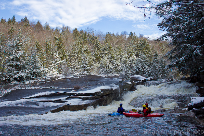
Rapids start out gradually, building from Class II before increasing in difficulty as the river approaches its main gorge-like bedrock features. The action culminates near the first major horizon line, marked by an island dividing the flow. Here, a series of ledges and pourovers lead into the run’s signature slide sequence. The right channel offers an engaging line with multiple ledges, short slides, and a few solid holes.
Paddlers who are not fully comfortable with quick boat scouting and tight Class IV eddy catching may want to stop on the island to scout, or take out river right to portage. While the shoreline is wooded initially, it soon opens onto clean bedrock slabs that provide good access for inspection.
Downstream, a short but fun stretch of Class IV leads to another prominent horizon line at the lower end of the island. Small eddies above the drop on both sides allow for scouting, with the easiest portage route on river right. The main line is generally straightforward at moderate flows, though a medium hole at the base can form, backed up by a rock ledge, and the right side may be slightly undercut.
A large recovery pool below provides a welcome regrouping spot before a boulder garden continues the action. At lower flows, pinning hazards may be present, while higher water improves the overall lines.
Below this sequence, the river eases into more forgiving rapids leading down to the Farr Road Bridge take-out.
Confluence where the South Branch joins the Black River.
Park along North Lake Road at a pull off on the right shortly after a big hill and hike in to avoid some of the flatwater at the start.