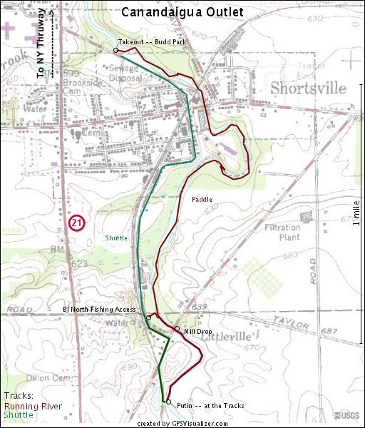
Canandaigua Outlet
Littleville to Manchester(The Shortsville Run)

| Difficulty | II-III |
| Length | 2.1 mi |
| Avg Gradient | 27 fpm |
| Gauge | Canandaigua Outlet at Chapin Ny |
| Flow Rate as of 24 minutes | 26 cfsbelow recommended |
| Reach Info Last Updated | June 7, 2016 |
Canandaigua Outlet flows north from the outlet of Canandaigua Lake to the Erie Canal. The creek is full of strainers and wildlife. The only interesting whitewater occurs where the creek passes through Shortsville ('The Shortsville Run').
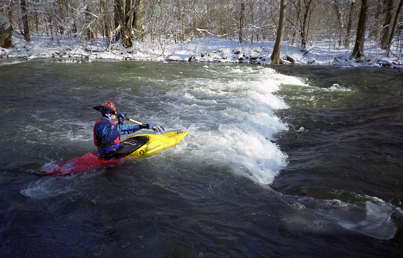
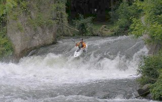
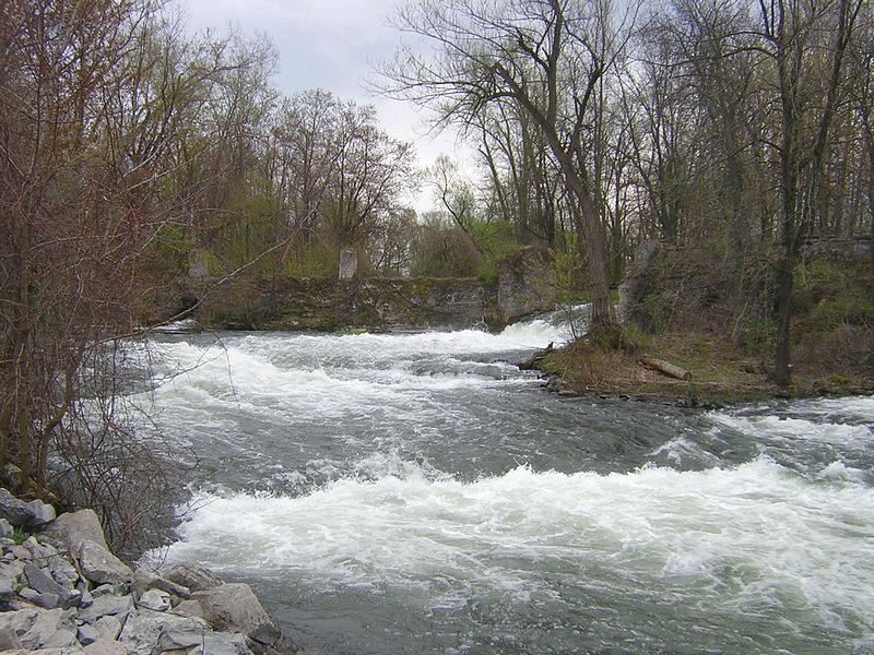
The Shortsville Run is a 2.3-mile class II-III whitewater paddle with a 5-foot vertical waterfall drop (class III) at the 'Old Mill' immediately above the Highway 19 bridge at Littleville. The average gradient throughout the length of the Shortsville Run is ~27 feet per mile. The maximum sustained gradient occurs in that half-mile stretch between the Highway 41 (Shortsville Road) bridge and the takeout at Jones-Blunt Park, where the gradient is ~50 feet per mile.
DIRECTIONS:
(See this map for detailed, local info on the shuttle.)
To the Takeout:
Take Route 21 South through Manchester to Shortsville.
Take a Left onto Water St.
Park in one of the parking areas, next to the stream on the Left.
To the Putin:
Continue South on Water St.
Stay straight, crossing Main St. and the tracks. The road you're now on is Sheldon St.
Sheldon St. curves around Right, becoming Aldrich St. At the next intersection, bear Left (South) onto Pioneer Rd.
After about half a mile, Pioneer Rd. T's into Rte. 19. Bear Right onto County Road 19. Park near the tracks and hike up to the (main) putin.
Note: the Fishing Access Site is on Pioneer Rd., near CR 19. As noted below, use this putin at your own risk.
Warning
Not far downstream from the Fishing Access, be careful about the river-right bank. At the cow pasture, if you grab what looks to be an inviting eddy, you risk getting zapped by an electric fence.
Wildness and Crazy Out-of-Control 'Paddlers'
For years, the town of Shortsville held its 'Wild
...The putin is about 1/2 mile upstream from the Highway 19 bridge and old mill, where the railroad tracks approach the river-left bank.
You will have to park where the railroad tracks cross highway 19 and then walk along the tracks about 1/4 mile south to the creek.
An alternative putin, to avoid the Mill Drop, is at the Benjamin J. North fishing access located about 200 yards downstream from the Highway 19 bridge.
Please note that state fishing access points are, by law, restricted to fishing only.
Kayakers will be ticketed if caught.
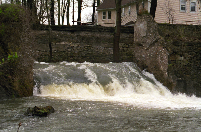
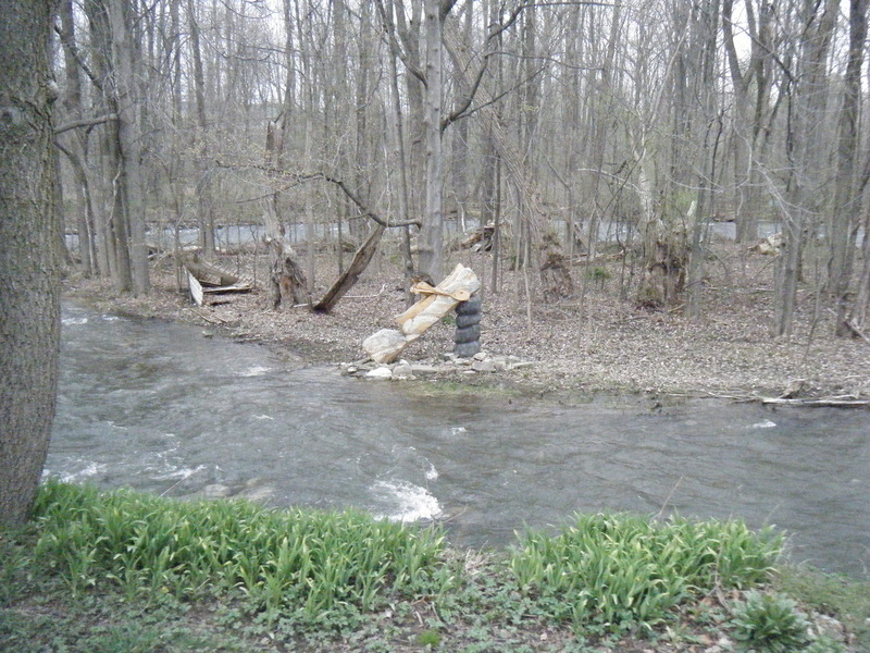
The Mill Drop is the first and most technical whitewater on the Shortsville Run. This 6-foot falls occurs where the creek plunges through a break in the 'Old Mill' diversion wall. Forty feet upstream from the falls there is an eddy along the river-left stone wall. You may car scout the falls from the Highway 19 bridge, but private property prevents a closer foot scout.
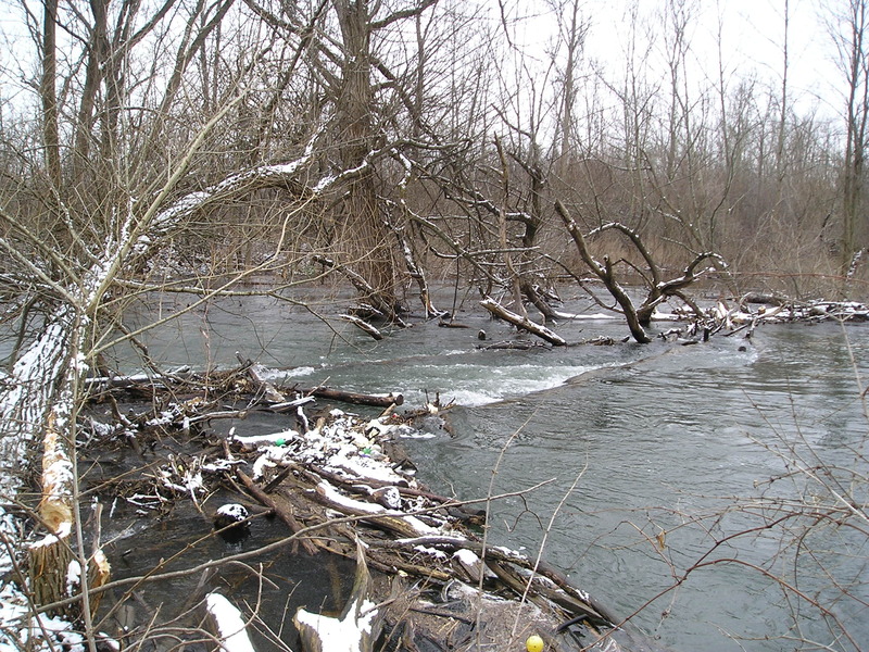
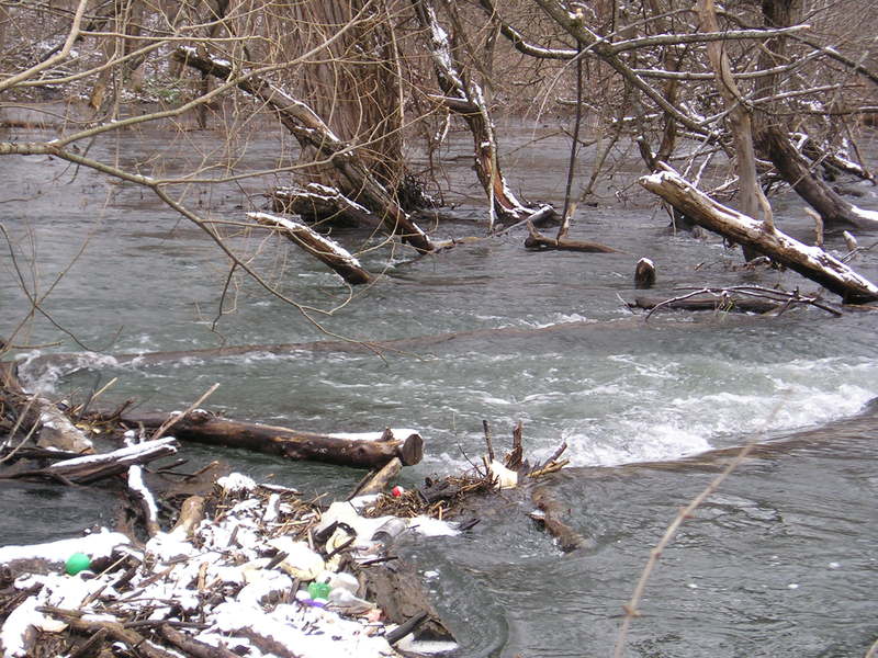
The Surf Wave is next, about 200 yards downstream from the Highway 19 bridge, at the Benjamin J.North fishing access. A river-wide ledge drop forms a fun but shallow surf wave. Immediately downstream of the Surf Wave is a long stretch of shallow class II+ whitewater through a rock garden. There are numerous surf waves in this section.
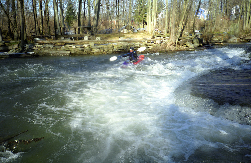
Jones-Blunt Rapid is the final rapid (solid class III). It is located immediately before reaching the takeout. A series of ledge drops over a 100-yard distance provides great fun and is easily scouted by foot. The drops are angling and could present minor problems for novices. Takeout at Jones-Blunt Park (more commonly known as 'Budd Park') just downstream, on river left. A small parking lot is located there.
The takeout is at the Jones-Blunt Park located on the northwest edge of Shortsville.
Alternatively you may paddle downstream another 3/4 mile past Jones-Blunt Park (class I-II) to the Dewey Road bridge.
About 100 feet upstream of this bridge is Spin Hole, a diagonal hole that is large and sticky enough to practice spins.
Using this alternate takeout increases the total run distance to 3 miles.
Apr 7, 2010
On the bank of Canandaigua Outlet, at Jones-Budd Park in Shortsville, NY.