Cattaraugus Creek
Zoar Bridge to Gowanda (Zoar Valley)
| Difficulty | II-III |
| Length | 9.5 mi |
| Avg Gradient | 20 fpm |
| Gauge | Cattaraugus Creek at Gowanda Ny |
| Flow Rate as of 55 minutes | 1.21 ftbelow recommended |
| Reach Info Last Updated | June 9, 2016 |
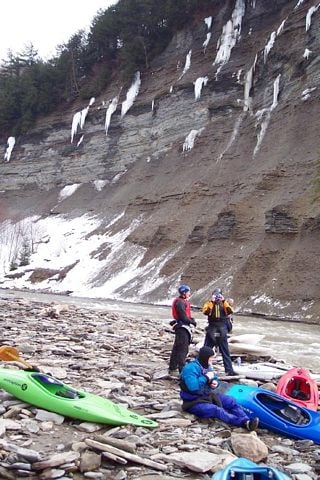
Cattaraugus Creek is a seasonal creek in the Lake Erie basin that flows through the magnificent 400-foot deep Zoar Valley Gorge. This wild, isolated area contains the largest tract of old growth forest in New York outside of the Adirondack Mountains. The Zoar Valley has been opened to logging. Visit the Friends of Zoar Valley for more information.
Directions
To the putin:
Go to Springville; head South on Rte. 219 to the traffic signal past McDonald's.
Turn right at the signal onto Zoar Valley Road. (ZV Road has some steep ups and downs, but is paved.) Take this road to the second bridge over the creek (approx. 8 miles).
Turn Left over the bridge; you will see a state fishing access area.
The trail is flat to the creek. This is the usual put in for the raft companies. Getting your boat from the putin lot to the creek is a very easy, wide, flat path, lined with large rocks.
To the takeout:
Go back over the bridge; turn Left on Zoar Valley Road. Head toward Gowanda.
You will come to a fork; bear Left and follow the road past the Harley shop to Gowanda.
You will go over a railroad as you come into town; go left, then quick right.
This will take you to Main St.
Park behind the super market (directly across Main St.). You'll see a park along the creek with a bike path. Take out on River Right, along the park. The bank at the takeout is slippery, a very short walk to the car.
(Directions adapted from a post by Dave Meyer on the FLOW Massage Board.
Western New York Area Reaches
...
Three delicious playholes at the confluence with the S. Branch.
The last rapid with a bunch of good play waves and holes.
May 25, 2012
In regards to running more river you could probably put in at Hammond Hill Rd (access would probably be easier from the catt county side) or at Scoby Dam in Springville. I've done the section of river from Scoby to the usual Put In in the summer time and it was a fun stretch of river in a canoe with friends who don't know what they are doing but might be a bit long and dull in a whitewater boat. Though there were a few sections that looked like they might make for some waves and more interesting rapids at high water.
Jul 9, 2009
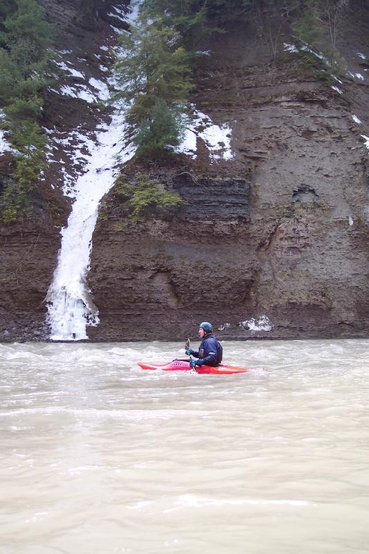
a runoff cascades from the top of the gorge and a kayaker takes a break
Jul 3, 2009
This a very beautiful creek. It was at 4.2, or 2600cfs