Chautauqua Creek
Putnam Road to Lake Erie(The Glug)
| Difficulty | III-IV |
| Length | 12.9 mi |
| Avg Gradient | 55 fpm |
| Gauge | Chautauqua Creek Below Westfield Ny |
| Flow Rate as of 3 hours | 1.75 ftbelow recommended |
| Reach Info Last Updated | June 9, 2016 |
I've run this creek only twice so far and I would have to say it is one of my favorite runs of all time! I have noted the location and description of rapids I could remember and find on Google Earth. There are many other Class III's and Class III+'s that I have either forgotten about or are harder to find on Google Earth. Most of these unmarked rapids are not as steep, but are just as intense. Drop type rapids are easier to see on Google Earth than other rapids. It is also difficult to see rapids in narrow sections surrounded by hemlocks from the satalite images. In all there are at least 25 rapids of Class III or better!
The new put in is now at Putman Road due to private property at Lyons Road. To my knowledge, the creek has not been run by anyone up this far, but there are probably many strainers. Please respect the landowner there and do not exit the creek in this area. The creek widens out as you go from here, but gets more water so if it looks good at the put-in, you should have a good trip. Chautauqua flows through a very romote gorge called 'The Glug' by locals. Once you pass through the dead end Lyons Road, class II boogie water begins with good surfing. Then things become more interesting and several ledges on the creek come up with blind entries where the creek becomes very narrow and drops about 10 feet over stretches of about 30 yards. These short intense rapids are especially common near the beginning of the run but persist throughout much of the run. Basically, the whole run is at least constant Class II between rapids except for about two miles of Class I on the braided section between the two gorges. There is nothing on this reach to bore sane paddlers, so come prepared to have fun the whole run! Near Westfield there are several Class III ledges, one of which has a has a straight off drop of 7 feet in the center of the creek.
Unfortunatly in the Spring of 05' a huge late season snowstorm wiped out half of the hemlocks in the gor
...
Put in at the dead end of Lyons Road. There used to be a bridge here. The best place to put in is to the right of the dead end road. It's not as steep there. The small pool after a small Class II ledge is the best place to put in.
After 1.25 miles of warm-ups and great surfing, it's time to face the first ledge chute. You know it's coming up when you pass the first shale cliff on the right side on a gradual horseshoe bend to the left. You will then round a right hand bend and immediately begin to descend through Glug De' Dug. Watch your elbows if the water is low as it channelizes into an actively erroded chute no wider than 6 feet. This short ledge drops about 15 feet. You may want to scout it on the right side to make sure it's free of wood as it is a blind entry.
Immediately after Glug De' Dug, you come to Harrington Ledge. This one drops about 15 feet as well and is even shorter. It is not quite as intense because it is a little wider and doesn't have many features to it. Pretty much you start bookin' down a 45 degree ledge and try to keep your balance for the hole at the bottom.
This is the first waterfall on Chautauqua. It is a blind entry just before a right hand bend. You will know it's coming up when you see a cliff on the left side with no vegetation at all. It only drops about 5 feet but this area can be dangerous if there are strainers due to blind entry and very steep banks that may make it difficult to portage around the wood.
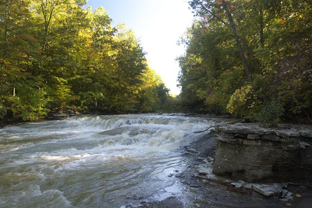
After the braided section, you are welcomed into the second gorge by Three Sisters. They are three water supply dams with very good characteristics despite being man made. Each consecutive dam gets bigger and the last one is by far the best with an 8 to 10 foot plunge into a deep pool! Welcome to the second gorge! Several Class III+ ledges follow over the next several miles.
There's a Gale Warning... please be advised, a 7 foot waterfall may create fun conditions!
A third of a mile from South Gale Road, you face the first rapid after coming out of the second gorge. Houses appear and the cliffs are not nearly as tall anymore, however the rapids remain for the next couple of miles. Most of the creek drops over a steep ledge, but the center line is a U shaped freefall line. It is wide enough that you don't have to worry about your elbows and the hole at the bottom is not that bad for not being a 'lip' type of falls.
This is the first access point after Lyons Road. Park on the right side of the creek in the pull off by the bridge. You can put in here if you don't have much time and there are a few Class III's still to come. You can also take out here to shorten the trip from Lyons Road to 11 miles.
To my knowledge, this is the last convenient place to take out. I've never been farther downstream. From Google Earth, it doesn't look like there are anymore rapids to the lake from here.
May 18, 2020
I will edit the gage soon. They now have CFS for the Westfield gage. 2.00 ft, the minimum level corresponds to 250 CFS.
Feb 23, 2010
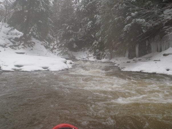
Peter and I ran this stretch on 12/26/2009 after a very nice X-Mas present of snow/rain to bring everything up. We parked for the take out on river right on S Gale Rd in the fishing access dirt parking lot, and headed up to the putin. The Putnam Rd put-in was all iced over and didn't look like there was nearly enough water, but perhaps with more water (and spring/fall) it would be do-able. We accessed Lyons rd via the Southeast (river right) side and parked at the end of the pavement, walking down the road to access the river. There is no bridge crossing Lyons rd anymore, and we walked over 30 ft of private property to access the river there. We had a decent level and enjoyed the run very much.
I would give it a III-IV rating as the RiverMain page says, mostly because of wood. There weren't any rapids that were individually IV but there were many cases of wood, including one portage around a river-wide strainer/log-jam at the end of the 'braided section' between the two canyons.
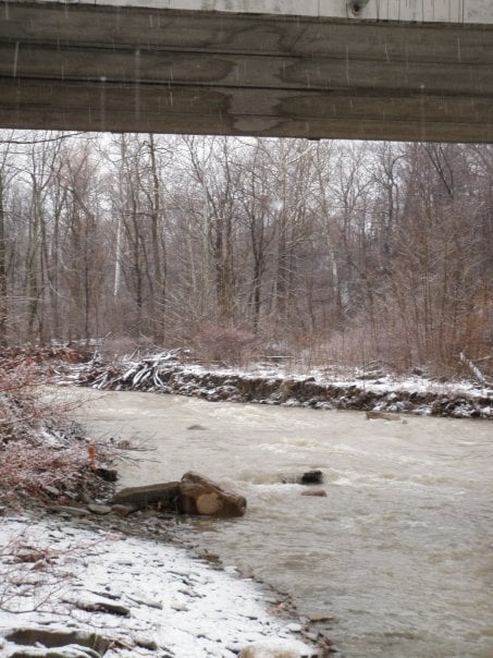
I took a picture of the river at the take-out bridge to show the level, so if you can spot some rocks there to compare, that might help. I don't remember what other creeks were running at though. Browncs@colorado.edu
Dec 26, 2009
This was a blind corner into a sliding drop into a harmless but fun hole.