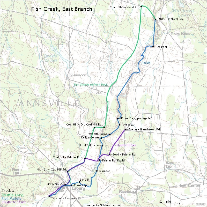
Fish Creek, E. Branch
Point Rock to Taberg
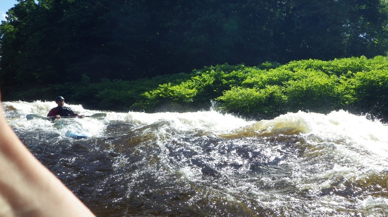
May 6, 2015
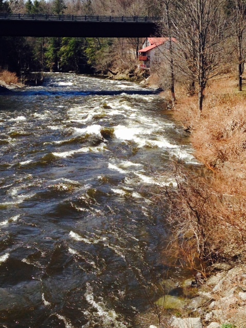
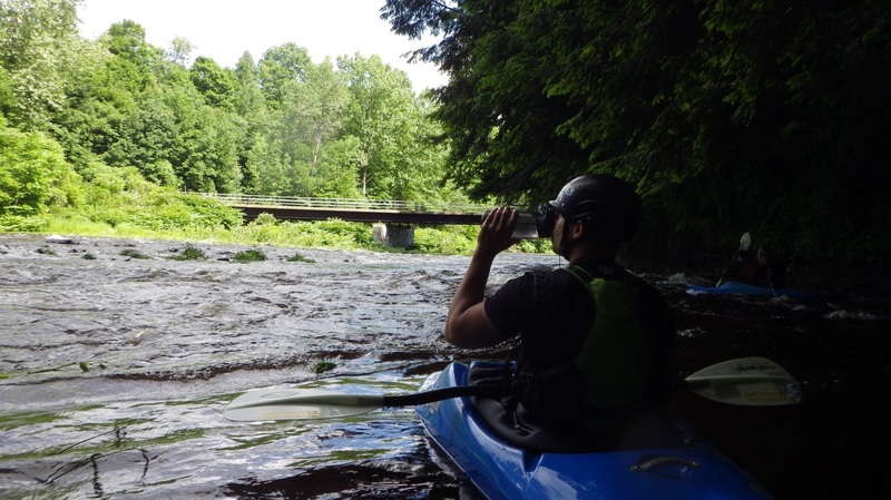
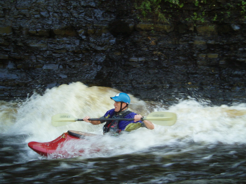
Town rapid after Main Street bridge. 2600 CFS
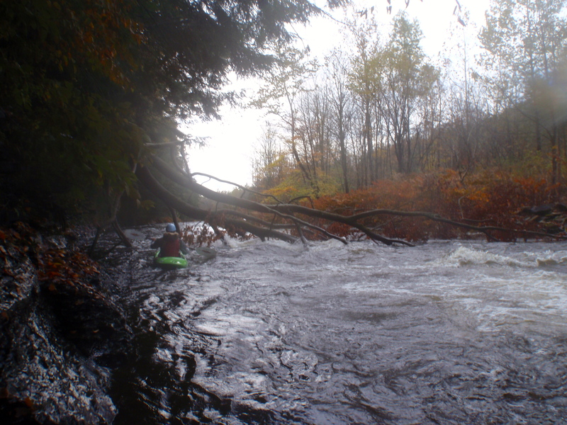
May 6, 2015
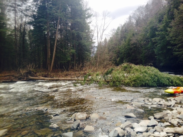
Pine tree down over entire river after Palmer Rd bridge (05/01/15)
Oct 2, 2014
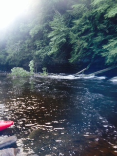
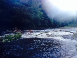
River right 1/4 down stream from Palmer Rd
Oct 2, 2014
River left 1/4 mile down stream from Palmer Rd. Both strainers were on river for most of the summer and as of 09/14 are still there
Aug 19, 2014
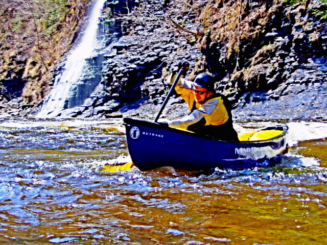
Palmer Road Bridge: let the fun begin!
Jun 27, 2014
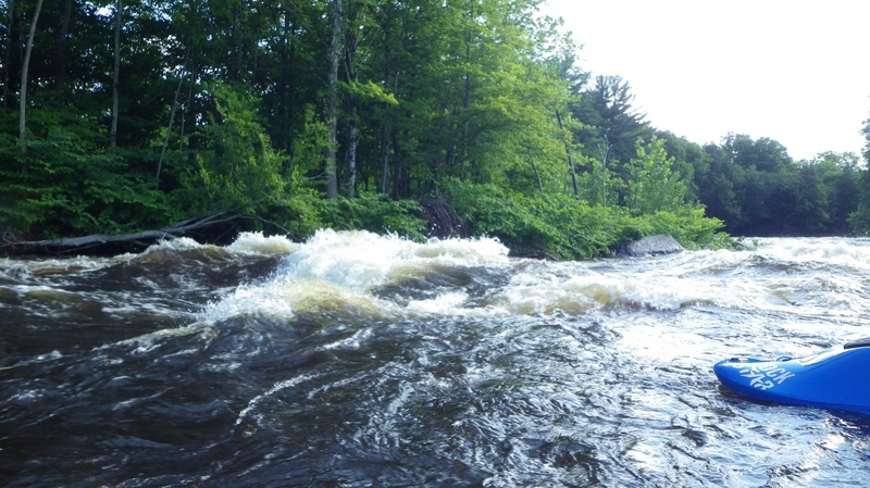
Tempting Wave, but with a Nasty Hole downstream at the Sand Pit
Jun 27, 2014
Rough Pillow from down-stream
Jun 27, 2014
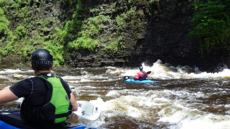
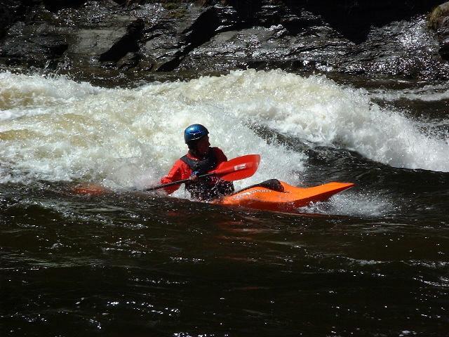
Hole at Kelly’s Corner, seen from river right
Jun 27, 2014
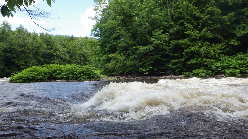
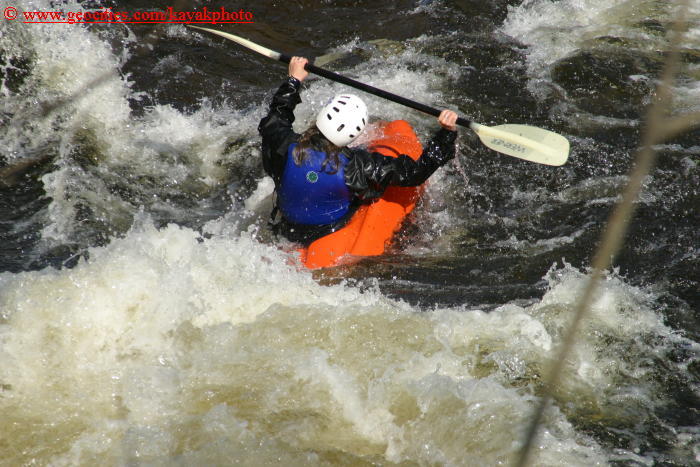
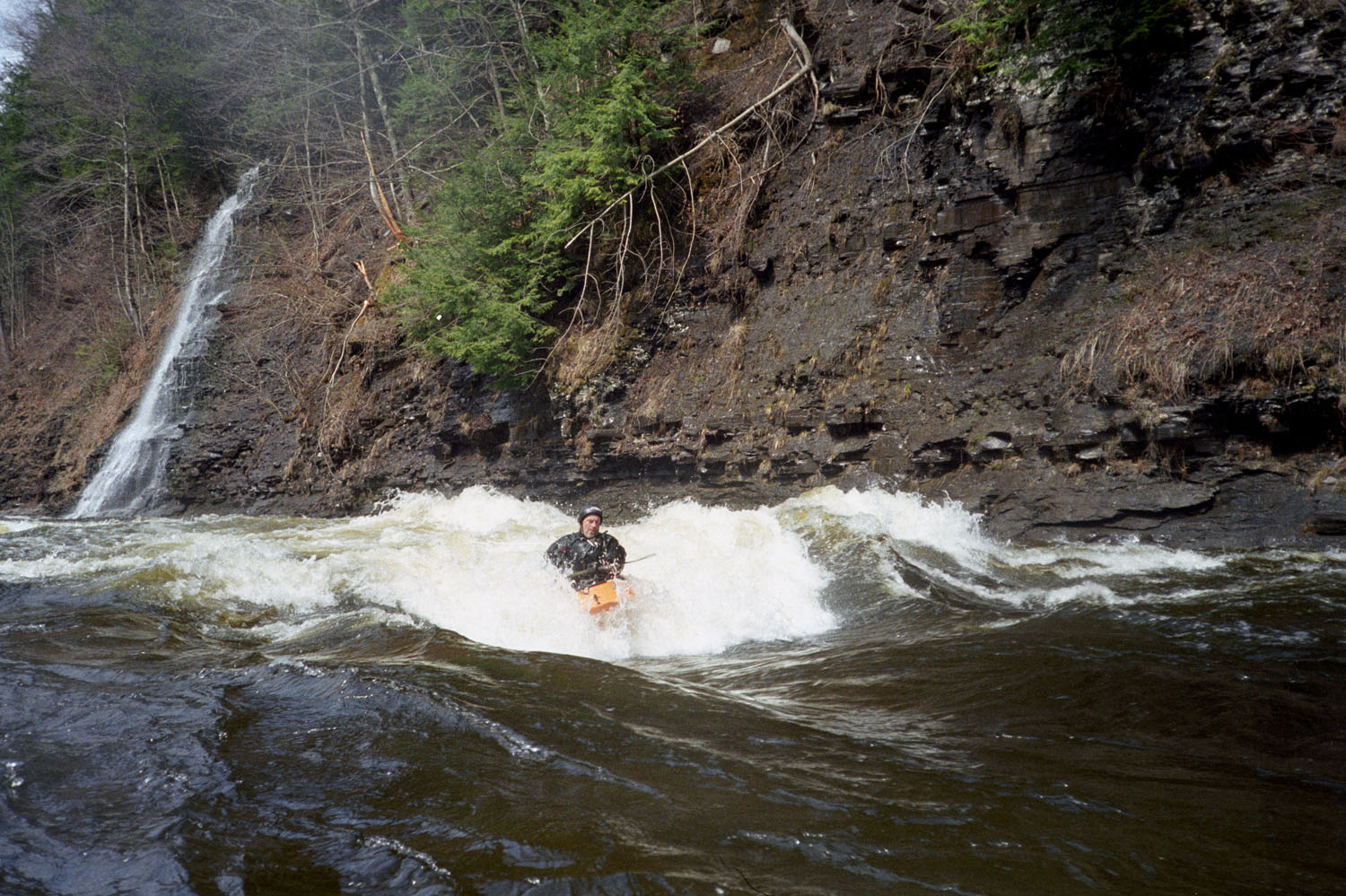
Great surf in the Narrows
Oct 30, 2013
This is definitely runnable at 700 cfs.
Above the dam, no scraping and rapids and wave trains are plenty fun.
Below the dam, there can be some getting hung up on rocks between rapids but again, plenty of fun.
1000 cfs definitely too high to be considered minimum level.
Oct 17, 2012
Large tree across the width of the river, directly around the bend after the Palmer Rd. bridge.
Oct 16, 2011
We ran it from the top. Lots of good surf waves up. Sneak left around Kelly's/Phil's/Matt's Corner was open. Sneak right at Hotel California was open.
Note to self: this is a long run if you do the whole thing so if you're doing it in October, wear appropriate base layers and bring enough food!
Jun 26, 2011
I'm sorry to say that the Fish Gauge has once again gone whack, perhaps due to heavy rains in April and May. On 5/29/11, 5.07 turned out to be way too low. I'm going to set the min to 6', but until the USGS brings some stability to the gauge (its meaning has bounced around a bit in recent weeks), I just don't trust it; it seems that we're back to the days of having someone post a visual. :-(
Note: the gauge seems okay now, as of 6/26/11. Let's hope it stays that way.
Nov 16, 2010
Copied from FLOW board post by Terry (Bosco Boater). Nice description of runnability based on new gauge levels:
As for the current gauge, I find that 3.5 is as low as I can go with out grounding. It gets thin in spots but there is a line all the way down and most of the features are present but small. The hole have no holding power at this level. At 4 ft, the features get more padding and the lines are easier to find. At 4.5 to 5.5 the river is at it's best, all of the features are running good, there are multiple lines, the holes start getting a little sticky and the waves are at a good surfing level. Fun times. At 5.5 to 6.5 The river picks up a lot of speed, the holes get much stickier and the waves get much bigger. At 6.5 and above the river just gets faster, the eddies get much smaller and harder to hit. A lot of the rapids tend to wash out and it starts to get harder to hit the take out for the dam portage. You will usually see a lot of wood and other debris as it rises through the higher levels. It isn't unusual to see many full sized trees running by the house at this height so be aware of that when you are running. It would suck to get run over by a tree!
Jan 31, 2010
F.L.O.W. paddlers take a break from endless surfing on Fish Creek
Apr 11, 2009
On April 05, 2010, at 12 Noon: USGS=5.00, Taberg visual=3.55, and Point Rock visual=2.9. On April 05, 2010, at 4PM: USGS=4.73 and Taberg visual=3.45.
Nov 3, 2008
New ONLINE guage as of 10/16/2008: Gage #: 04242500
Link: http://waterdata.usgs.gov/nwis/uv?04242500
------------------------------------------------------------------------------------------------------------------------------------------------------------------------------------------------------------------------------------------------------
Approximate Correlation pending confirmation:
------------------------------------------------------------------------------------------------------------------------------------------------------------------------------------------------------------------------------------------------------
Bridge Gage: 1.5 Low (Class 3), 3 Med (Class 3+), 4.5 High (Class 4)
------------------------------------------------------------------------------------------------------------------------------------------------------------------------------------------------------------------------------------------------------
USGS Gage: 3.5 Low (Class 3), 5 Med (Class 3+), 6.5 High (Class 4)
----------------------------------------------------------------------------------------------------------------------------------------------------------------------------------------
Sep 17, 2008
The Fish gage got messed up in recent high water, and was repaired. On the new gage, it appears that around 4.5' is the new minimum, or in other words the gage is reading 0.5' higher than previously.
Nov 19, 2006
Map created by Ratt Boy based on data ported to Garmin GPS, with mad props to GPSVisualizer.
Thanks to Chet Bunn for his input to the creation of this map.
Check out all the Ratt Boy Maps by clicking here.
Sep 2, 2005
We've been lucky to catch the fish on two of our trips to NY. It's the best play run I've had the pleasure to paddle. I think we each surfed 20+ stellar waves. Everybody loves the Fish.
Apr 24, 2004
Most of the snow and ice finally melted.....tons of small waterfalls dropping in above the Dam.
Apr 25, 2003
More of my photos can be found on my NEW kayakingphotos.com page and my American Whitewater page.
More of my photos can be found on my NEW kayakingphotos.com page and my American Whitewater page.
More of my photos can be found on my NEW kayakingphotos.com page and my American Whitewater page.
Apr 27, 2002
Hotel California is one of the few named features on this river. It can be a really nasty hole at levels higher than 3'. At 2.5' and lower one can punch through the middle. Any higher and you want to stay out of the meat of it by punching the right eddyline above the hole. This is the preferred route at any level.
It got it's name because 'you can check out any time you like, but you can never leave'.
Between 2-3' (ideally 2.5') 3 extraordinary waves form right above the take-out. The first one was named Orgasmo by JC. This is the one Bubba is surfing.
Apr 1, 2001
Bernie Wooten playing in one of the dozens of superlative holes on the Fish at 2.5 feet.