Genesee
Letchworth Gorge(Lee's Landing to St. Helena)
| Difficulty | II-III |
| Length | 5 mi |
| Avg Gradient | n/a |
| Gauge | Genesee River at Portageville Ny |
| Flow Rate as of 39 minutes | 8.69 ftbelow recommended |
| Reach Info Last Updated | May 10, 2021 |
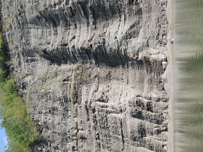
Letchworth State Park boasts a spectacular, meandering 550-foot deep river gorge lined with slate cliffs. It is called the 'Grand Canyon of the East.' Within the gorge, the Genesee River is class II run at low levels (9.0 feet) but becomes a respectable class III river with great surfing opportunities at higher water (stage 10.5 feet). The Genesee River is consistently at its highest during March and April. The river periodically floods between October and June. The highest recorded flood peak was 90,000 cfs on June 23, 1979. The river is closed to kayakers at stage 14.0 feet and higher. Every October, the draining of Rushford Lake augments river flow through Letchworth Gorge by about 1.0 foot.
Logistics: Sign the release and get an annual Waiver # at the Park Office Admin center near the South end of park. Get a map at the gate when you pay your $10 park Entry Fee so you can find everything. The revised permit ( 2019 ) has a river level limit of 11 ft. for recreational kayaks without spray skirts, float bags and proper personal whitewater clothes for cold water. Experienced kayakers & canoers are permitted to paddle above 11 ft. with proper whitewater equipment and clothing. Above 14 ft. the river is just a flood without any value.
Take Out: St Helena parking lot. From the visitors center turn right out of parking lot on park road (3.4 miles) Turn right at the sign for St. Helena and go to lower parking lot (0.2miles). Take out is down the gated restricted access road, river left (0.45 miles)
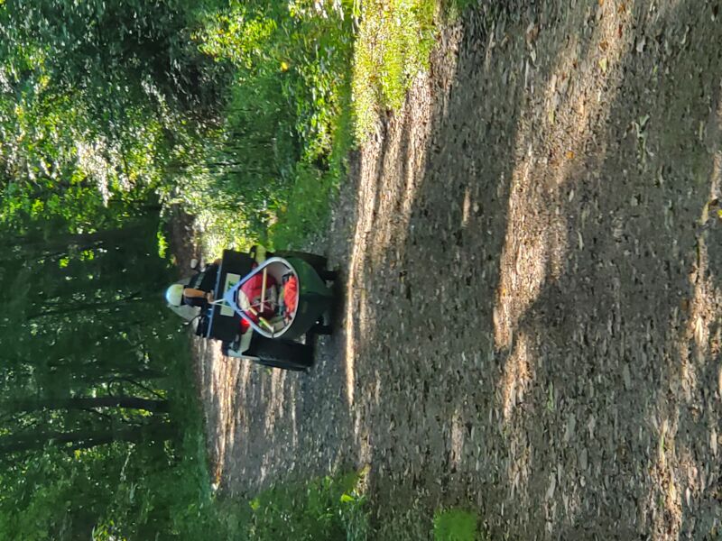
Put In: From check in at the main Park Office, Turn right out of parking lot on park road and take the park road to Lower Falls area and lower parking lot near A cabins. Look for a gate at the top of the dirt road near the CCC statue past the Adventure Calls Outfitters (Raft Co.) Lee's Landing, a 1/2-mile carry downhill from the parking
...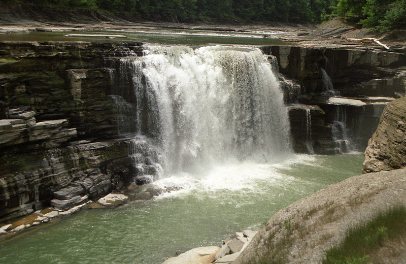
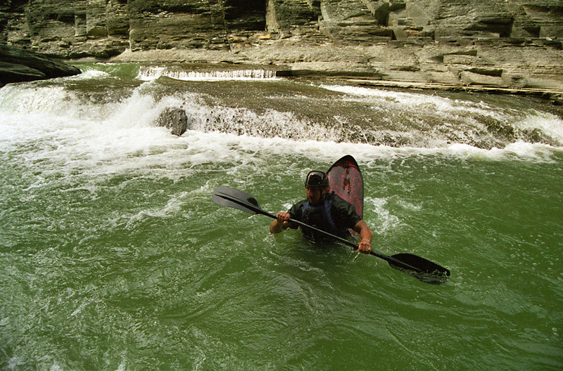
Immediately below Lower Falls is The Inner Gorge, a 200-yard long segment of the river confined between the vertical walls of a deep gorge.
Paddlers are allowed to run the river from the base of the Lower Falls, but they are not permitted to putin anywhere except at Lee's Landing.
Thus, you must paddle and portage upstream from Lee's Landing through The Inner Gorge to get to the base of Lower Falls.
Vertical gear & ropes are needed. At stage 10.0 feet and higher, it is impossible to access The Inner Gorge.
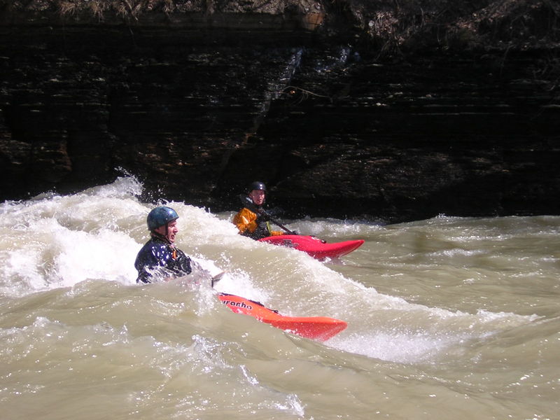
Approximately 1/4-mile upstream from Lee's Landing is The Sluice, a narrowing against the river right wall where the river funnels through a sluice. This play spot is best at stage 9.0 feet and higher. The Sluice is best for super-sonic surfing, micro-eddy hopping, and nuclear-powered stern squirts.
There is only one legal putin, at Lee's Landing. From the calm pool at Lee's Landing, one can either paddle upstream or downstream. Upstream you will find The Inner Gorge (including Lower Falls) and The Sluice. Downstream is The Loop and the standard run all the way to Saint Helena.
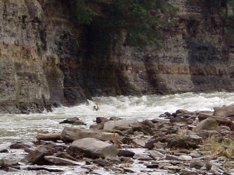
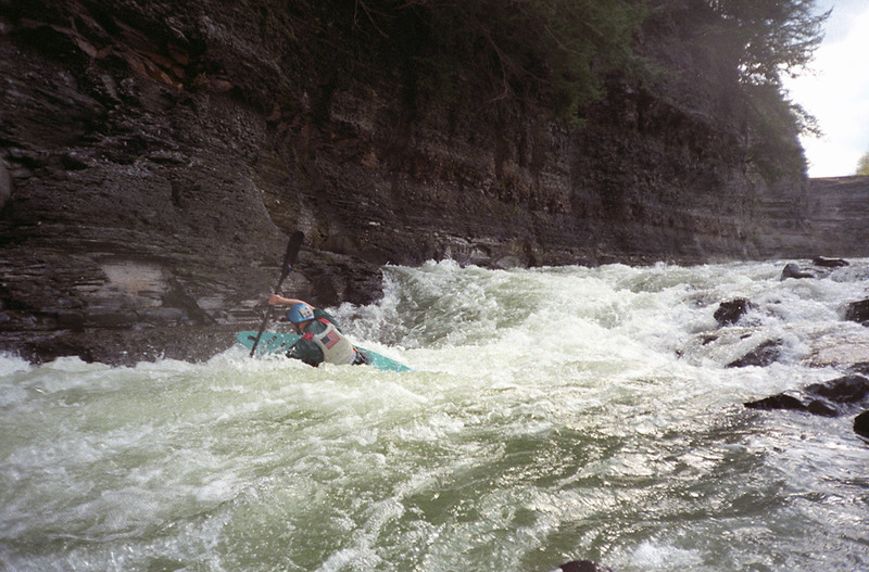
Immediately downstream of the pool at Lee's Landing, the river plunges down a relatively narrow 200-foot long cascade with a complex and surging wave train. This stretch is perhaps the wildest rapid on the Genesee River below Lee's Landing. At high water (Stage 13 feet), these waves can be over 15 feet high. If this rapid doesn't excite you, then you should probably hike back up the hill and head home.
Edit/Update: Flooding in 2016 widened Entrance Rapid and mellowed out its former glory. It's now more comparable to the gorge rapids - a long stretch of bolders and cobbles that has the same amount of drop, but none of the surf, and is more of a bump and grind below 9.5'. Above Entrance, is a pool called 'warm up' that has some great surf at >10.5'.
This rapid derives its name from a red ball that is suspended on a wire over the end of the rapid.
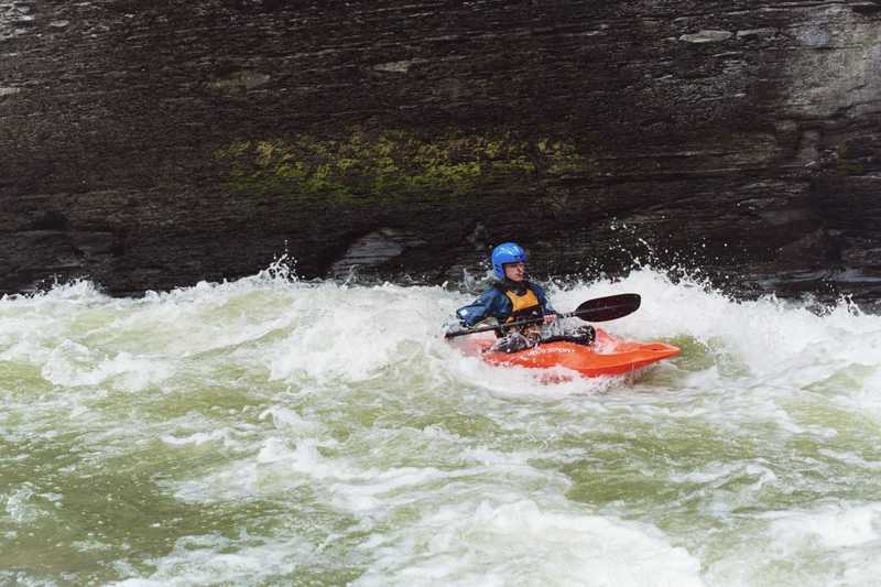
Immediately after Entrance Rapid the river turns left into this 150-yard stretch of whitewater with about two dozen great surfing waves and holes.
These waves are great surfing at 10.5 feet. At 11.5 feet this becomes a heavy class III run, with large waves and a stopper hole. At 13 feet this stopper hole is monstrous.
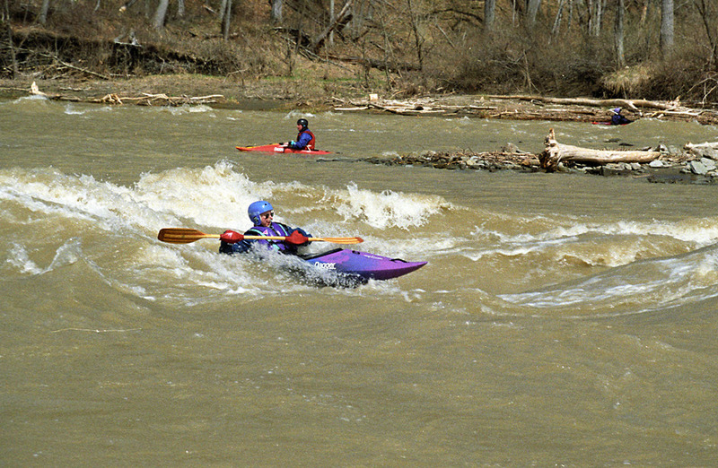
Although Lunch Rock is no longer there, this rapid still retains the name. Past Red Ball there is a long stretch of flat water before entering Lunch Rock Rapid. A major wave/hole is located here. Below 9.0 feet the hole is too shallow. At 9.5 feet it's a fun little surfing wave with a deep pocket but is little else. At 10.5 feet, it is a small but powerful hole that offers a real bite. At 11.5 feet, the right channel opens up, offering some nice surfing, and the hole in the left channel becomes a stupendous surf wave.
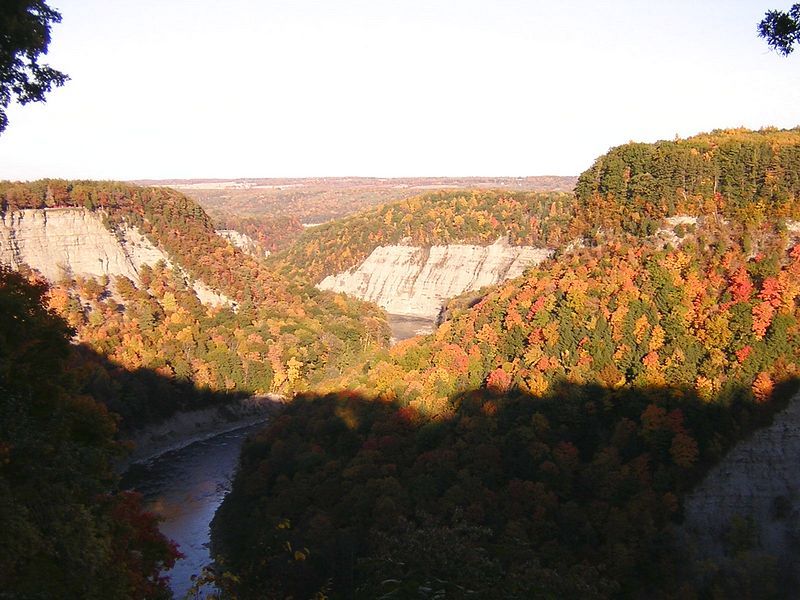
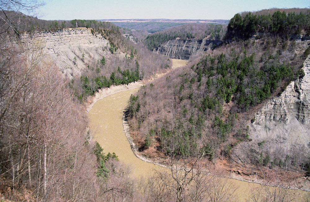
Further downstream it is the scenery, not the whitewater, that is interesting. The photo at the top of this page shows this section of the river.
The takeout is located at Saint Helena. The dirt road here is not obvious, so keep your eyes open. It is a long hike up the hill to the parking lot. Occasionally the rafting company will give you a ride on their shuttles from the water's edge to the parking lot. Be sure to thank them profusely.
Nov 30, 2022
My 3rd trip of my 1st adventures during 2022 on this section in an open solo esquif canoe. I'm a novice on whitewater in a canoe, likewise with my partner in a kayak. Anyone with better skill sets will not perfer this water at 9.0 ft however if seeking to develope your paddling skills it offers great technical challenges with little water risk, although I have been forced to take a swim on one occasion. I have rafted the WV Gauley river both Upper and Lower, The NY Black river, and the PA Youghiogheny. The views on this section of the Genesee river thru the state park are the best I've experienced. Be watchful of rain falls, the river is very responsive, I've experienced half foot gage level changes from put in to take out, study the water gage data history to better understand. Land slides and rock falls are possible, know and apply simple hazard mitigations and it'll prove to be very enjoyable.
Aug 23, 2021
The Entrance rapid described here is actually about 150yds upstream of the put in at Lee's Landing as opposed to downstream from it. A quick ferry across and short portage up to the pool above gives you access to this rapid that runs close to the wall on river left.