AJ
Andrew Jones
May 7, 2017
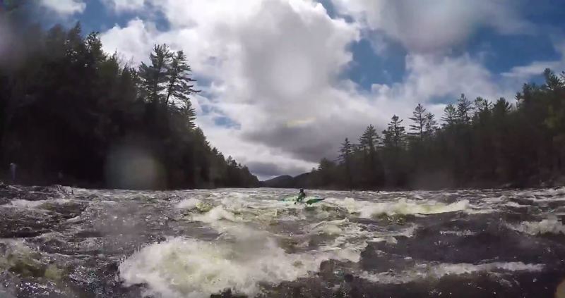
The closer you get to Riparius, the bigger the water gets. Still all read-and-run but the waves and holes get more challenging and you can no longer find lines around all the whitewater.
| Difficulty | II-III |
| Length | 13 mi |
| Avg Gradient | n/a |
| Gauge | Hudson River at North Creek Ny |
| Flow Rate as of 39 minutes | 2.77 ftbelow recommended |
| Reach Info Last Updated | June 14, 2022 |
The section of the Hudson River running from North River to Riparius is much quieter than the Hudson Gorge run further upstream.
The Put-In is a trail beaten down to the river across the road from Adirondack Outfitters that is a little steep and has a rope with knots to help people up and down. It is just upstream of the mouth of Thirteenth Brook and the parking area and park right there. Immediately after the put-in you'll want to catch the channel on river left to tackle Mouse and Moust Tail Rapids. Apparently at high water levels there is a sneak line that becomes available on river right for the top portion (Mouse). A unique mineral deposit in the rock wall at river left of Mouse Tail may be of interest to the geologically-inclined.
Half a mile downstream is Perry Ehlers Rapids, which is likely the most challenging rapid on this section of the Hudson. Balm of Gilead Brook meets the Hudson just upstream of Perry Ehlers on river right. Those wishing to skip Perry Ehlers can line and boulder hop/wade on river right at low levels or jump onto Rt 28 and cary a tenth of a mile. Be mindful of the fast-moving traffic if carrying.
Below Perry Ehlers there is a mix of flat class I and swifts until one reaches North Creek. This upper section is adjacent the highway and is a commonly used intro to whitewater section.
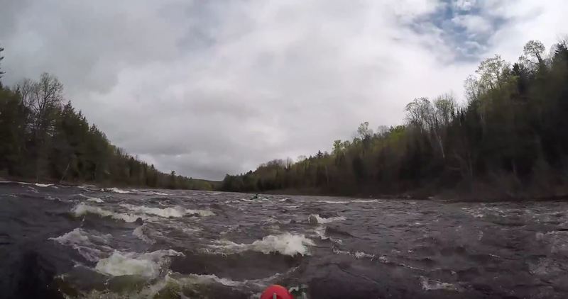
Passing under the Rt 28N bridge in North Creek, the river turns North and becomes more remote until Riparius. A railroad parallels the river through most of this section on river right, and River Road would be a short bushwack up the right riverbank in most places, but those paddling past North Creek should plan to commit to the entire section to Riparius.
The section of the Hudson from North Creek to Riparius backs off then responds briefly just before arriving in Riparius. It can be challenging identifying an obvious channel through some of the swifts in this portion of the river at low water levels. Boulders will be your main
...Dirt path across from 13th Lake Rd just upstream from Mouse Rapids and the mouth of Thirteenth Brook.
Mouse and Mouse Tail Rapids are immediately downstream from the Put-In. At high water levels a sneak route may be available on river right, but the main channel is river left.
Perry Ehler's Rapids is about .75 miles from the Put-In and .5 miles below Mouse and Mouse Tail Rapids. It is Class III at high water levels and is likely the most challenging feature on this portion of the Hudson. The channel is river left, but those wishing to skip the rapid can line the boat and boulder-hop/wade on river right at lower water levels or carry down Rt 28 a tenth of a mile.
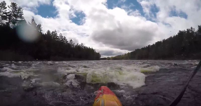
The final, unnamed rapid before the Take-Out at Riparius Bridge is .5 miles long. The final ledge can be seen from the bridge and at higher water levels can form standing waves and holes.
Take-Out on river right immediately after Riparius Bridge. There will be a sloping grassy hill that leads to a parking lot and picnic area.