Mill Creek (Hudson trib.)
Johnsburg (above Wevertown) to Hudson River
| Difficulty | I-IV(V) |
| Length | 4.5 mi |
| Avg Gradient | 33 fpm |
| Gauge | Hudson River at North Creek Ny |
| Flow Rate as of 1 hour | 2.31 ftbelow recommended |
| Reach Info Last Updated | April 12, 2016 |
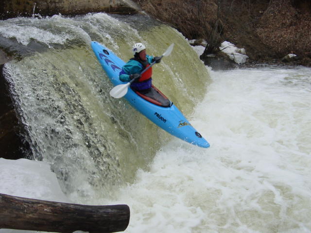
The longest trip involves putting in just upstream of the culvert under South Johnsburg Road. Immediately after exiting the culvert you fly over a 10 foot waterfall (see photos). I call this 'Pipe Dream'. Be careful to scout the landing first. The next 1.5 miles involves lovely 80 fpm rapids down to the route 28 bridge. From here you have a short stretch of flatwater which ends at a (possibly unrunable) mill dam waterfall - carry on the right. Another mile of boogy water brings you to the 'Black Hole' slide - beware the pinning rock on the right. You can take-out here, or run a short rapid (IV) down to the Hudson River, which has pleasant rapids (II/III) down to The Glen.
Eastern Adirondacks Reaches
Ausable, E. Branch Ausable, W. Branch (1.) Ausable, W. Branch (2.) Balm of Gilead Brook
Boquet (2.) Boquet (3.) Boquet, N. BranchBoquet, S. Branch
Boreas (1.) Branch, The (Boquet trib.) Branch, The (Schroon trib.)
...No trip reports yet.