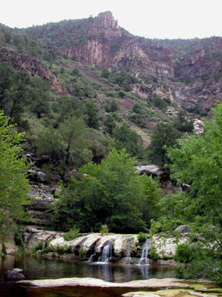
Wet Beaver Creek
01. FR 618 to Camp Verde Bridge
| Difficulty | I |
| Length | 10.1 mi |
| Avg Gradient | 55 fpm |
| Gauge | Wet Beaver Creek Near Rimrock, Az |
| Flow Rate as of 34 minutes | 8 cfsbelow recommended |
| Reach Info Last Updated | October 9, 2017 |
Wet Beaver Creek is similar to Oak Creek and flows through a red rock canyon. The stream is much less crowded than Oak Creek and has convenient road access. Most of the creek is difficult to access by boat but access below Montezumas Castle National Monument is suitable for low water boating.
There are high water strainers on the lower reaches.
Access:
Put-In: Leave I-17 at the Sedona/Oak Creek Exit. Travel east approximately three miles on FR 618 to the Beaver Creek Ranger Station then turn left on FR 618B to the parking lot at Beaver Creek Picnic and Day use area.
Takeout: Via I-17 to the Middle Verde Road exit and Verde River Bridge.
No trip reports yet.