Oatka Creek
Leroy to Fort Hill
| Difficulty | II-III |
| Length | 3.5 mi |
| Avg Gradient | n/a |
| Gauge | Oatka Creek at Garbutt Ny |
| Flow Rate as of 53 minutes | 76 cfsbelow recommended |
| Reach Info Last Updated | September 29, 2020 |
Oatka Creek is a seasonal creek that drains into the Genesee River just south of Rochester. The creek is characterized by numerous ledges and pour-overs. Though rather tame, it features a nice surf wave, many excellent play holes and a beautiful but unrunnable 50-foot waterfall ( Buttermilk Falls). Oatka Creek is most fun when run at high levels (6 feet on the Garbutt gauge).
Western New York Area Reaches
Beaver Meadow Creek Canadaway Creek (1.) Canadaway Creek (2.)
Canaseraga Creek Cattaraugus Creek Cattaraugus Creek, S. Branch
Cazenovia Creek, W. Branch (1.)Cazenovia Creek, W. Branch (2.) Chautauqua Creek
...The putin is located in downtown Le Roy, just below the Route 5 bridge.
There is a nice city park on river left with ample parking and convenient river access.
There are numerous surf waves adjacent to this park (best above stage 5.5).
Just downstream from the putin are three bridges in quick succession.
Below the third bridge is the best surf wave on the creek.
It is fun at 4.5 feet, but is is best at stage 5.5+ feet.
This wave is a great 'destination boating' play spot.
The creek divides left and right at the surf wave.
Take the right branch.
Downstream there are three holes.
Beware, these holes can be VERY sticky.
Below the convergence of the two branches, there is another river-wide pour over.
Like so many other pour overs, this hole is VERY sticky at stage 5.0+ feet.
At two miles, North Road crosses the creek.
This is Crocker's rapid.
If the water level is less than 4.5 feet, takeout here.
There is ample roadside parking.
Not far downstream from the North Road bridge, you will cross under an old railroad bridge.
One hundred yards downstream from this railroad bridge, you will notice a definite horizon line and hear a tremendous roar.
This is Buttermilk Falls.
Takeout just above or just below this bridge, on river left.
WARNING!****Buttermilk Falls is approximately 50 feet high.
It is not runnable.
The pool at the base of the falls is very shallow and is clogged with boulders, shopping carts and other debris.

Portage around Buttermilk Falls on river left.
There is a well-worn trail that will lead you along the rim of the gorge.
After hiking about 200 to 300 yards, you will see a walking trail that leads through a break in the cliffs and down to the creek.
Putin anywhere that is convenient.
The gorge downstream from Buttermilk Falls is bony at 4.5 feet.
At 5.0 feet and higher, this section of Oatka Creek is very exciting.
The water is pushy and rock abound.
Definitely not a place for paddlers who cannot stay upright.
A capsize in this water would quickly lead to an injury and a swim.
Oatka Creek parallels Route 383 for several miles east of Fort Hill.
Takeout anywhere along Route 383 that is convenient.
Apr 28, 2011
Ran this 3/12/2011 around 5.25' or so down to the falls. A few strainers but all with sneak lines. However, I would recommend going left at the island instead of right as there is a nasty strainer and sticky situation as the right side converges back to the main. After scouting this we simply portaged across the island and put in on left side. Fun run at this level!
Note -- Ran today (4/28/2011) and everything was clean -- not strainers. Right side was clear.
Aug 18, 2006
Stage 6 feet is considered flood by the USGS.
Jan 31, 2001
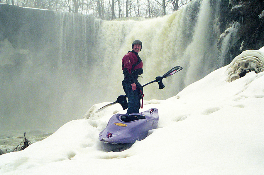
Doug Roode at the base of Buttermilk Falls, preparing for a seal launch into the creek (stage 4.5 feet on the Garbutt gauge). Typical spring conditions in upstate New York (March 2001).
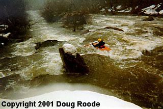
Harry Marinakis, M.D. paddles off into the sunset after a seal launch from the ice formations at the base of Buttermilk Falls (4.5 feet on the Garbutt gauge).
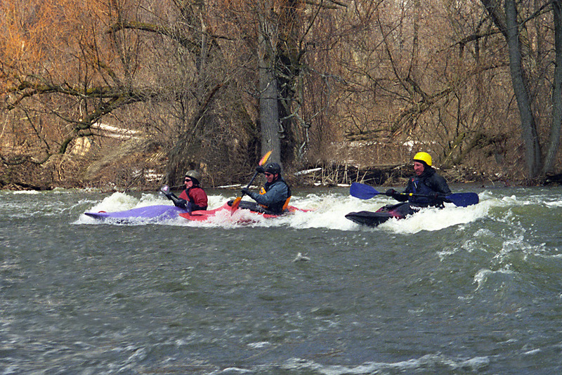
Doug Roode (left), Steve Baker (center) and Jim Albano rip up the famous Oatka Creek surf wave at 4.5 feet on the Garbutt gauge (March 2001).
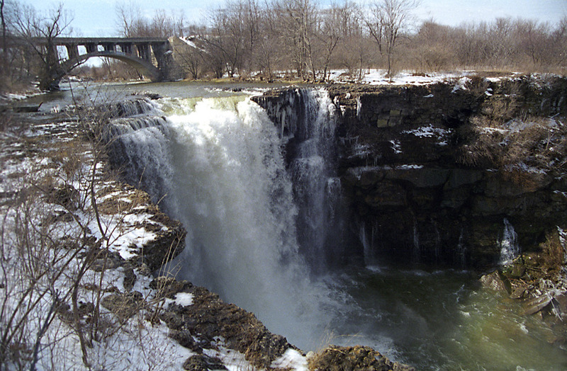
A view of Buttermilk Falls and the abandoned railroad bridge just upstream. This waterfall is not runnable, as the pool below is shallow and clogged with debris.