| Difficulty | II-III |
| Length | 5.1 mi |
| Avg Gradient | 60 fpm |
| Gauge | Rondout Creek at Rosendale Ny |
| Flow Rate as of 24 minutes | 98 cfsbelow recommended |
| Reach Info Last Updated | April 26, 2016 |
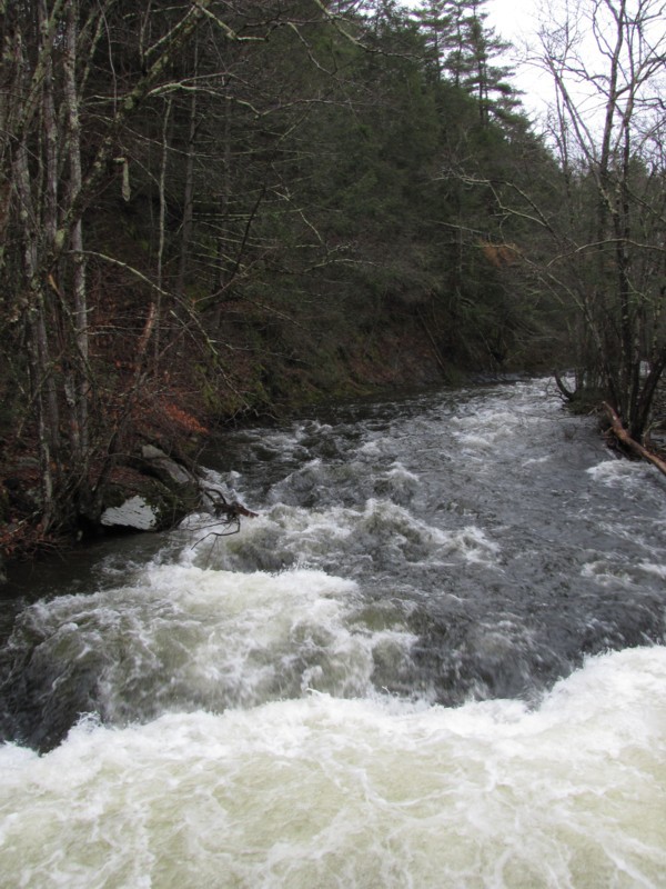
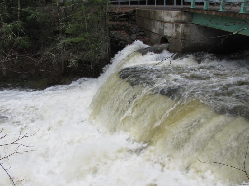
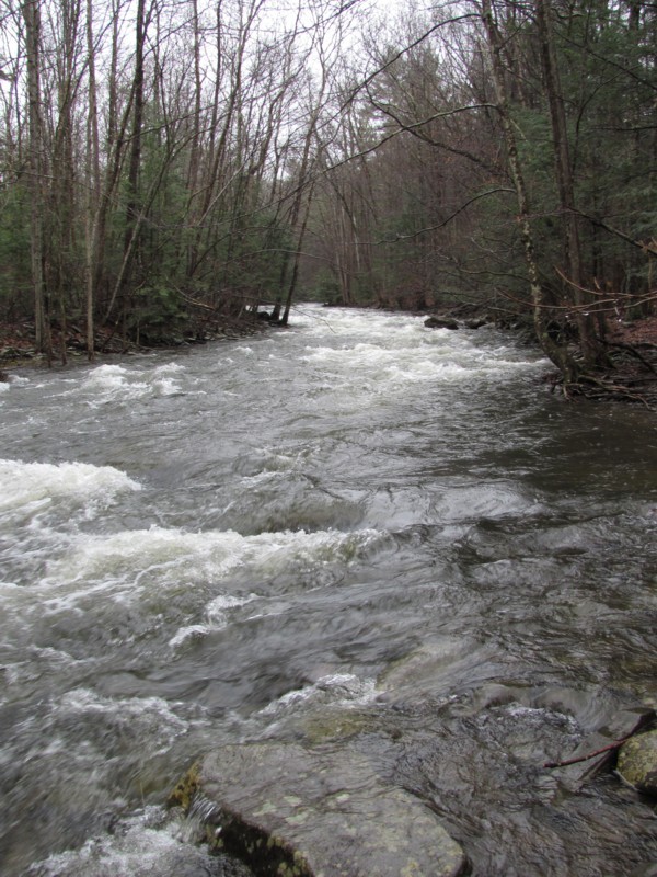
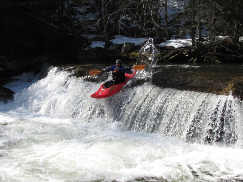
This is a pretty straightforward creek that is pretty and boat-scoutable for most paddlers. There is really only one rapid that will surprise you, but it also is an easy point-and-shoot drop. The only reason it is surprising is because it is at the end of the run, and it is a pleasant surprise. A great creek for warming up for the season or for paddlers just learning to creek.
Dennis Squires's book New York Exposed: The Whitewater State Volume II is an awesome book that provides a great description of this creek as well as many other runs in this part of New York state. I highly recommend it if you are a New York boater.
Catskills Area Reaches
Basic CreekBatavia Kill Bear Kill
Beaver Kill (Delaware Trib)Beaver Kill (Hudson Trib) Beer Kill
Beer Kill, W. BranchBowery Creek Bush Kill
Callicoon Creek, E. BranchCallicoon Creek, N. Branch Catskill Creek (1.)
...Mar 16, 2011
As JD says, this is a very pretty stream that's a lot of fun. It's possible to put in farther upstream, but the easy trip is from DeWitt Rd (optional 8' waterfall under the bridge) to either Dug Road or Boodle Hole Road. The location shown on the AW map, as well as the listing for 'Doug' Road is for an access point about midway through the typical trip.
See this map instead: http://tinyurl.com/rochester-creek
I think of this as a really easy intro to creeking. It's small and intimate, but not fast or technical (at least at modest levels). The first half is no more than class 2, and there's an option to take out at Dug Road. 1.5 miles below DeWitt road there's a small dam to watch for. At reasonable levels it should be easy to spot and take out on the left. Runnable at low levels, but the hole can get nasty as levels rise. The second half builds to 2+ or easy 3 at the end, finishing with a couple of ledge holes. They might get a bit sticky, but can be punched at modest levels.
First ran this in March, 2010 at perhaps 5000 CFS on the Rondout gauge (Rosendale), which was a very good level. Ran it in March, 2011 at 1800, which resulted in a fair amount of bumping and scraping. Figure an absolute minimum of 1650, with 2100 being much better. Cleared snow showed that parts were 4' higher when the Rondout was at 20,000 a few days earlier, so I'd guess at a maximum of perhaps 7500.
I'm not sure how low this can be run, but if the Rondout at Rosendale is at 5000 CFS this should be good to go.
Mar 15, 2011
Jeff runs the drop at the small dam, 1.5 miles into the run. This was at a near minimum level for the run.