| Difficulty | II-III |
| Length | 0.6 mi |
| Avg Gradient | n/a |
| Gauge | Schroon River at Riverbank Ny |
| Flow Rate as of 1 hour | 1.44 ftbelow recommended |
| Reach Info Last Updated | April 12, 2016 |
River Description
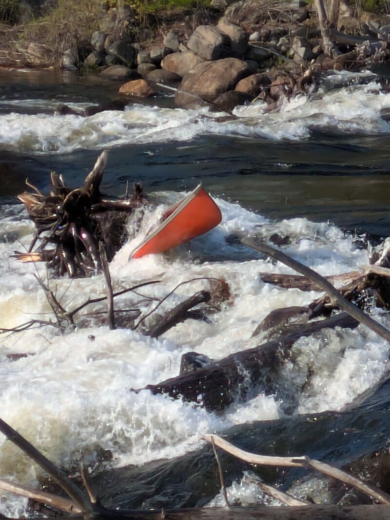
This section of the Schroon river is about one mile long at best. Most of the shoreline is privately owned so you will have to be careful about tresspassing. The only public access for a putin is above the bridge in the center of town on river right. However, when putting in here you will immediately face running a broken down dam. There is only one passible channel over a four foot drop which is on river left center. It would be wise to scout this drop from the road on river left before deciding as a wrong choice could result in ending up in a strainer or getting pinned. If it is too low to run you may face some pinning possibilities. However, in higher water is is a rather straight run. Once over the dam the remaining mile is pretty continuous class 3 whitewater with the take out above the next bridge on river right in a very small park. As you get closer to the end the rapids grow larger and you should move to river left as there is a strainer on river right which the current tends to flow through. In any case, the river left side is the most fun with the biggest waves.
Eastern Adirondacks Reaches
Ausable, E. Branch Ausable, W. Branch (1.) Ausable, W. Branch (2.) Balm of Gilead Brook
Boquet (2.) Boquet (3.) Boquet, N. BranchBoquet, S. Branch</
...River Features
Put In
Access PointDistance: 0 mi
Take Out
Access PointDistance: 1 mi