South Sandy Creek
1. Route 95 to Route 11(Lorraine Gulf)

| Difficulty | III-IV |
| Length | 11.6 mi |
| Avg Gradient | 45 fpm |
| Gauge | Sandy Creek Near Adams Ny |
| Flow Rate as of 1 hour | 30 cfsbelow recommended |
| Reach Info Last Updated | March 28, 2016 |
Here is my writeup from the now defunct Inland Surfing Association web page:
SOUTH SANDY CREEK
Section: Lorraine Gulf (Bullock Corners to Allendale)
Counties: Jefferson (NY)
USGS Quads: Pierrepont Manor
Suitable for: Intermediate and Advanced
Months Runnable: March and April, or after 2 days of steady rain
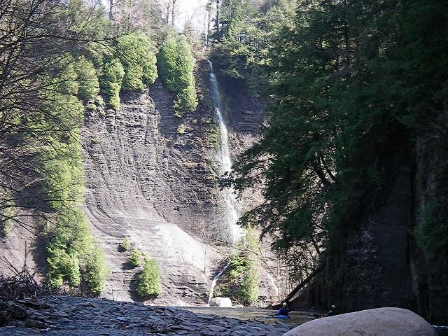
Interesting Highlights: The whitewater and the waterfall
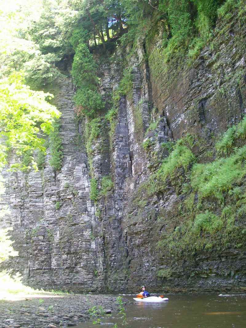
Scenery: Beautiful
Difficulty: III (III+ at high water)
Average Width: 40 feet
Velocity: 3 - 6 m.p.h.
Gradient: 38 feet per mile
Runnable Water Levels:
Nearest USGS Gauge: Black River at Watertown, Station #04260500
Best USGS Gauge: Independence River at Donnatsburg, #04256000
Nearest Waterline Gauge:
Minimum: About 16' below the top of the rectangular base of the bridge abutment on route 178 (Access Point B). The rocks in the river downstream of the bridge on the right should be just covered. This level makes for a long paddle. The minimum fun level would be considerably higher, with the water level near the top of the rectangular base of the bridge abutment.
Maximum: Not established
Hazards: Strainers
Scouting: None
Portages: Any strainers
Rescue Index: Remote
Source of Additional Information: The Inland Surfing Association paddling club at (607)785-3891 or the Adirondack Mountain Club's 'Canoe Guide to Western and Central New York State', Kevin Howells
A
...fun river at higher levels. continuous switchback rapids. when the river is running...GO it drops fast.