Twentymile Creek
S. Ripley to Lake Erie
Mar 20, 2014
Running Good 1st day of Spring 2014
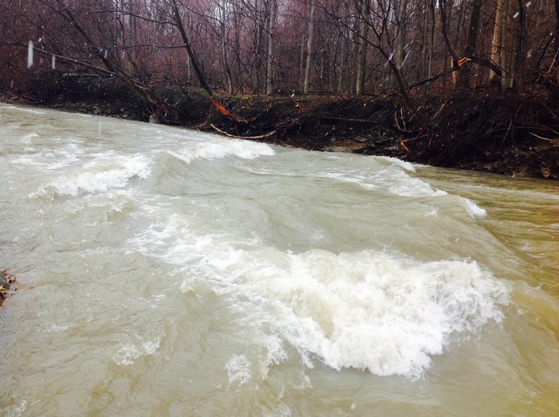
PA side under I-90
Mar 20, 2014
Pic under I-90. Upper good to run now. North of route 5 looks like death or serious injury for sure
Jan 23, 2013
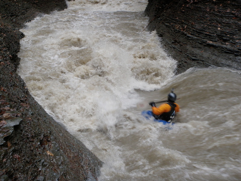
Nate Blick getting tossed in the big one. Of the four of us I was the only one to make it through this beast upright and to be fair it was mostly due to being the group photographer and seeing where not to go haha. Also two of the four hard boaters were in playboats which probably will not be attempted again ever. The raft had to be portaged for obvious reasons. Proper line is center left with some good left angle because it kicks right harder than it appears.
Jan 23, 2012
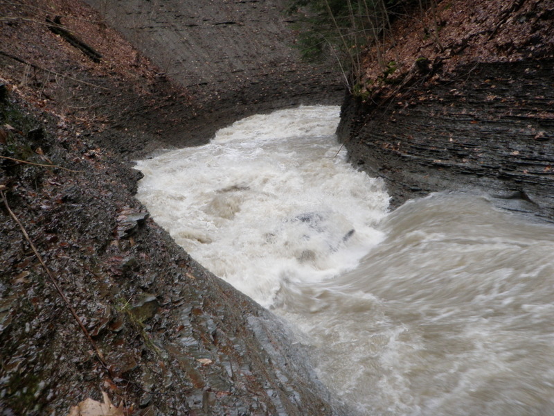
Looks a lot different from up here, we all changed our lines when we got out at the bottom and looked at it. Once you take out to look at the bottom you are already committed, there really is no way out of the box canyon unless you set a rope before hand. Rescue is not an option either, pretty much on your own on this one.
Jan 23, 2012
http://www.youtube.com/watch?v=vOUR8FrlhQ8. Sorry you have to copy and paste AW won't take the link, you can also just type kayaking flume of doom in youtube. 63 degree in January, yea we had to take off work. Undoubtedly one of the biggest if not the biggest holes in the area. This creek has only been run a handful of times by probably less than ten people but its is a gem of a micro creek with a 36.9 square mile drainage basin its actually one of the bigger ones in town. I consider this part of the Erie PA creek network because it ends in Erie county even though most of the run is in New York. Interested boaters should also look at Four and Twelve mile creeks on AW in PA. Six and Sixteen mile are also excellent and soon to be posted. Walnut, Elk, and Little Elk are the Western Erie runs and are less difficult but still superb with proper level, offering less drops but more surfing than the eastern 'mile' creeks. Chautauqua creek in New York and its tributary little Chautauqua are considered sister creeks to Twenty mile and its main tributary Belson because they are right next to each other and Main branch and tributary are near equal in size and greatness. Little Chautauqua takes the cake for biggest drops. Unfortunately it has the most wood as well and is for the most part not runnable at present time although it has been before. I have seen video from 15 years ago when it was clean, and amazing. The Flume is also known as gauges gulf to locals, and is a popular swimming hole in the summer when the level is low.
Apr 15, 2004
This is nice shot of Twentymile (back) and the Gage Gulf (foreground) comming together. Dave and I had to fight our way up the hill to snap some pictures, but it was well worth it!
Here is the put in for this awesome run. Shown here is Dave Atkinson making final preparations for the decsent.
This is one of many small ledges near the put in.
Nice and scenic.
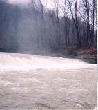
I wonder how high this one is?
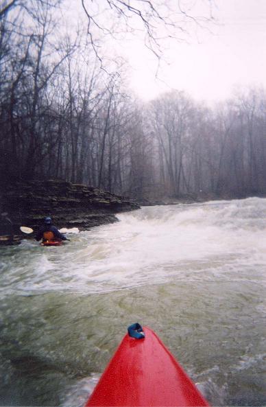
Dave heads into the chaos! That took some guts to take this shot before heading into a Class V didn't it? I know, I'm vain!
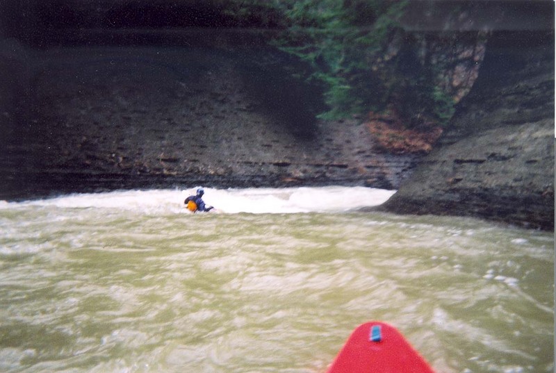
This is a HUGE hole. In fact, when taking the picture I wasn't even that close to the hole. For scale, the tree above the hole was very large and there was plenty of head room underneath it!
Intimidating? Scarry? You bet!!!
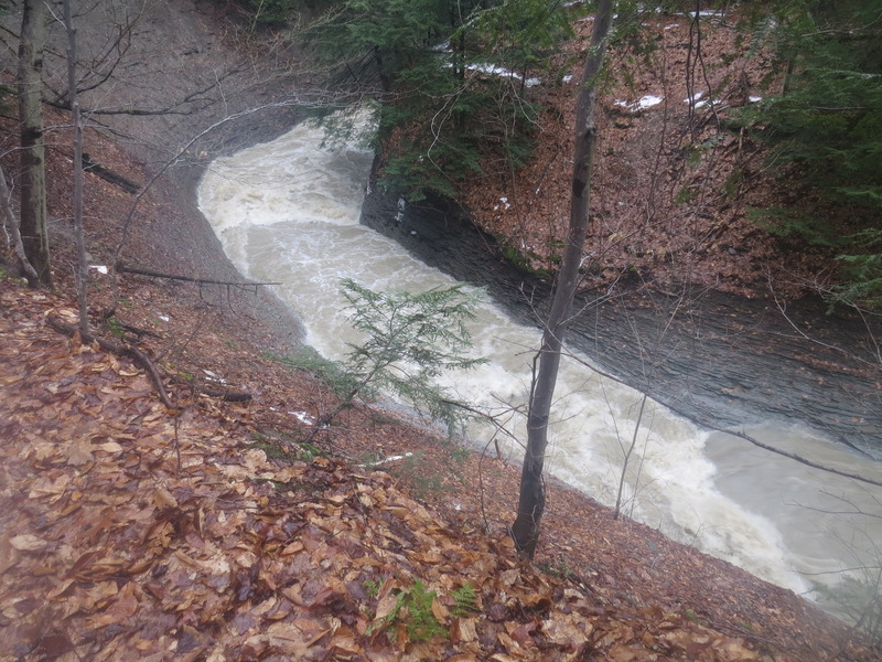
You can see how far downstream the hole recirculates.
Nice little waterfall. I think this one is around Mile 5.
Not far above Railroad Rapid.
Do you really want to surf that Dave?
Dave approaching the artificial falls.
Dave Atkinson looking up at Snake Falls.
View of Iron Bridge Falls from below.
Apr 1, 2004
Juntion Falls is a fun and easy waterfall, but you will want to ferry to the left bank to scout The Flume of Doom after running the falls.