West Canada Creek
Trenton Falls to Herkimer
| Difficulty | II |
| Length | 25.8 mi |
| Avg Gradient | n/a |
| Gauge | West Canada Creek at Kast Bridge Ny |
| Flow Rate as of 38 minutes | 314 cfsbelow recommended |
| Reach Info Last Updated | April 28, 2022 |
For decades, West Canada Creek from Middleville to Herkimer, N.Y., proved a reliable beginner/intermediate run with consistent water released from Hinckley Reservoir upstream. After a number of high water events a play spot formed near the end of the run above Kast Bridge. In the summer of 2012, one [...]Read More
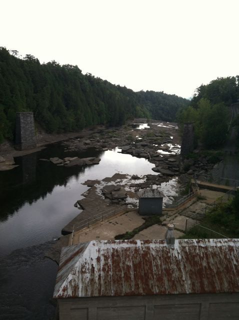
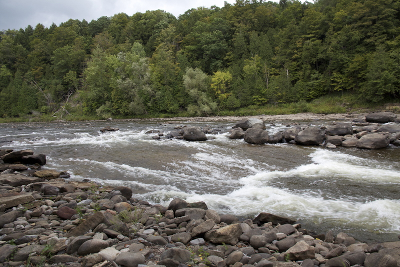
The West Canada below Trenton Falls becomes a docile swift water to Class II river where one often sees fishermen (great fishing by the way), boaters in canoes and recreational kayaks, tubing and even an occassional motorboat. From the Dover Road Bridge in Trenton Falls (just below the release dam) to Herkimer is about 28 miles of paddling, although most whitewater boaters put-in further downstream near Middleville, NY.
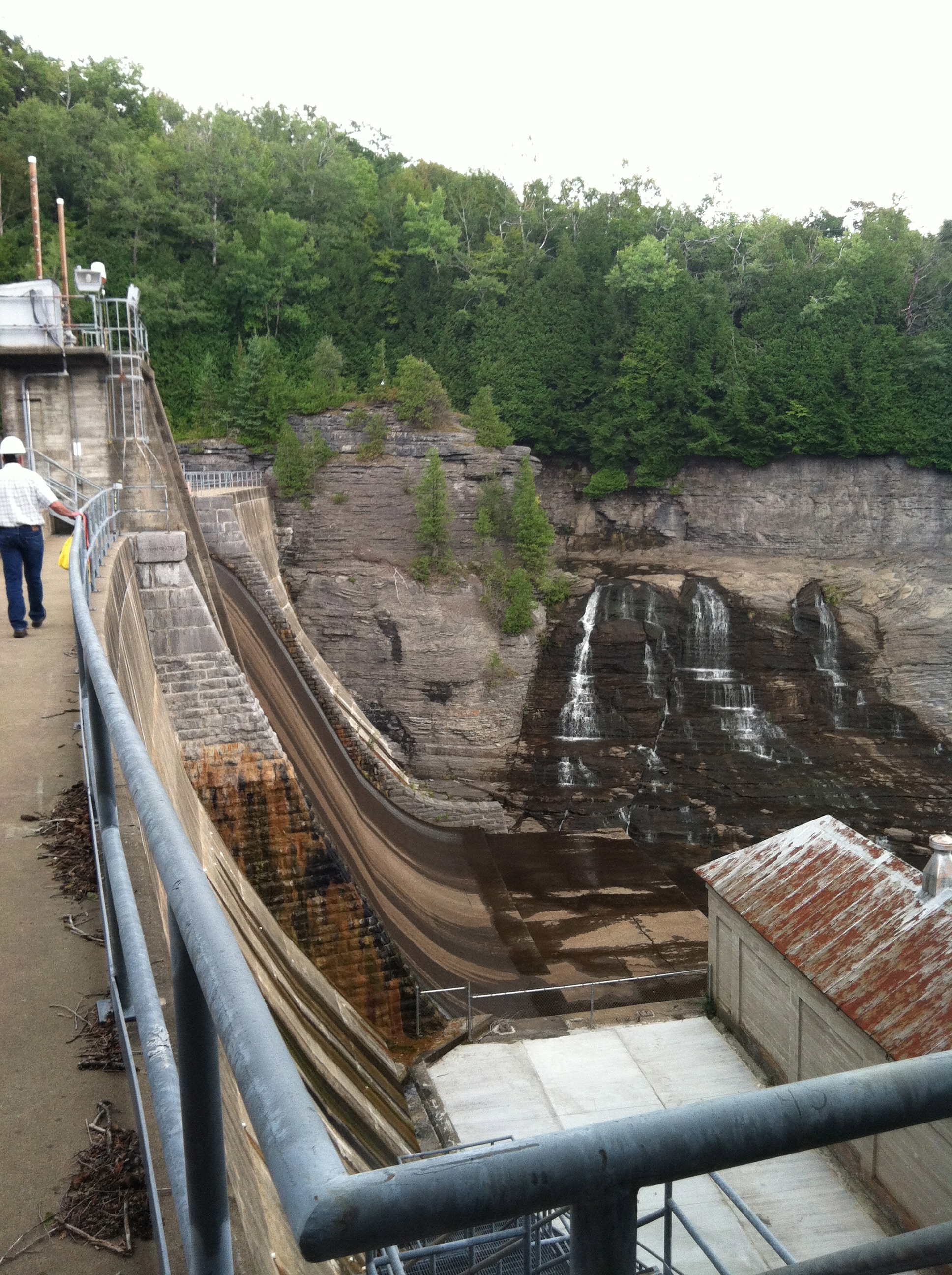
A Note on the West Canada: River levels will generally be high enough for paddling year round, water is released both from the Hinckley Resevoir and at the Power Company at the Trenton Falls Gorge. (Speaking of which, the section of river from Prospect to Trenton Falls is home to some seriously big waterfalls, now open at times throughout the year for tourists, but likely never to be open to kayakers.) The West Canada is known to rise and drop rapidly due to the upstream power operations.
Check the flow graph to get a sense of what the power station has been doing. Expect the summer flows to stay at a baseline flow then surge for a few hours so the dam can make power at the daily power rate peak. Use this -Waterline Link- to keep an eye on expected flows.
There are several man-made features along the way from Trenton Falls to Herkimer, a couple dams including the low-head type that would best be avoided, and bridges that at high, fast water levels can create broaching scenarios.
Additional Info from Mike Webster:
Section 1: Dover Road to Route 28 Class (1 - 2)
Description: A pleasant moving water cruise to the whitewater put-in above Middleville. No real whitewater, but moves right along with frequent public access points to NT 28. One mandatory portage at Newport dam.
Section 2: Route 29 in Middleville to Route 7/Kast bridge above Herkimer (Class 2 - 2+)
Description: This is a classic class II-II+ teaching section from above Mi
...