White Oak Creek
Bethel-New Hope Bridge to Georgetown Dam(White Oak Valley Road to Georgetown Dam)
| Difficulty | II-IV |
| Length | 13 mi |
| Avg Gradient | 20 fpm |
| Gauge | White Oak Creek Above Georgetown Oh |
| Flow Rate as of 41 minutes | 30 cfsbelow recommended |
| Reach Info Last Updated | December 7, 2020 |
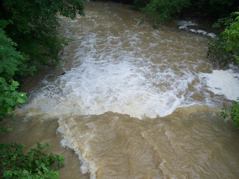
Normally White Oak has virtually no water in it (less than 20 cfs) as it is not spring fed. However, after a heavy rainfall it can jump to over 10,000 cfs in just a few hours. The next day it could (and often does) drop below the minimum recommended boatable level of 1000 cfs!
The smooth slate sloping bottom allows the water to build up to high speeds during big flows, kicking up NICE waves - a playboater's paradise without having to travel hours away to the 'real' whitewater in Tennessee or West Virginia.
At 1000 - 1200 cfs, the creek is doable, but scrapey. Drops are small and obstacles are few. Eddies are well-defined and there are small play features for timid intermediates to work on. This would probably be considered a typical class II.
As the level increases it becomes less welcoming to the uncertain and more fun to the skilled.
Somewhere around 2500 cfs, White Oak approaches class 3 difficulty. The waves become bigger and holes become playable. The eddies become less well defined, but still there. The water becomes swift and swimmers may not get to shore right away.
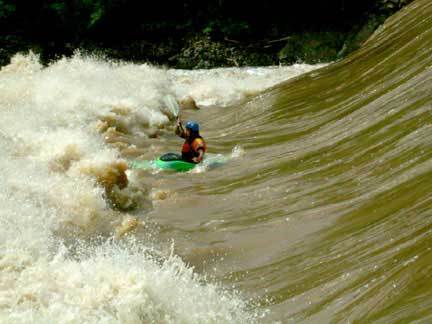
The optimum level for skilled play is probably around the 2500 to 8000 cfs range. After the creek gets above 10,000 cfs most everything is washed out and you get some HUGE waves. (Think New River over 10ft). It is worth going down because I bet you will never throw bigger wavewheels or kickflips. At this level, the creek could be considered in flood and flood rules should apply - i.e., avoid swimming at all costs, watch for strainers and logs - not just 'static' ones against the shore or obstacle, but ones floating down river (wooden paddling buddies). It will be crucial to be familiar with flood river dynamics in general. While technically not more difficult than Class 3, the flood conditions make this run more dangerous.
At higher levels, more daring and skills are required. Debris floating downstream becomes quite dangerous. Swimming is not an option, as
...
This was once one of the best waves on the run, but times have changed. The wave seldom gets above a foot and is usually good for little more than a front surf if you work at it.
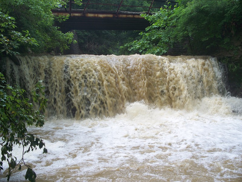
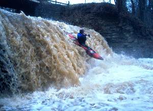
(NOTE: This is different from the photo of the 'Put-in Falls', which is actually on Unity Creek, which flows into this run immediately upstream of the listed put-in. Those looking to start their run with a big bang may wish to check to see if there is sufficient water to run that drop.)
After the put in wave there will be a short slack water section. The creek will make a dogleg leading into the first rapid. Start far left to miss the hole. At one time you could play this hole, but as time has gone by it has gotten more nasty -- best to avoid it. After the hole, work to the center and play the waves below.
After the first rapid move to the left to catch an on-the-fly wave. Good for front surfing and quick spins. When you are done surfing or get blown off, work back to center for some great waves.
Welcome to the flat water! There will be current so you don't have to paddle hard if you don't want to. (Pass the time by perfecting flat water moves.)
Around the 2 mile mark there will be an old bridge pillar. At higher water a NASTY whirlpool forms behind it. The left wall is also undercut. It should be easy to avoid trouble here, but could get very interesting (BAD!) if you don't!
This is about the best playspot on the river. However it changes depending on the flow.
1000-2000 Small hole, not very powerfull but good for some endless spins. Good eddy on the right.
2000-3500 Big, powerfull hole. At this level you can perform all hole tricks. Eddy is really starting to fade. Walk up right bank.
3500-4500 WOW! Playable, but for real men and women only!
4500-15000 River wide hole, very stickey. Sneek far left.
15000-? Smooths out to nice (and big) wave hole as it starts to wash out. Surfs up!
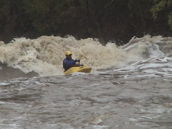
This is a newer feature that was first surfed and named by John Geoppinger. He named it so because it is that addictive! At levels of 5000 to 7000 cfs this monster forms just below First ledge. Ever been on the New River Dries? Its here in Ohio. This is the biggest wave hole on the run. It look intimidating, but is really friendly. Jump in and hold on because unless you are use to surfing big water, it will take you for a ride. Exit the hole on the sides. There is an eddy on the left that only the fastest of boats can catch the hole from, but if you are paddling a spud boat, walk up the left bank.
This rapid use to split in two with most of the flow going to the left. However there has been a large change. There has been a huge deposit of rocks and wood at the enterance to the left side. Now 90% of the flow is diverted to the right. Follow straight down the middle at the top. The creek will then turn to the left into some large standing waves. Good surf on the fly!
When you round a bend and see the first bridge you are at the top of this rapid. This is the longest rapid on the run. Start left. At the top there is a hole that will spank you at any level. To miss, just drive hard to the eddy on the left. This eddy is getting harder and harder to catch as there is a powerful curler you have to punch to catch the eddy, and yes, the curler feeds the hole. The hole is getting much worse also. At higher flows, from this eddy you can catch a great steep wave that you can hit big fat blunts on. Once you wash off of this one just read and run the rest of the rapid. At the very bottom, past the bridge, there is some construction material on the far right bank. Low flows it a seive and higher flows it a hole.
This is a pourover that is near the end of the run. At lower flows this is one heck of a strong hole (don't ask me how I know). Drive hard left, punch the shoulder of the hole and catch the eddy. At higher flows it breaks into two holes. The right is bad and the left is surfable. After this rapid there has been some construction and has narrowed the stream creating some large waves.
A good portion of this dam has washed out. You may wish to take out above the dam site to look at it and decide about running it.
Below is a GoogleMaps view of the washed out dam.
A fine sequence of photos of runs of this at high flows is available on Flickr (our thanks, to Doug Elick).
Take out downstream on the left bank and walk back up the hill.
Jul 25, 2016
Ran on 7/23/16 around 1,000 cfs. S-turn rapid has significantly changed. The bottom section has widened, resulting in the rapid being less pushy and more shallow. The rapid was much smaller and easier to run. At 1,000 cfs, there weren't holes at the top of the rapid, just a small wave train.
Feb 18, 2013
Did this run for the first time just a few weeks ago. Wasn't sure how the new gauge was reading since the dam had blown out. There was a painted ft. gauge on highway 125 it read just below 3ft however the gauge was reading right at 12ft. At this level really now good whitewater just some small ledges but a good level for if you are unfamiliar with creek and wanting to come back when its running higher.
Mar 9, 2012
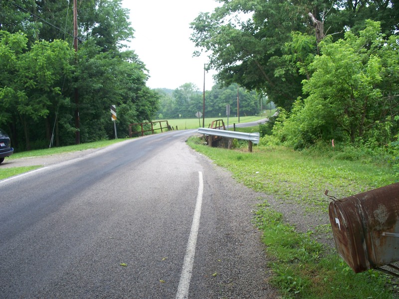
Found out that the bridge on White Oak Valley Road is offically closed. We got permission from the construction guys to park near their work site, out of the way. Otherwise, you'll need to head back into Hammersville for an alternate route to the put-in parking spot until the new bridge is finished. The alternate route is only 3 minutes more drive time, but is 3 miles longer (just check google maps for directions). If you go during the weekend, I doubt that parking at the construction site is an issue because the construction crew won't be there.