Clackamas
1. June Creek Br. to Collawash River
| Difficulty | III-IV |
| Length | 8.1 mi |
| Avg Gradient | n/a |
| Gauge | Clackamas River Above Three Lynx Creek, or |
| Flow Rate as of 38 minutes | 614 cfsbelow recommended |
| Reach Info Last Updated | May 4, 2026 |
The Clackamas River is one of the Pacific Northwest’s most beloved whitewater rivers—renowned for its clear water, lush forests, and a mix of Class III runs ideal for intermediate paddlers along with tributaries that offer challenging Class V whitewater. The river is also part of the National Wild and [...]Read More
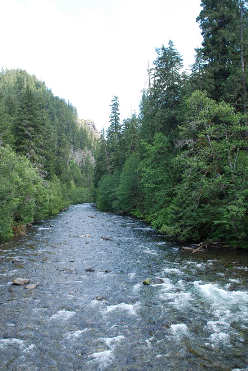
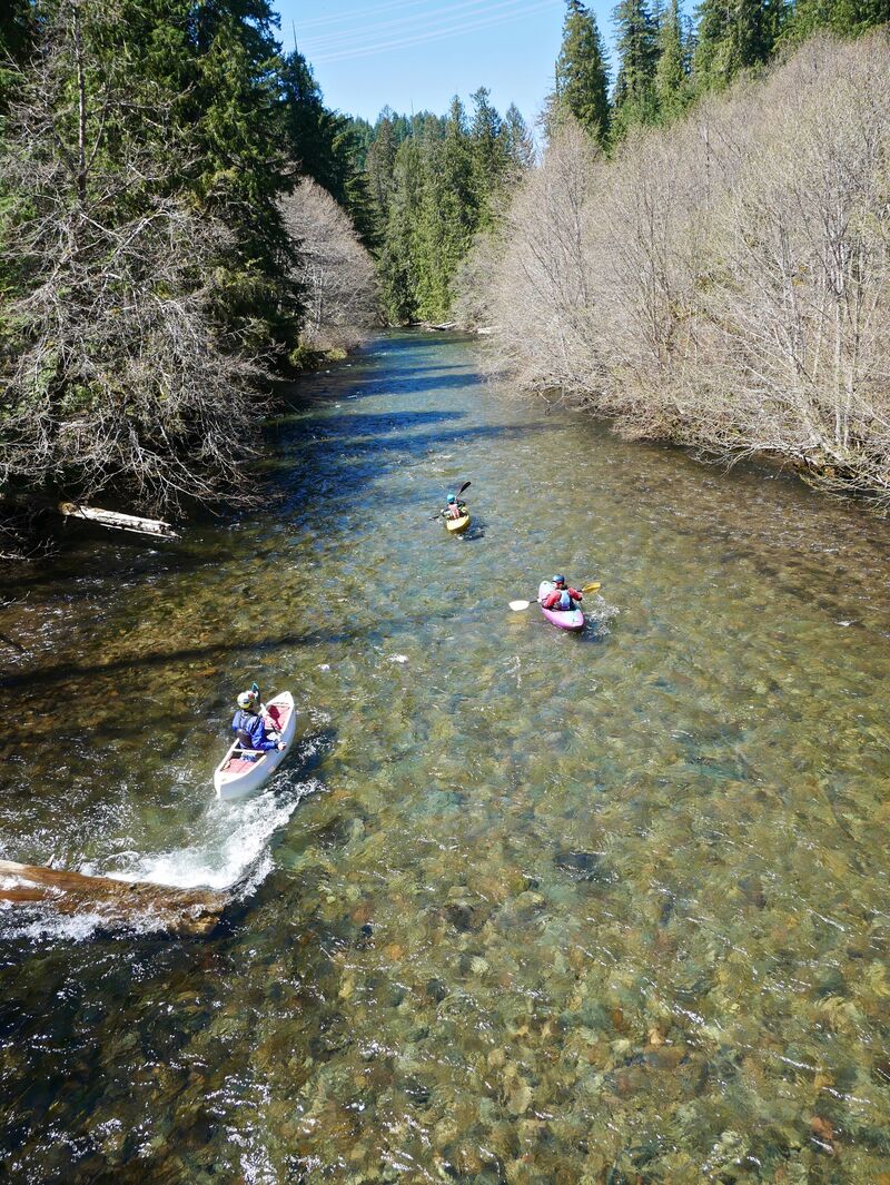
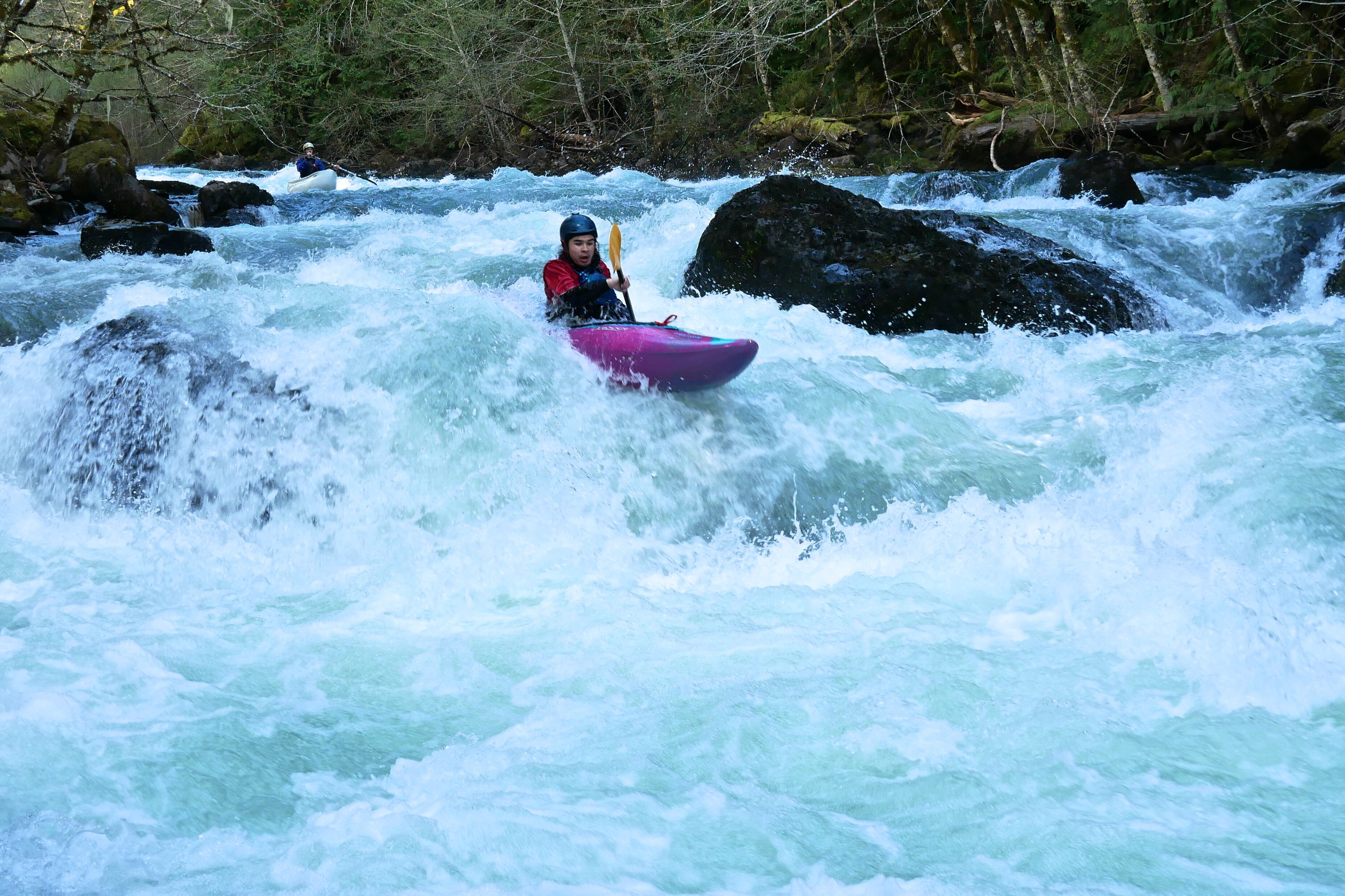
The June Creek section of the Clackamas contains nearly continuous intermediate rapids, beautiful scenery, clear water and a pleasant riverside hot springs. This is a great run for boaters looking to make the transition from rivers to creeks because it is roadside; if you get fed up with the rockfest it's easy to climb out.
From the June Creek Bridge the action picks up quickly with two or three stand-out drops. There is usually wood on the right at the first sharp right turn which can complicate things at lower water. One of the steeper and more technical drops, 'Wall Shot Rapid', is about 3.1 miles into the run and is scoutable from the road. It is has sharp bend to the left along a wall with a couple boulder entrances along the river right at normal flows.
Shortly after Wall Shot be on the lookout for another steep drop through a mid-stream hole where the river narrows. A second short gorge is further downstream. Both are worth scouting from the road on the drive upstream.
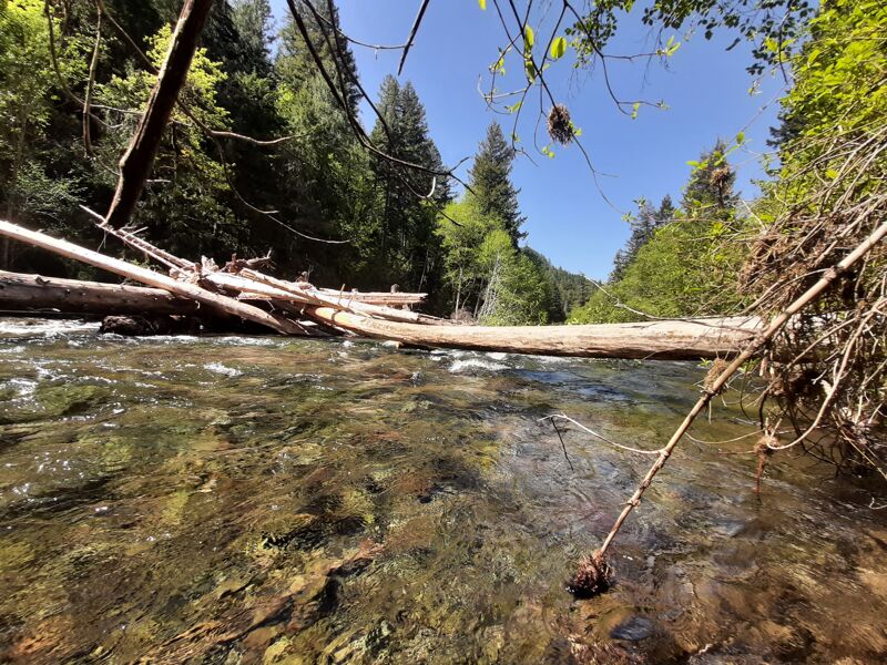
During the pandemic and after the USFS installed fish habitat log jams in the area upstream and downstream of Monolith, and as of May 2026 at least one of them had collected channel-spanning wood. More wood accumulation is expected in this area.
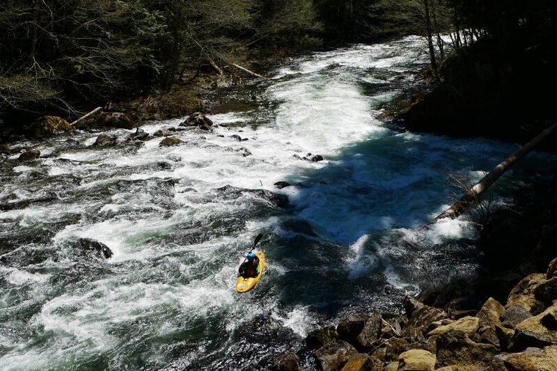
The most difficult rapid, Monolith (IV), lies about a half mile below the hot springs and is also scoutable from the road at milepost 6. Be sure to scout both the lead-in and run-out for wood as it tends to collect here. Once through Monolith the rapids diminish in difficulty and spread out. When you see the beautiful, tall cliff wall rising up on your right you are right above the last big rapid, Boulder Garden (IV). Boulder is roughly a quarter mile long series of holes, boulders, and waves depending on the flow with multiple line options. The take-out is shortly after this, just above the Collawash confluence and the NF-63 bridge on river left or take-out just below the rapid after Boulder Garden on the right.
For a h
...Latlong for where we actually launched on 5/3/26: Lat 45.017295 Lon -121.921806
This location is nice because it gives you 1/4 mile of easy water to get your boat under you before it gets insanely technical.
A steep, often technical drop on a sharp left turn. Often has wood in the preferred line and more challenging at lower water. Also known as Corner Pocket.
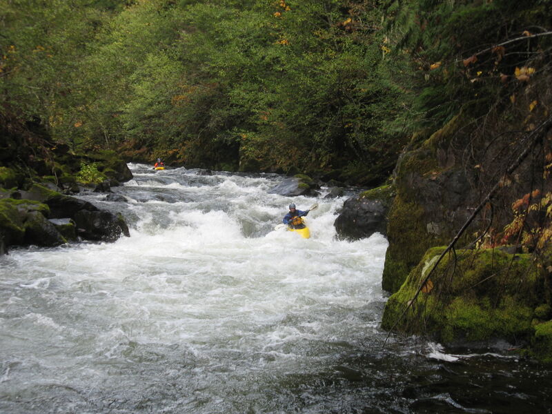
A fun rapid where the river narrows into a small gorge. Scout from the road for wood and line choice. Also known as Hat Grabber, this rapid gets intense at medium-high water.
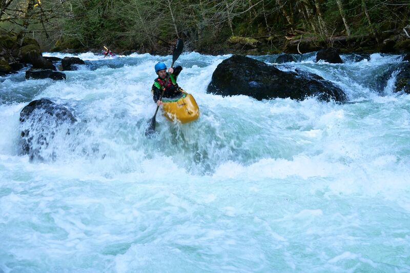
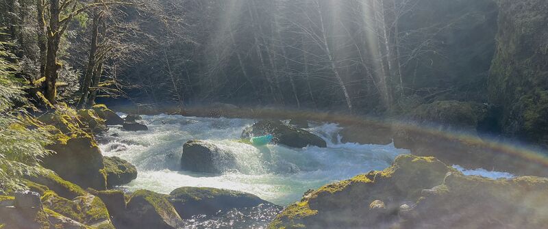
A 50 yard lead-in through waves and holes leads to the largest drop on the run. There are multiple lines, but is generally run just right of the center rock and then left of the next rock/hole. This ledge is often called the Typewriter hole because if you punch it in the middle it will typewriter you to the left before it sets you free.
This is a good take-out, particarly at lower water or when there is wood between here and the confluence. There are two small eddies directly below the rapid and a trail up to the road.
There is an old road on the left upstream of the bridge that leads up to the road. Generally this is easier than taking out directly at the confluence.
May 3, 2026
This run was remodeled by the December 2025 floods and some rapids, like Monolith, are significantly different. That said it was still fun in hardshells & packrafts with a 3 lynx gauge reading of 1300 CFS, which translates to less than a third of that where we were paddling. There was one place just upstream from the hotsprings where two logs blocked the entire wet channel and it would have been an easy portage on the left but we ducked the logs on the left edge of the channel and made it. We also portaged Monolith, it still had the large log on the right (out of play at this low flow) and another piece of wood between the two large rocks in the middle. It did have a line--start right move left and punch hole.
Jun 3, 2025