Crooked
1. Lone Pine Bridge to Crooked River Ranch

| Difficulty | IV(V) |
| Length | 17.2 mi |
| Avg Gradient | 40 fpm |
| Gauge | Crooked Riv at Smith Rock St. Park Nr Terrebonne, or |
| Flow Rate as of 7 hours | 67 cfsbelow recommended |
| Reach Info Last Updated | April 30, 2023 |
The National Conservation Lands—a 26-million-acre collection of national monuments, wilderness areas, wild and scenic rivers, trails, and historic sites—are managed by the Bureau of Land Management (BLM) to conserve some of the most treasured landscapes in the American West. Established administratively by the BLM in 2000 and made permanent [...]Read More
Central Oregon’s Wild and Scenic Crooked River flows through stunning basalt canyons in Central Oregon’s high desert. The region attracts outdoor lovers from around the state and the region, and provides one of the most challenging and outstanding whitewater runs in the West. The Crooked, which is a major [...]Read More
Season: March or April in years when sufficient release from Ochoco and Prineville Reservoirs occurs. In years of low snowpack there may be no release.
Description:
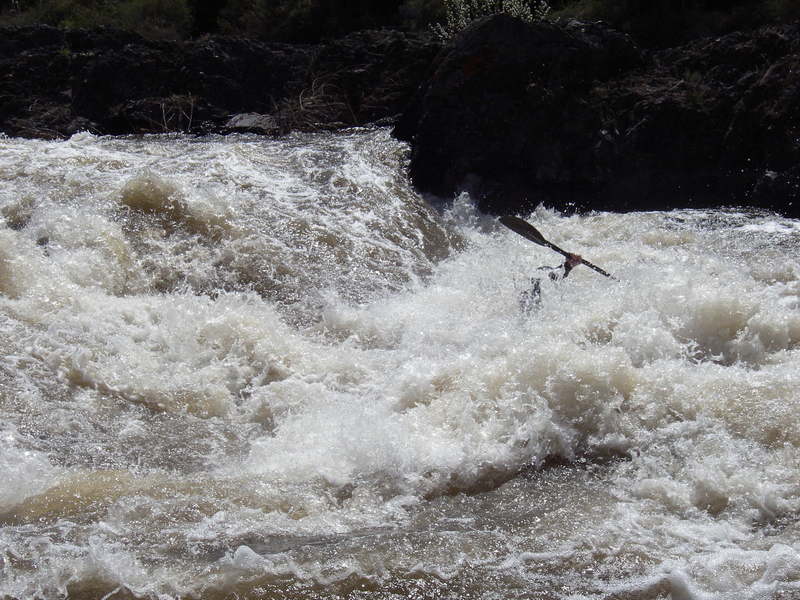
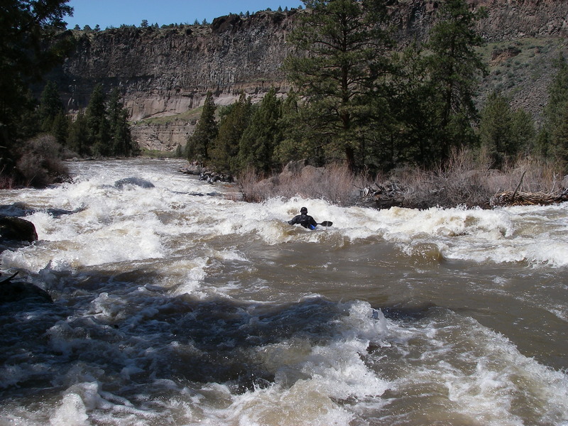
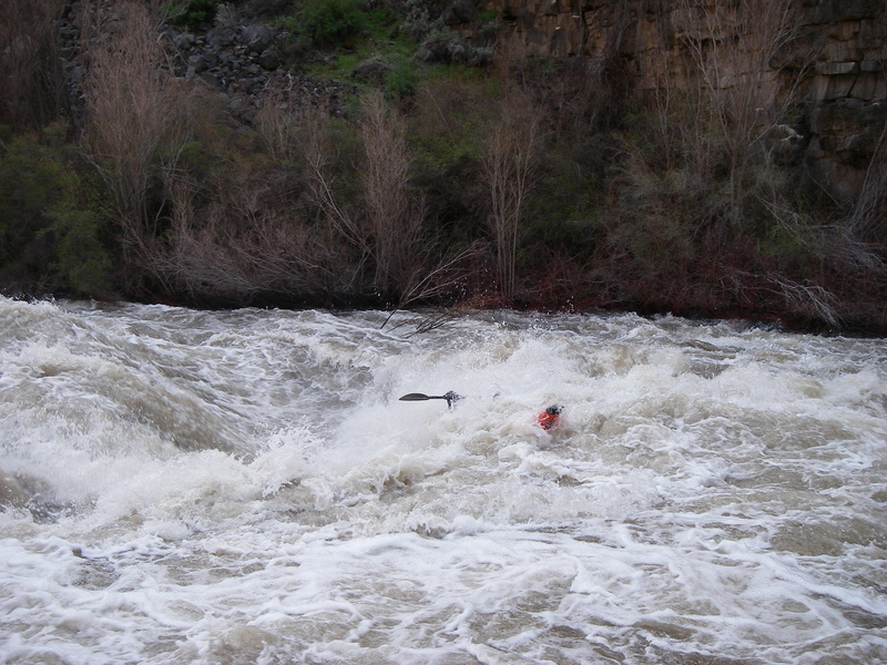
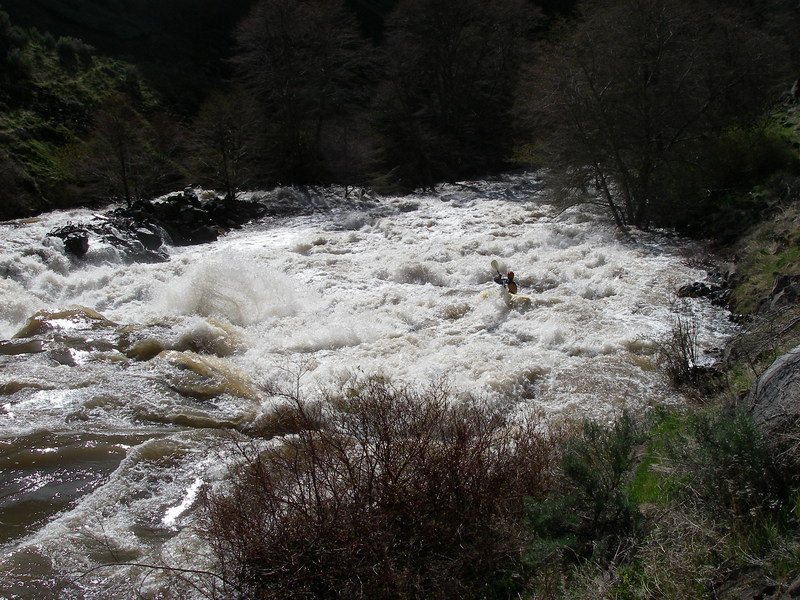
The Crooked is one of the West's finest whitewater runs and would easily be one of the most popular expert runs in the country if not for the fact that adequate flows appear with short notice and quickly disappear. When the river is in, it's time to drop plans for everything else and make your way to central Oregon. During these rare opportunities, it's not uncommon to see the river attracting folks from the tri-state area of Washington, Oregon, and Idaho. The river includes several sections of continuous and demanding whitewater and half a dozen signature drops that present an extra challenge. Many, but not all, of the drops have good recovery sections that allow some opportunity to enjoy the spectacular scenery.
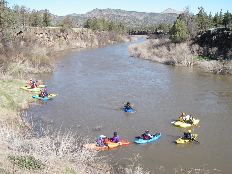
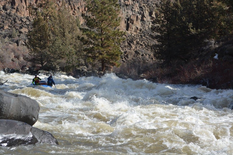
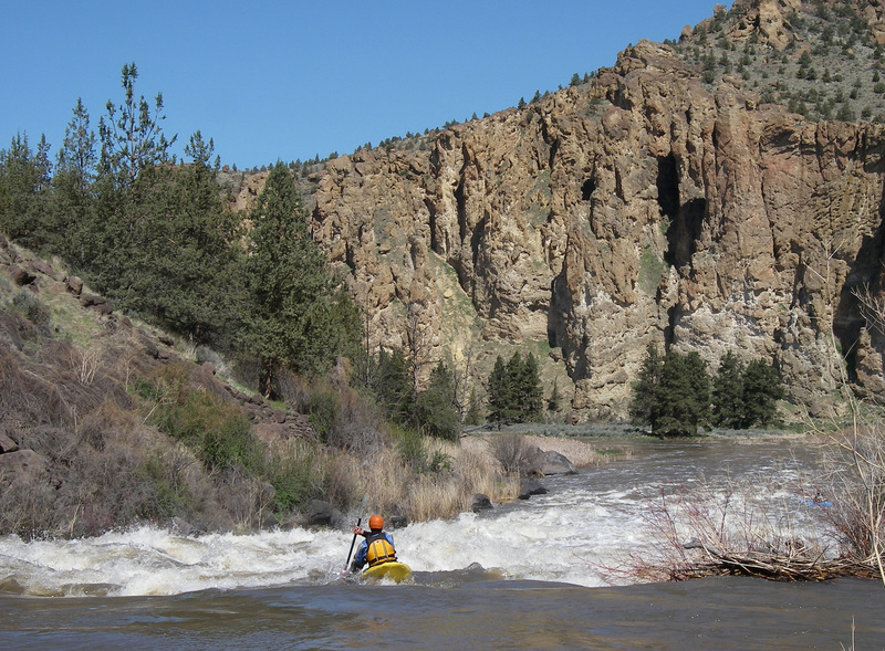
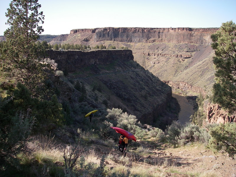
The river starts out with 2.5 miles of flatwater from the put-in at Lone Pine Bridge. This provides a good warm up and opportunities to view wildlife that live along the river. As the river approaches the North Unit Main aqueduct, which arches overhead carrying water from the Deschutes, the action begins with a bang: you can hear the roar of the rapids below as you approach. For the next 1.5 mile the river explodes with continuous class III/IV whitewater which builds to IV+ at higher flows. Although rapids on this section are not as challenging as the most difficult drops on the run, it will give you a good idea of what to expect. The river settles back to flatwater as you enter Smith Rock State Park. You will have an incredible view of the rock towers that rise up from the valley floor attracting hundreds of climbers to the thousands of established routes. This is also your last convenient exit before committing to the remainder of the run and if you are having trouble at the start, be warned that more challenging rapids await downstream.<
...
The start of the fun on the Crooked with one of the longest rapids on the run. Hang on for the ride down to Smith Rocks. Located at USGS River Mile 27.6.
The first big rapid after you pass through Smith Rocks. Located at USGS River Mile 22.4.
Run either a left or right line depending on flows and your preference. USGS River Mile 20.6.
Big intimidating rapid that is not as hard as it looks and is a fun ride. Located at USGS River Mile 19.5.
The crux move is to avoid the hole in the center. Scouting from the right is advisable. Located at River Mile 14.8.
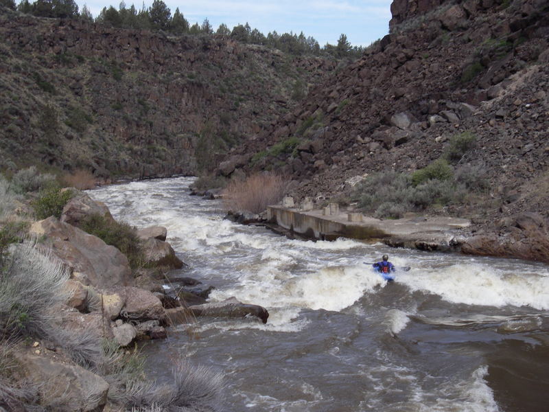
A historic rock dam that forms a challenging rapid. Located at USGS River Mile 12.9.
Take-out is on river left after running China Dam. Hike up the old road grade to the canyon rim. It's a bit of a trek.