| Difficulty | III-IV |
| Length | 7.3 mi |
| Avg Gradient | n/a |
| Gauge | Fall Creek Blw Winberry Creek, Near Fall Creek, or |
| Flow Rate as of 24 minutes | 238 cfsbelow recommended |
| Reach Info Last Updated | October 27, 2018 |
River Description
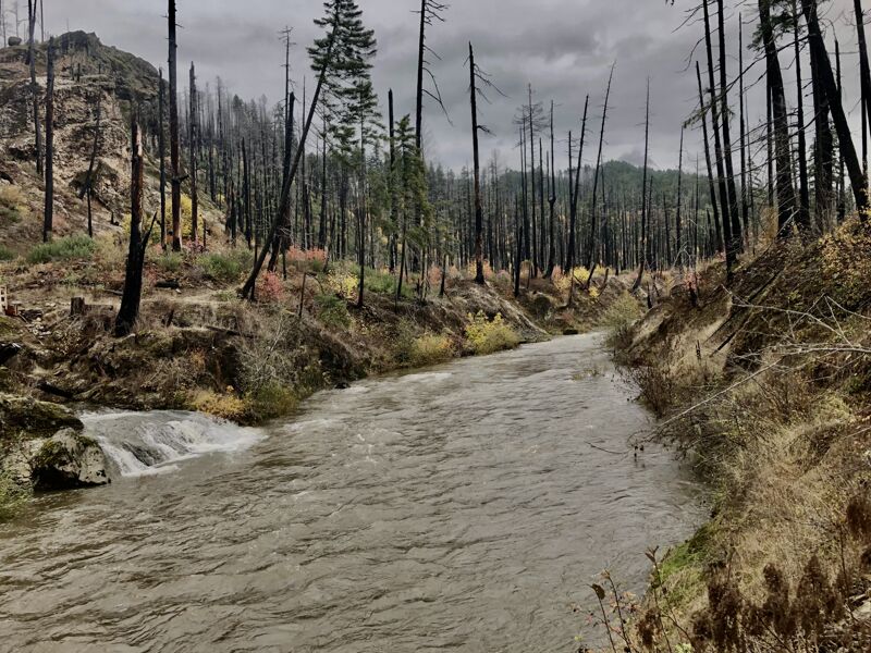
This is above the Fall Creek Reservoir.
Each fall the USACE draws down the reservoir to aid out-migrating Pacific Lamprey amocetes November to December. The I-II stretch below the reservoir gets a bump, but it has no impact on the inflow upstream of the reservoir which this listing describes.
To determine the water in this run, you must look at the INFLOW to the Fall Creek Reservoir, available on the USACE website here: http://www.nwd-wc.usace.army.mil/dd/common/projects/www/fal.html
When it's raining, there is a correlation between the outflow below the reservoir and the inflow above it, so the linked gauge here can be useful. But it's not a 1:1 and the inflow to the lake should be checked to be sure before making the drive.
-Clinton 10/26/2018
River Features
Put In
Access PointDistance: 0 mi
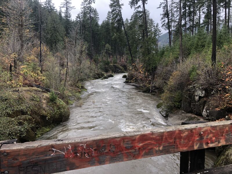
The put in is at the bridge just downstream of Bedrock day use site. There are multiple options to put in, but most opt for the 8-10ft seal launch off the rocks just across the bridge, on river right, and just downstream of the bridge. The next mile or so is more or less gorged in bedrock until the river leaves the old burn area and enters the forest.
8mile - Bonus Drop
RapidClass: IVDistance: 0 mi
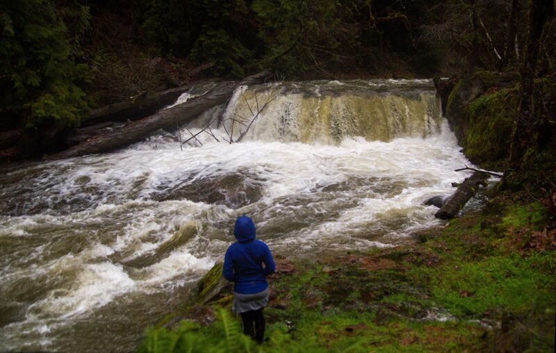
Roughly 8 miles upstream of the Put-in at Bedrock Campground, there is a roadside drop about 8-10 feet in height. It requires the run below to be on the high end to be in, but offers a clean lip, a sloping bedrock landing and a moving pool run-out. It is very lapable and has a fire ring. Look for it on the left hand side of the road about 8 miles up from Bedrock. As of 11/5/2022 access is restricted due to the Gale fire cleanup from 2021. The road is closed about 5 miles up from bedrock and there is a lot of activity from forest workers. It is unclear if the falls and surrounding forest was impacted by the fire, but it's likely. Photo is from 2019 at a runnable flow.
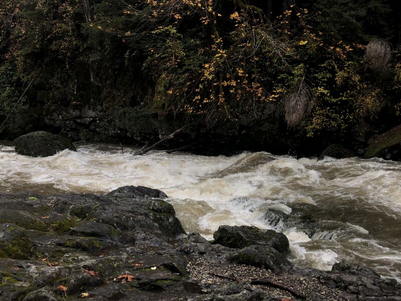
Ledge Hole
RapidClass: IVDistance: 0.25 mi
Not far below the put in the river constricts and presents paddlers with a small but powerful ledge hole at high flows. Stickier on the right. Below this drop there is a long recovery pool, but it is fairly gorged in so collecting gear from a swimmer might be challenging.
Log Jam / Portage
PortageDistance: 1.6 mi
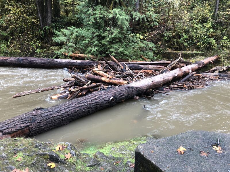
Logjam visible from the road 11/5/2022. Scout ahead of time and make a plan. A small class II rapid leads right into the jam. Easy walk on the right. Location in the map is approximate.
Fish Ramp Rapid
RapidClass: IVDistance: 5.34 mi
Fish Ramp is the Crux of the run and is class IV at medium levels and up. It is a rather unique rapid and appropraitely named, as a concrete boat ramp enters from the left immediately at the bottom of the rapid. I am told it is, or was, used in fish collection and relocation efforts around the Fall Creek reservoir. It's mostly a long low angle rock slide with a hole in the middle, and an intimidating looking pilow on the right that becomes an explosed rock with water splashing up on it at lower flows. The line is mostly down the middle, avoiding the rocks on the left and right at the bottom. At the time of this writing, there is some wood on the right behind the big boulder at the bottom as well. A long recovery pool follows this rapid. This is also a convenient takeout location. Below this rapid the run is mostly class II with ample flat water until you get to the takeout rapids at the reservoir.
Take Out
Access PointClass: IIIDistance: 8 mi
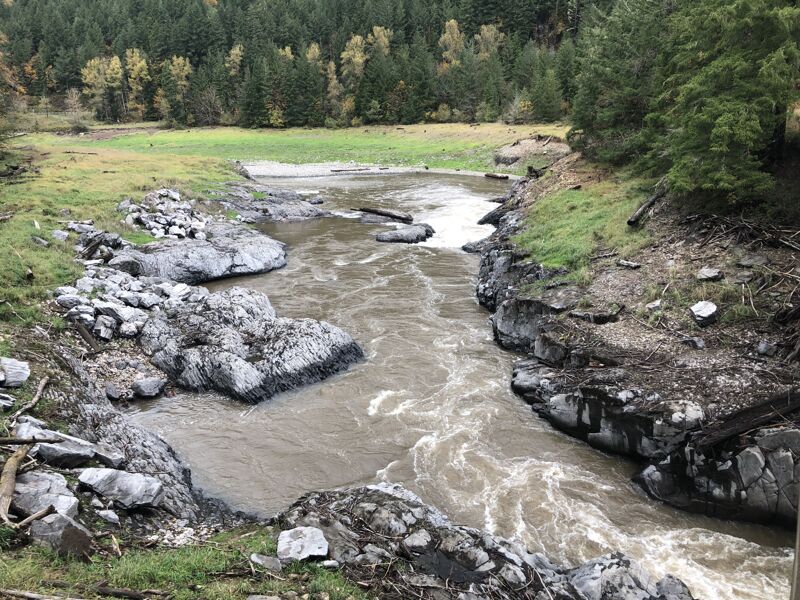
There are two takeouts most paddlers use. This one is the furthest downstream and is where the river meets the reservoir. There are two rapids here that are optional. One is leading into and directly under the bridge, and the other is a bit downstream. You can scout both on the way up.
Trip Reports
Log in to add a reportCB
3000+ CFS scouting - Clinton Begley
Nov 5, 2022
Everything was high today so we tried to go check out the waterfall about 8 miles up from bedrock campground but were turned around by a road closure and workers cleaning up after the 2021 Gale fire. The road is closed about 5 miles above Bedrock campground. The river was running high, just over 3000cfs inflow on the USACE fall creek reservoir gauge.
There was at least one portage, visible from the road, above Fish Ramp a ways, and possibly another below fish ramp. Everything else we saw looked clean.
CB
Park and Huck 8 Miles Above Bedrock - Clinton Begley
Jan 24, 2019
Roughly 8 miles upstream of the Put-in at Bedrock Campground, there is a roadside drop about 8-10 feet in height. It requires the run below to be on the high end to be in, but offers a clean lip, a sloping bedrock landing and a moving pool run-out. It is very lapable and has a fire ring. Look for it on the left hand side of the road about 8 miles up from Bedrock. As of 11/5/2022 access is restricted due to the Gale fire cleanup from 2022. The road is closed about 5 miles up from bedrock and there is a lot of activity from forest workers. It is unclear if the falls and surrounding forest was impacted by the fire, but it's likely.