Hood
1. Dee to Tucker
| Difficulty | III-IV |
| Length | 7 mi |
| Avg Gradient | n/a |
| Gauge | Hood River at Tucker Bridge, Near Hood River, or |
| Flow Rate as of 1 hour | 2.59 ftbelow recommended |
| Reach Info Last Updated | April 1, 2024 |
Hood River Access Project With the completion of the project to remove Powerdale Dam in 2010 and the acquisition of Punchbowl Falls which became a new county park in 2016, American Whitewater continues to work towards improvements to access that will realize the full potential of the recreational opportunities [...]Read More
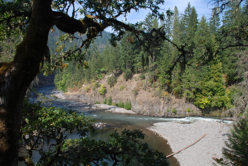
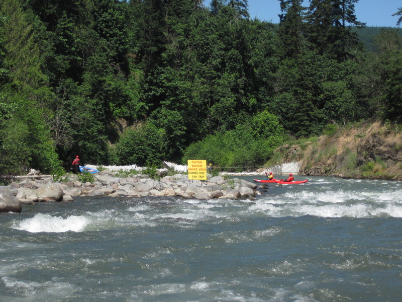
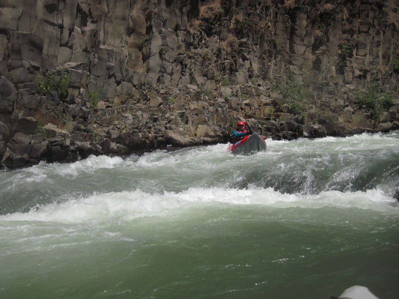
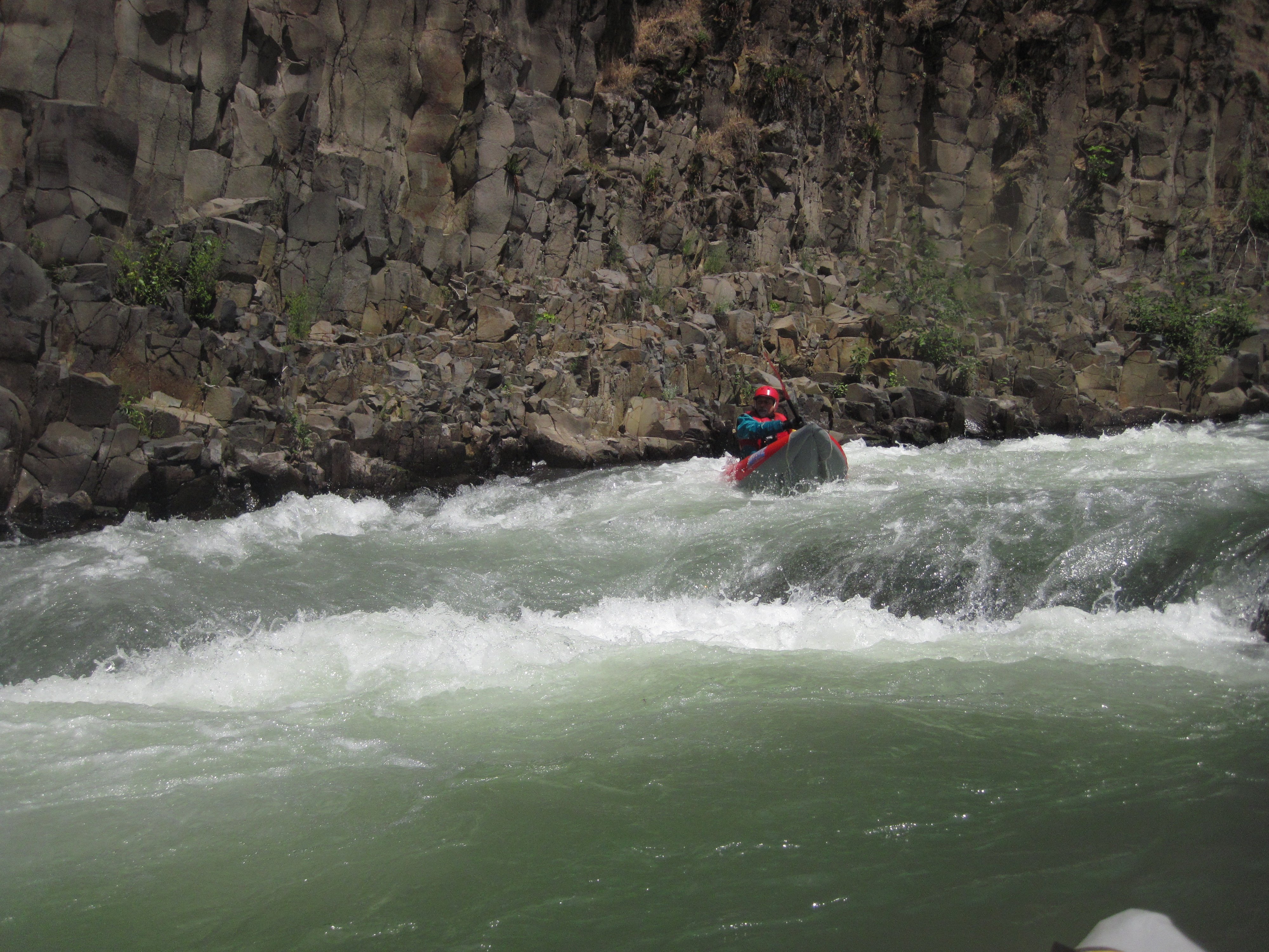
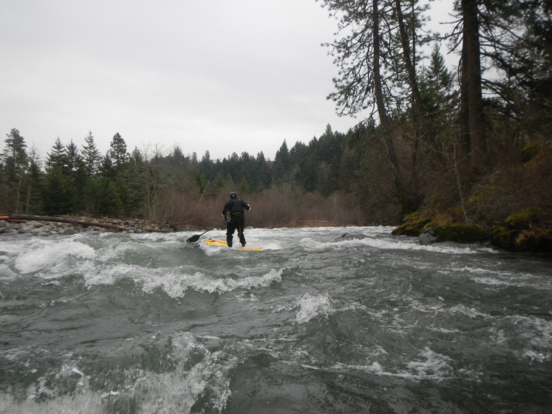
The run is known as one of the best intermediate to advanced whitewater runs in the Columbia Gorge and its no wonder so many paddlers call Hood River home with this river in their back yard. The river corridor, although largely in private ownership, is nearly completely undeveloped as bedrock walls of columnar basalt rise up from the river to the forested canyon rim. While most of the run is class III, it finishes off with some more challenging class IV. Although these final rapids are relatively straightforward class IV at moderate flows and a good place to learn to boat more advanced whitewater, things crank up a notch as flows rise. Stories of epic high water runs at flood stage circulate among the Hood River boating community.
The section of the Hood known as Dee to Tucker typically starts out with a fun mile of whitewater on the East Fork Hood that ends with Confluence Rapid. An alternative is to put in at the base of Punch Bowl Falls on the West Fork Hood.
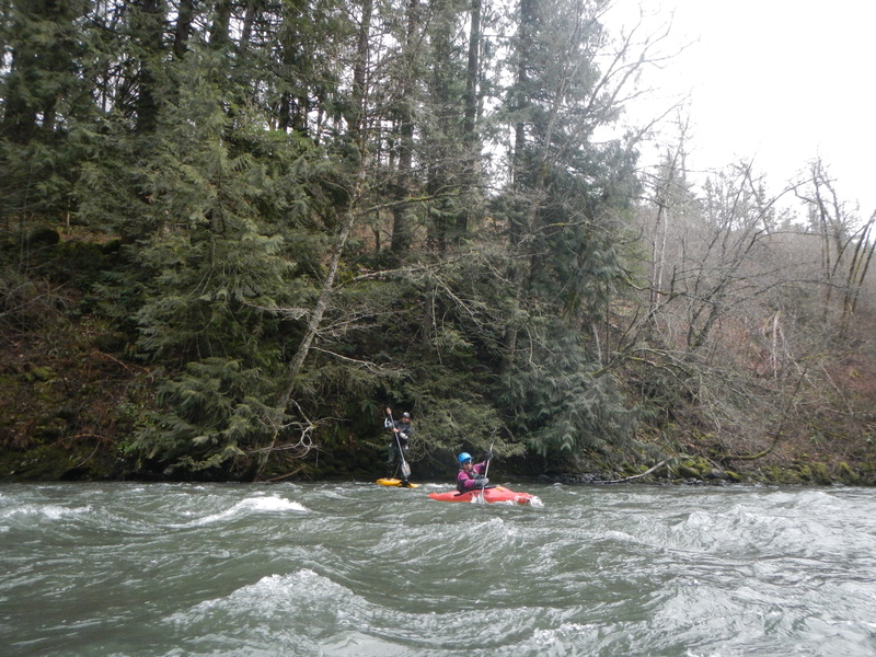
At standard flows, the 5 miles downstream from the confluence of the east and west fork is enjoyable and nearly continuous action with class II whitewater interspersed with a number of fun class III rapids. The scenery and quality of the whitewater are simply spectacular and draw paddlers from across the region. Early in this section and soon after passing the intake for the Farmer's Irrigation Canal, you will come to Aquaduct Rapid (aka Pipeline). The upper drop takes you down the left against a bedrock wall and the lower drop includes the best surf spot on the run.
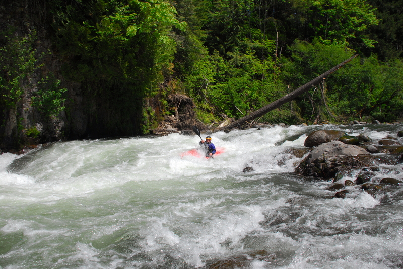
As you near the end of the run, you will come to a green truss bridge that carries a waterline across the river. This marks the start of the class IV rapids and the first one, Island Rapids, is a long one down the river right channel. Immediately below this drop the river slams into Wallbanger, a head wall rapid on river left. A few more fun class IV rapids continue as you pass Tucker County Park on river right and eventuall
...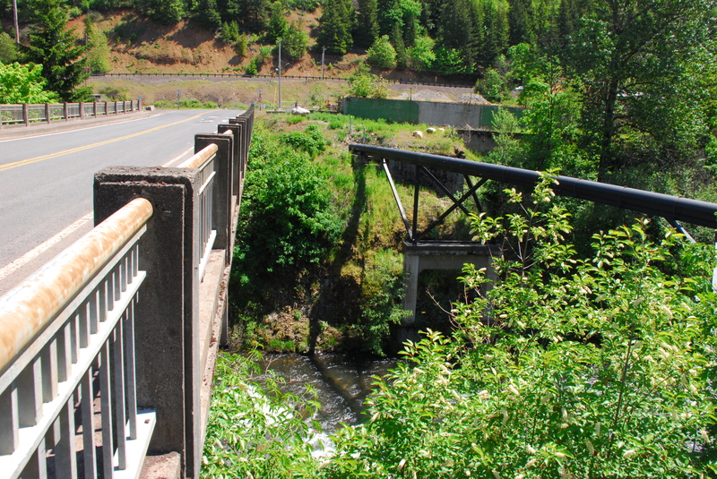
The banks are extremely steep within the bridge right of way. Paddlers have historically access the river downstream of the bridge on river left but that is private land.
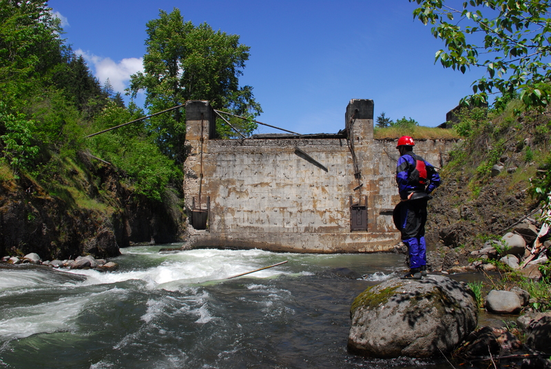
Remnants of an old dam that has hazardous debris and a tendency to collect wood at river mile 13.7. For this reason most prefer putting in downstream.
An alternative access from the end of Iowa Street at river mile 12.4 that avoids private property issues at Dee but has limited parking.
A fun drop at the confluence of the east and west forks of the Hood River at river mile 12.2.
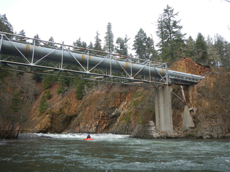
The upper half of the rapid flows down river left. After passing under the aqueduct at river mile 10.8, you will enter the lower half which has a sweet surfing wave with decent eddy service.
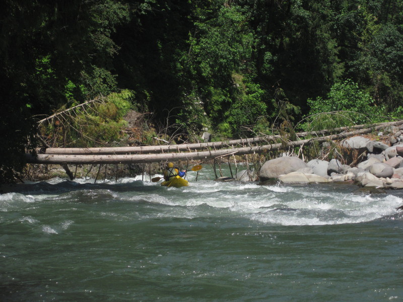
The start of the class IV rapids at river mile 7.4 that continue on down to Tucker Bridge. The first one is the longest.
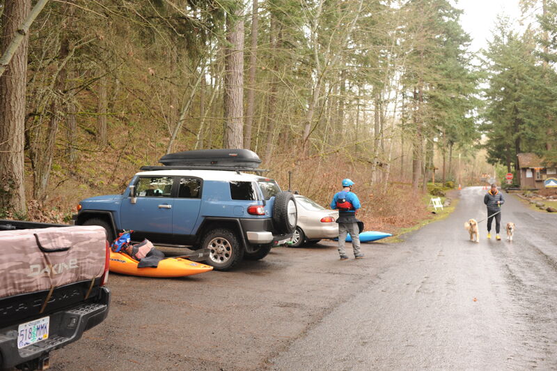
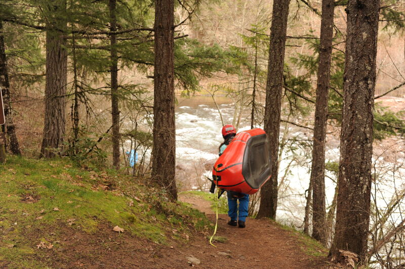
Access is on river right in Tucker County Park. For many years parking for the day-use area was gated off making this access unusable during the winter boating season but in 2023 park staff agreed to keep the outer gate open allowing paddlers to access the parking area and river access trail for day use. An alternate access is available at the Tucker Bridge just downstream where you can climb up a steep trail within the bridge right-of-way on river right, but parking is extremely limited. This is an option when the park is closed.
Mar 10, 2024
Access photos for the take-out from a trip that used Tucker Park as the put-in.
May 21, 2017
We put in at the Highway 281 Bridge and continued on down to Tucker. The first part of the run was narrow and brusy but boatable. The old dam site required a portage as we encountered considerable debris in the river upstream of the remants of the dam.
Sep 28, 2012
East Fork Hood in the vicinity of Dee