Hood, West Fork
3. Lake Branch to Punchbowl Falls(West Fork Hood)
| Difficulty | III-IV+ |
| Length | 5.7 mi |
| Avg Gradient | 82 fpm |
| Permit | No Permit |
| Gauge | West Fork Hood River Near Dee |
| Flow Rate as of 42 minutes | 156 cfsbelow recommended |
| Reach Info Last Updated | May 26, 2025 |
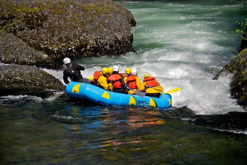
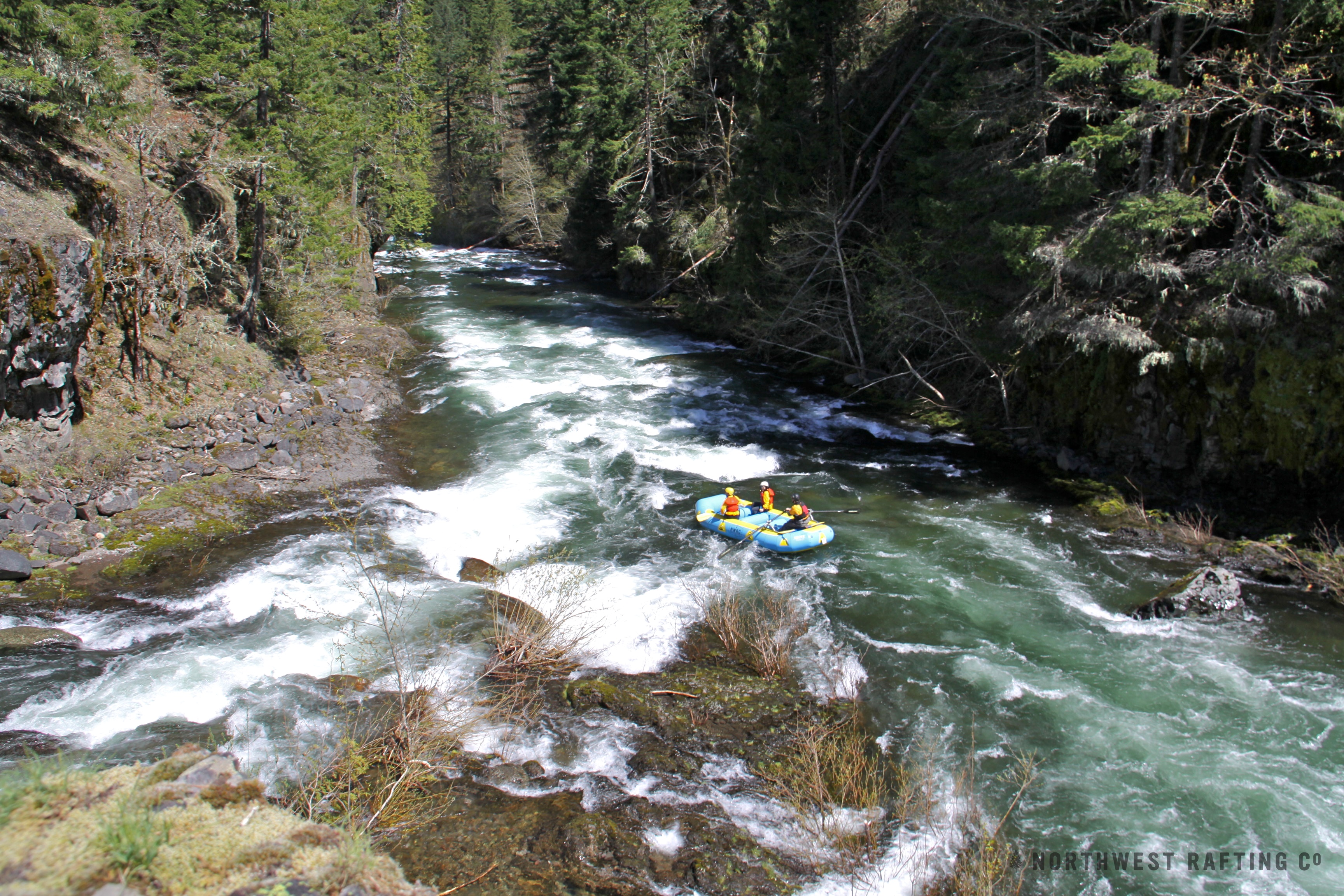
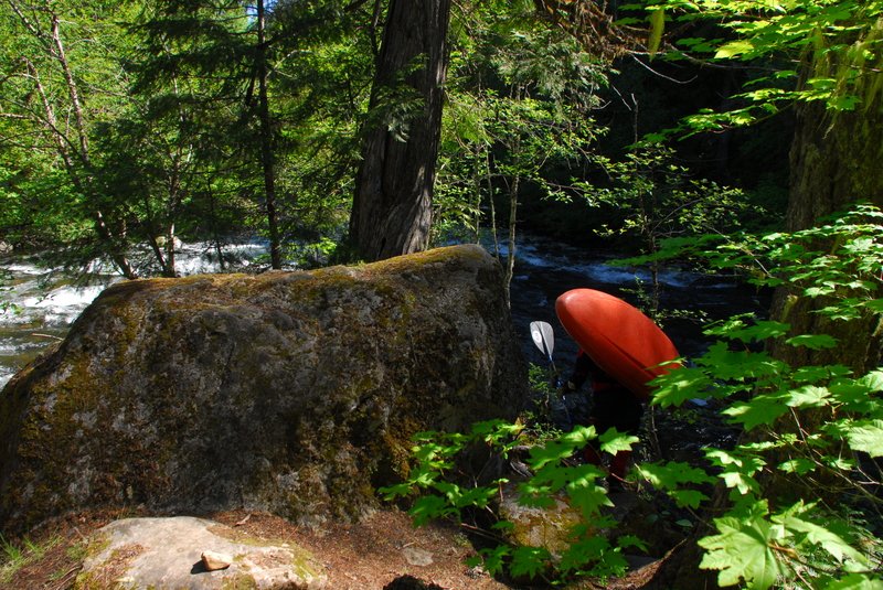
The West Fork Hood is the best Class IV run in the Columbia Gorge. It's known for its fun Class IV rapids that build up in intensity. Most of the rapids occur in 2 basalt gorges that are spectacularly beautiful to journey through.
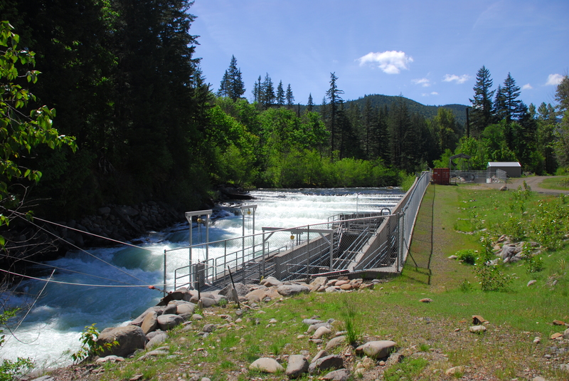
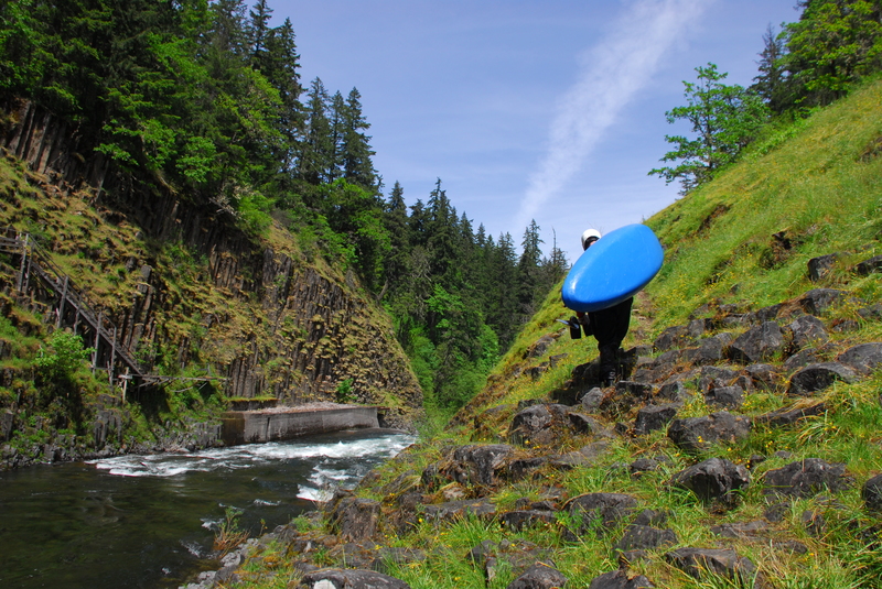
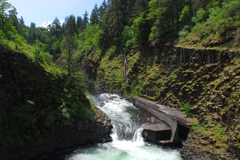
Launch at the confluence of the West Fork and the Lake Branch of the Hood River. About a mile downstream is the first basalt gorge with a number of classic rapids. Shortly below the gorge boaters pass under a road bridge which can serve as an alternative putin if the road has too much snow. Below this bridge the rapids are more spread out with more gravel bars and boulders than upstream. 2 miles below the bridge be on the lookout for the mandatory portage around a large fish ladder. Several hundred yards above the fish ladder you should see the water intake for the sorting facility. Takeout in the small eddy on the left and walk downstream to a short climb back down to the river directly below the last tier of the fish ladder.
Below the fish ladder, the rapids pick up in intensity. The most difficult rapid on the West Fork is about a half-mile below the fish ladder and is a long, complex rapid that goes around a right bend and enters a long, complex bouder garden culminating in a couple large features at the bottom. You can scout most of this rapid from the right. Rapids come in quick succession after that, but have short pauses in between them. The last rapid goes underneath the high bridge directly above the takeout. This rapid is best scouted from the bridge before you head up to launch, though as you probably already know, you can't tell how steep it is from overhead.
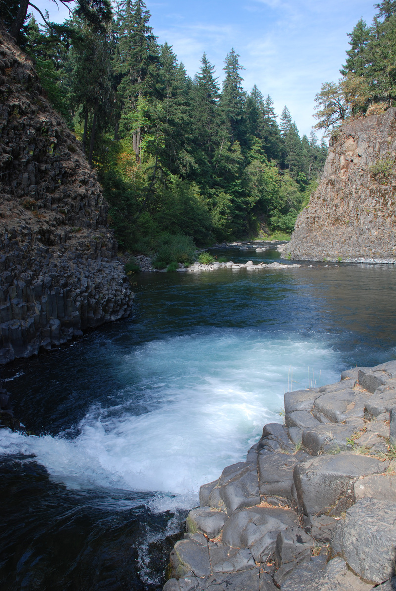
Eddy right below the high bridge rapid, then find the second right eddy where the takeout trail leaves the water. This take out is above Punchbowl Falls. The 'goat path' climbs up and left, ascending the bluff above the falls, from which you can view the 10-foot drop into a gnarly hole. It is runnable, but the hole is deep and a swim here would be
...
Launch at the confluence of the West Fork and the Lake Branch of the Hood River.
Eddy right below the high bridge rapid, then find the second right eddy where the takeout trail leaves the water. This take out is above Punchbowl Falls. The 'goat path' climbs up and left, ascending the bluff above the falls. Parking is available along Punchbowl Road. American Whitewater worked to secure public access to this site when the private land at the confluence of the West and East Fork of the Hood River was for sale. Western Rivers Conservancy was able to acquire the parcel and Thrive Hood River lead an effort to establish it as a Punchbowl Falls County Park.
Waterfall at the end of the run below the standard take-out. It has been run by those with the approrpriate skills, good safety set, and the ideal flow conditions.
Dec 24, 2020
We did this run today 12/23/2020 at 2,000cfs and falling at Tucker (5.8 feet and falling), which matched up with 1200cfs and falling at Dee (http://levels.wkcc.org/?f=2v3). This was a nice flow but after chatting with the rest of the gang we concurred that we normally have run this section a good bit higher, and that the flow parameters presented on this website do not agree with local community usage. We have run it a LOT when it would fall in the 'too high' range on this page. We have also run it a fair bit on rising water, not falling. At today's flow it was bouncy and intense in places with a few bad holes but mostly read and run. This run is GREAT when the Tucker gauge is at 7 feet (and falling), not too high. Because the run is well upstream from the Tucker gauge, 7 feet and rising is a flow to be wary of. At 9-10 feet it reaches next-level bigness meriting a class V rating but for a strong class V boater it is a fun romp, not scary. It is a gorged in, continuous, big-water style run and requires that paddlers have a solid roll. Swimmers will have a hard time getting out, and will probably lose their boats.
Jun 27, 2020
6/24/2020 We did this run at 3.7' on the Tucker gauge and 300 cfs on WF gauge. In the past, we have run this as far down as 3.5'/250 cfs and it still goes. Near and below 4', it's more of a 'creeky' run and very enjoyable for paddlers with the right mindset. On a nice day in late Spring and early Summer, it's a great alternative to yet another Middle White Salmon run. The first 2 miles to the fish-ladder can be a little tedious at very low flows, but the rest of the run is still very entertaining and everyone who Jacob and I have taken down at these levels has been pleasantly surprised and is always anxious to return. If you can scrape down the first small rapid at the lower put-in you'll be fine. I would only recommend the Lake Branch put-in with 400 cfs or more and the uppermost put-in at Lolo Pass at 500.