John Day
2. Service Creek to Clarno(Upper John Day)

| Difficulty | II |
| Length | 47.8 mi |
| Avg Gradient | 8 fpm |
| Permit | Online permit required from Recreation.gov year-round as reservations distributed on a rolling four month basis. |
| Gauge | John Day River at Service Creek, or |
| Flow Rate as of 54 minutes | 70 cfsbelow recommended |
| Reach Info Last Updated | January 13, 2026 |
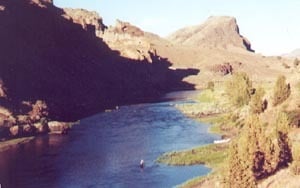
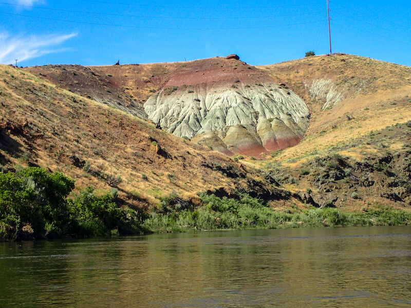
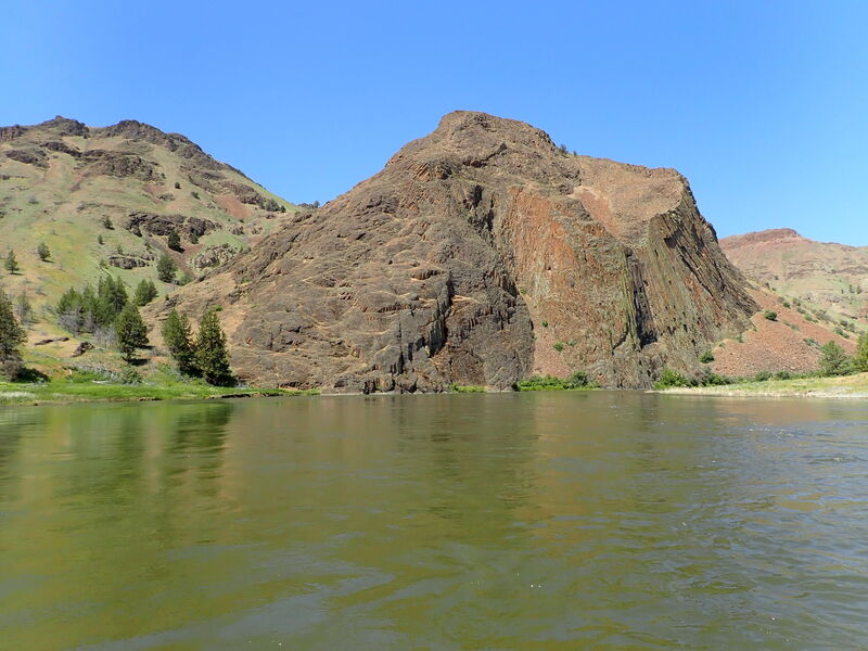
The full run is a multiday trip through cattle country and farmland, but there are also isolated stretches through a scenic, high-desert canyon. The highlights are three class II rapids (described below) and some excellent Eastern Oregon desert scenery, which includes the same colorful geologic formations that make up the nearby Painted Hills of the John Day Fossil Beds National Monument. Don't under estimate the rapids! The cost of a mistake on this remote river can be great.
Season: There are no dams on the river (but there are diversions for irrigation); flow is mostly dependent on snowmelt in the Blue and, to a lesser extent, Ochoco Mountains. The runoff generally peaks in April and May. Flow can drop to less than 1,000 cfs by July. It should be noted that bass fishers flock to the river in May and into June.
Regs/Permits/Etc.: The BLM requires an online permit year round, a river toilet for overnight trips, and a fire pan for having fires outside the annual fire ban season. Visit Recreation.gov for day use permits and overnight permits. For further information visit the John Day BLM website.
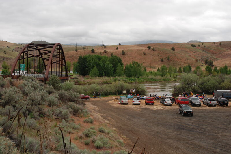
Directions to the Putin: If approaching from the north, take Oregon Highway 19 to Fossil. Continue south 19 miles and turn right (just past the Service Creek Trading Post) onto Oregon Highway 207. Continue 0.3 of a mile to the launch at the Donnelly Service Creek River Access Park. If approaching from the west, from Mitchell drive north on Oregon Highway 207 for 25 miles. The launch is just beyond the bridge over the John Day.
Directions to the Takeout: From Fossil, drive west on Oregon Highway 218 for 19 miles. The Clarno take-out is on
...Access on river right upstream of the Highway 207 Bridge. Toilet and camping available.
Private land with easement for boat access and boater parking only. The site is located on river left just upstream of a bridge. A toilet is provided but no camping is available.
Primitive campground with river access. A toilet is also available here.
Access point 3/4 mile downstream of Burnt Ranch Rapids on river left. Primitive camping and a toilet are available at this site.
Access on river right on the downstream side of the Highway 208 Bridge. No camping is available at this site.
Jan 1, 1900
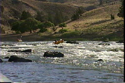
Burnt Ranch Rapid at low water.