Big Creek
The Middle Gorge Section
| Difficulty | V |
| Length | 2 mi |
| Avg Gradient | n/a |
| Gauge | Nf Willow C Nr Sugar Pine Ca |
| Flow Rate as of 6117 days | 416 cfsstale data |
| Reach Info Last Updated | January 19, 2010 |
The Overview of Big Creek:
Big Creek is just west of Wawona in Yosemite National Park and runs into the South Fork of the Merced just upstream of the Wawona Campground. The Middle Gorge has 5 waterfalls worth paddling and is only about 150 yards long. A common procedure is to run the falls in the gorge several times, then carry back up to your car. The first descent party reported that continuing down the creek to the SF Merced was not worth doing and most subsequent parties took their word for it. Recently, Chris Tulley reported that the rest of the creek down to the South Merced is excellent which prompted explanations from members of the first descent party.
Late April or Early May is the likely season. When the SF Merced is high, this creek is worth a look.
Getting There: Take Highway 41 to Wawona inside Yosemite National Park. Turn onto Chowchilla Mt Road. If you're coming in from the Fresno area (or south), you'll make a left hand turn onto this road that runs across the golf course. This road is not very wide and at first glance looks like its for golf carts only. But quickly widens and turns into a dirt road that crosses Big Creek in about two miles. GPS Coordinates at Google Maps.
Many people will drive or hike in and just run the Middle Gorge several times. It's like park and play for creekers. Another option is to put in at Fish Camp and run the 2 miles down to the middle Gorge. As seen here: Big Creek (Chowchilla Mountain Road to S.F. Merced River)
First 400 yards: The best parking spot is just across the small wooden bridge, putting in on river left, just pass t
...Apr 14, 2008
Stellar underrated V run! Consistant gradient of South Silver style granite bedrock interspersed with technical boulder gardens. A group of 5 of us ran this 4/9/06. Here is what we found:
FLOW
We had what we deemed a great boatable flow of ~200 to 250 cfs, for a class V run down to S. Merced. Note: the online guage is way off (it read 17 cfs the day we ran it) while the Merced below Briceburg was @ 3800 and falling due to recent rain. (Chris is refering to a gauge that is no longer listed on this page. It was gauging a diversion from the creek rather than the creek itself. The gauge now linked is on an adjacent creek of similar size. Hopefully flows are fairly similar between the two drainages and the present gauge has better accuracy - PM)
CHARACTER:
Lots (10+) of classic Sierra bedrock drops of 10-20 ft. Some great slides and big boofs. Some sections of technical class V boulder drops that reminded me 'Big Creek' in the Smokies (classic SE squeal like a pig creeking). We did not experience the 'brush' referenced in the streamkeepers description. Lots of horizon lines to keep you on your toes...smile
HAZARDS:
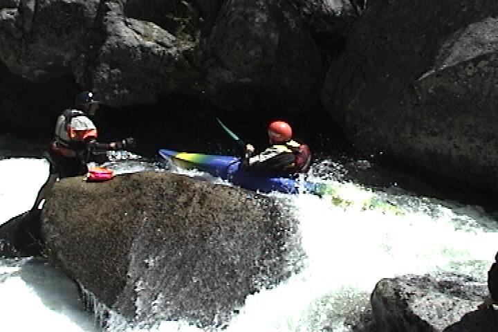
1)At our flow (~200-250cfs) the 4th drop of significance (shown in above description as the 'slide') becomes a nasty river wide hole that should be treated with extreme caution, as it is basically becomes a low head dam. We vertically extracted someone from here and it was not pretty.
Other than this all the rapids were runnable and had clean, albeit sometimes narrow lines. Expect to get out of your boat to scout frequently.
ACCESS:
PI: The gate was locked for us just after crossing the golf course. There is limited but discrete parking here. The hike is ~2 miles.
TO: We parked at a pull off with a restroom ~1 mi downstream of S. Merced bridge near Wawona. Shuttle is super short and could be walked.
TIME: First time runs by mere class V mortals should expect 4 or more hours to scout and run this ~2 mile stretch.
OVERALL RATING: 9 out of 10.
Apr 9, 2006
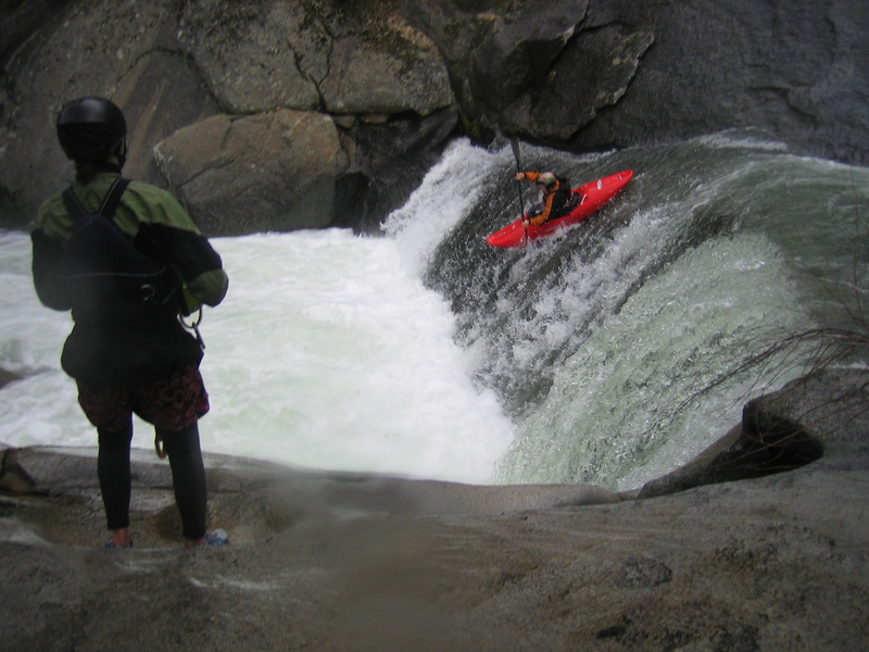
Amanda with a BIG boof
Macy boofing drop #2
This is the dangerous low head dam rapid. A member of the group was vertically extracted from this monster on the far left (note the pot hole). Extreme caution advised. scout and portage high left.
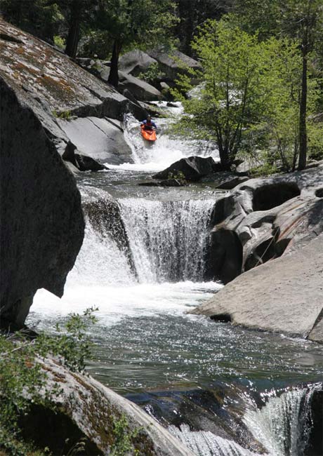
first gorge from downstream. Note the top drop in this picture is the 4th drop referenced as a keeper hole/pourover. The drop immediately following is a sweet one, as is the next drop down stream of the author. Screaming boof on the left.
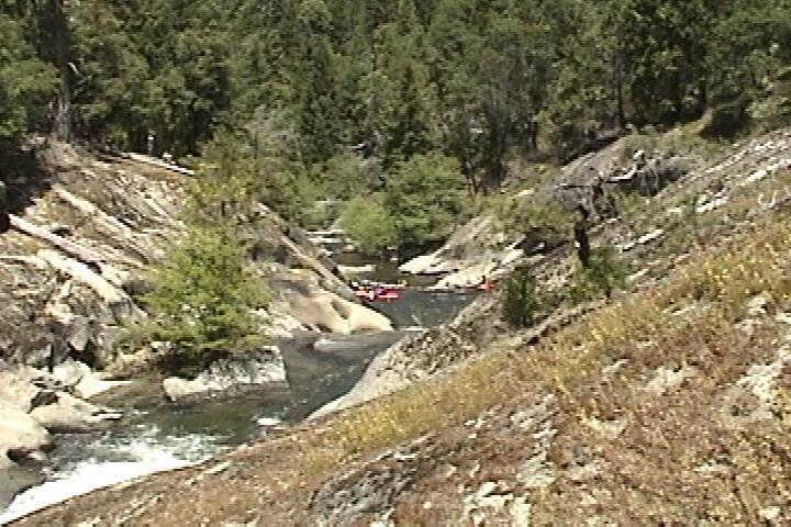
One of the many rapids that became a blur...
Jun 26, 2005
This junky rapid is next up after the first waterfall-seal launch. I was worried about getting hung up, but it was not a problem and help was close if I had trouble.
No one else ran it on this day, but I suspect they will in the future, because the portage is awkward. There is a short but steep slab leading into the next pool with no easy way to launch. To portage you can hold your partners boat at the top so your partner can get in and slide down, but the last person can't hold their own boat and must drop the boat and scramble around or slide and swim.
Rico has just launched from the pothole above, aiming for the deep water at the base of the falls.
Daniel launching from the top while someone helps Brian get ready to launch from the pothole. It is much easier to launch from the top but the aiming is much scarier. It does not seem like a definite straight shot when you are sitting there looking down.
Jun 26, 2005
Looking downstream into the gorge from the right bank.
There is a rock underwater in the pothole hiding behind the rock on the right side of the picture, so we launch into the base of the falls. Some people like to launch from the pothole, because it is lower and is easier to aim. Some people launch from the top and slide down along the river right edge of the pothole.
Jun 15, 2005
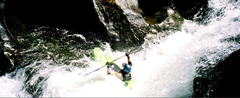
Gavin Gladding beginning the main sequence of falls.
Kat puts her head down and paddles for the lip.
Dan Hogg charges over the falls so he can get it over with and get back to work at the pizza parlor!
Brian and Gavin admire Paul's fashionable color scheme.
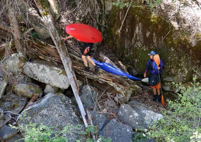
Daniel and Rico begin a steep, awkward but short climb up to nice ledges leading back to the beginning of the gorge. It is a very short gorge, so we typically carry back to run it a few times. This carry is on river left. Carrying on the river right side is much more difficult.
Jun 6, 2005
Clockwise from upper left: Gavin, Paul, Rico, Brian, Kat, Katie, Dan & Daniel.
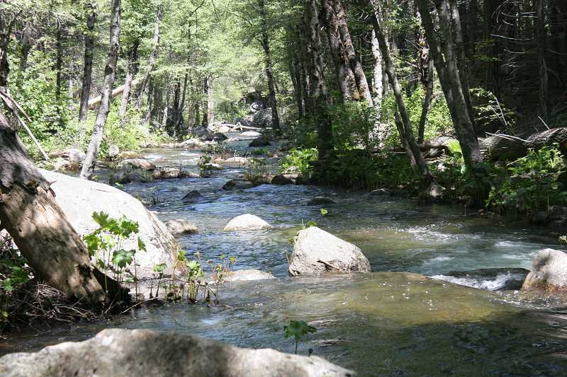
Looking downstream from the put-in at Chowchilla Mt. road. After this first 100 yards or so, the creek enters a small gorge.
Kat leaves the put in pool.
Brian Hogg bashes past a rock near the put-in on a low water trip down Big Creek at Wawona.
One of many flowers along Big Creek at Wawona.
May 2, 2004
Our first run that day!
This fall we 'Seal Lauched' off of from the pot hole on the right hand side of the photo
The Seal Launch, because the drop was shallow and this put you a little to the right of the drop into more water.
Great Fall! Nice, clean, deep enough that you could pencil right in.
About a 9-10 foot fall. Clean drop with another great deep pool at the bottom.
Last drops also very clean. The last waterfall you could sneek in behind it and has a nice pool to play around in.
The approach to the 4 Falls in the series.