Sandy
1. McNeil Campground to Lolo Pass Road (McNeil)
| Difficulty | IV |
| Length | 4.3 mi |
| Avg Gradient | 200 fpm |
| Gauge | Sandy River Near Marmot, or |
| Flow Rate as of 1 hour | 376 cfsbelow recommended |
| Reach Info Last Updated | April 5, 2021 |
The removal of Marmot Dam on the Sandy River was completed in 2007, restoring the river to a free-flowing state. American Whitewater continues to advocate for projects that enhance public enjoyment of the river through ongoing conservation efforts and established public access. The Sandy River Gorge has the feel [...]Read More
The National Conservation Lands—a 26-million-acre collection of national monuments, wilderness areas, wild and scenic rivers, trails, and historic sites—are managed by the Bureau of Land Management (BLM) to conserve some of the most treasured landscapes in the American West. Established administratively by the BLM in 2000 and made permanent [...]Read More
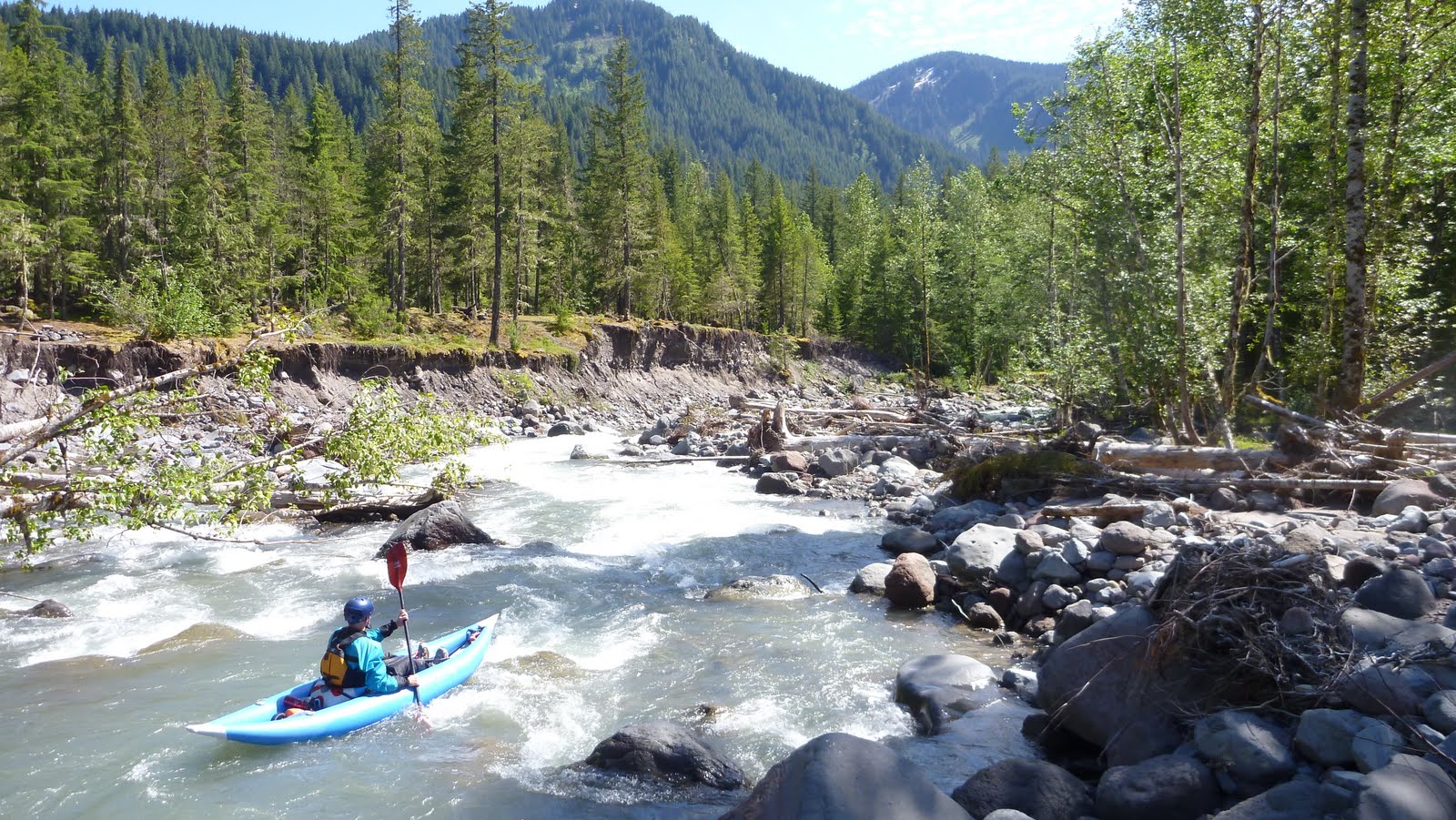
Description: This section of the Sandy is continuous and unstable. The rapids are changing year to year. The largest hazard is wood, which can make or break this run depending on the configuration. The higher the level, the more fun the whitewater, but the more dangerous wood becomes. Because of the ever changing nature of the riverbed a guidebook breakdown of rapids is not possible. In general, the river is steeper with more interesting whitewater near the beggining before tapering off to class II-III at the take out.
Go slow on your first lap to get the wood situation dialed, if it turns out to be clean it is a fun one to cruise down for a second lap.
Most hard shell kayakers will want to shoot for about 3,000 cfs on a first trip, then decide what direction to go water-wise for a return trip.
Put in at the bridge to McNeil Campground (or a little higher is possible) and take out at the Lolo Pass Bridge or roadside just upstream of that.
Additional References Full description in Soggy Sneakers.
May 24, 2020
5/24/2020 Ran it today with 2100 on Sandy at Marmot gauge and there was plenty of water, this is a well-padded Class IV flow. We put in a few hundred yards downstream from McNeil Bridge. If you don't know the run, it would be easy to blunder around an innocuous looking left-bend and into a longstanding batch of logs spanning the river about 1/4 mile in. This is an 'island' so you can portage down the shallow right channel or bushwhack nearer the left channel. It may look tempting to duck the logs, but there are ill-placed rocks that are hard to see that have embarrassed a number of paddlers so not recommended. Besides that portage, we had 3 others, but overall it was remarkably clean and very fun. A few weeks ago, a group ran it at 1900 and thought it too scrapy. The level can be affected by where the water hitting the Marmot gauge is coming from. If it's mostly straight off the mountain it will feel higher for the same reading than if the Zigzag and Salmon are contributing more water.
Mar 30, 2018
A low, but enjoyable flow on the Mcneil section of the Sandy.
