Santiam, S.
2. Mountain House to Foster Reservoir
| Difficulty | III-V |
| Length | 18.4 mi |
| Avg Gradient | 45 fpm |
| Gauge | South Santiam River Below Cascadia, or |
| Flow Rate as of 30 minutes | 87 cfsbelow recommended |
| Reach Info Last Updated | June 11, 2019 |
Includes the Monster Section described on Oregon Kayaking.
Trip Report from Wheels and Water.
Trip Report from Into the Outside.
Feb 25, 2024
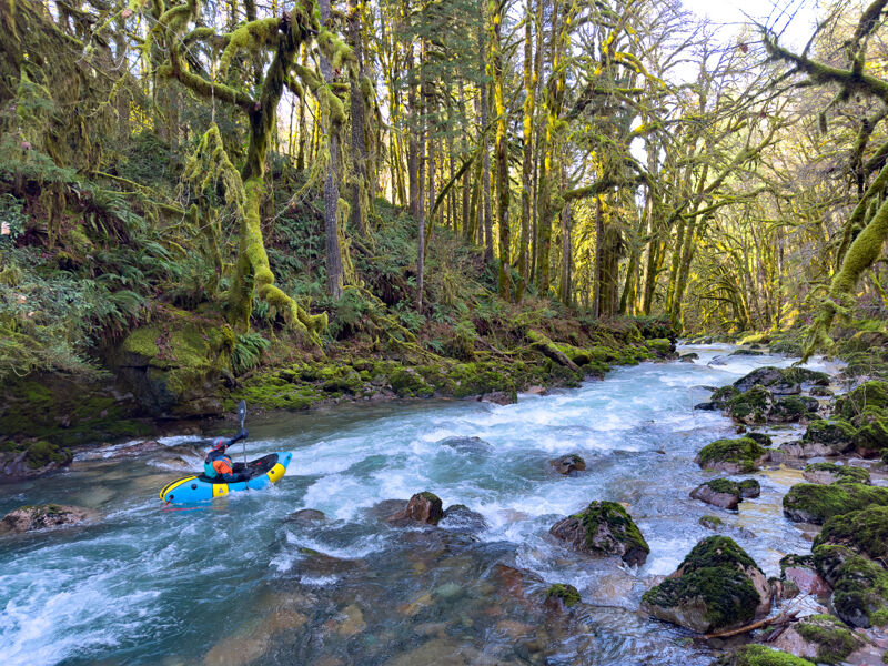
After always heading higher on the South Santiam for years, we decided to see what was in the stretch between Cascadia State Park and Foster Reservoir. What we found was a beautiful canyon and several miles of pool-drop 'splash and giggle' class 2-3. This would be a great run for someone who can catch Eddie's and is ready to graduate from the McKenzie or North Santiam.
After a couple miles, we came up to an obvious horizon line - Tree Farm Rapids. At this flow it was a legit class 4+ - 80% of the flow going left into a pin spot, with the move being cutting right into an undercut turbulent slot. In spite of what Soggy Sneakers said, the scout at this flow was on the left before you entered the lead-in moves. We caught the one-boat portage eddy on the right to do the easy walk around and seal launch. With maybe 200 more cfs, a sneak line would probably open up on the right with a slide onto a shallow rocky run-out.
The rapids picked up after this for a few miles, then slowly died off. The canyon stayed beautiful. We passed the campground and highway pull-out that allow early exit from the river, and paddled all the way down to the Caulkins Park boat ramp. Even though the reservoir was 20-30 ft below full pool, we still had about a 1 mile flat water paddle with deep mud at the end.
Feb 4, 2024
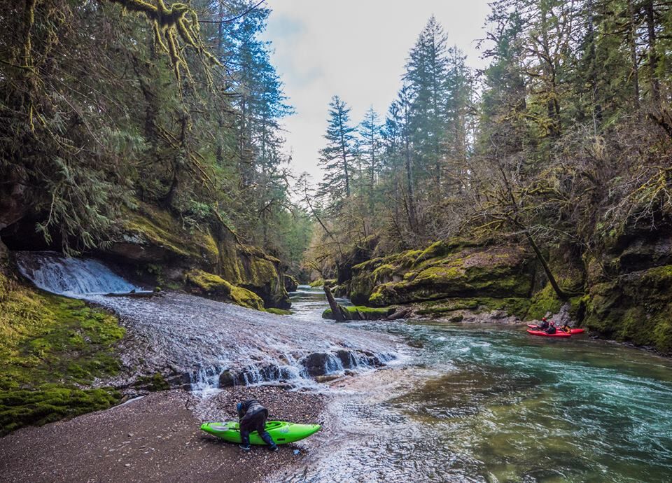
I'd barely given this section of river any thought until I drove over Tombstone pass a few days earlier. Kinda hard to ignore after you see the gorge with crystal clear water, bedrock slides, and countless waterfalls.
Flipping to Soggy Sneakers, this section is rated Class IV/V at first glance, but that's if you run all the way into Cascadia. There is in fact a Class III/III+ section above the Monster. At only 8 miles long, it's easy to overlook, but this thing packs a ton of variety into such a short stretch.
The first gorge is super tight with plenty of boulder gardens with stunning walls. Soda Fork adds a ton of volume a mile down from the put in, and the river picks up a lot of water before hitting a handful of III/III+ rapids and a half dozen cool bedrock ledges and slides.
There is a new rapid that is not in the guidebook at about mile 52.8. Some folks call it Ferrous Oxslide, it's a landslide rapid that definitely deserves a road scout, it's right at the edge of the road in a corner and easy to spot.
The remaining 4 bigger rapids are all easy to road scout, and wood seems like it will always be in play.
At these flows, Fernview was an ass dragger, and the right chute at longbow was tougher than it would be with a few hundred more on the gauge.
Full descriptions is run 105 in Soggy Sneakers, Section 1: Milepost 53.5 to Highway 20 Bridge.
Flow was ~950cfs, I'd consider that the bare minimum. 1200+ would be pretty great most likely.
Video here: https://www.youtube.com/watch?v=VlfQm7cB8vo